E) Gilmore's Mistake to Otter Slide ** Access Fee ** (5.9 miles)
Gauge Conditions
Runnable: ? – ? CFS
Approximate reading: This gauge is 6.1 miles away on Wolf. Use as a general reference only.
Data from American Whitewater & USGS
Run Map
Run Time Estimate
Select put-in and take-out to estimate time.
Plan This Trip
See wind-adjusted speed maps, forecast planning, and detailed time estimates.
Sign in to generate an AI timing estimate for this run.
Whitewater timing varies with scouting, portages, and group pace. Use as a planning baseline.
Description
This stretch is _not_ as commonly paddled as the stretches just upstream and just downstream. Being within Menominee tribal land, before putting on, a trespass permit must be purchased from Big Smoky Falls Rafting (715-799-3359) or Shotgun Eddy Campground and Rafting (715-882-4461).
River guidebooks prior to the 1970's listed this section together with the next collectively as 'Section IV'. However, in 1988, the tribe reopened the river (after about a decade of total closure to non-tribal members other than for rafting traffic via two tribal outfitters) and began charging a 'trespass fee' which included shuttling boaters upstream from Big Smokey Falls. It became fairly standard for boaters to use the rafting put-in at Otter Slide, foregoing this stretch of river. Over time, boaters have come to use Section IV to refer only to that lower part of the river (from Otter Slide to Big Smokey), leaving this piece of the river to now be referred to as 'Upper Section IV'.
Anyone paddling this reach is likely to combine it with the next section for a long day of paddling on the full historic Secion IV (12.5 miles), or combining it with a short Section 3 trip, either using our listed Otter Slide take-out or shortening a bit by using Shotgun Eddy's campground. (Make arrangements with the outfitter when you purchase your permit to do the trip.) Or ... you could go for a really big day and do short 3, plus this run, plus the lower Section 4, for a total of 16 miles, getting all the best the river has to offer. (NOTE: there will be a stretch of _four miles of dead-flat water_ surrounding the Otter Slide location.)
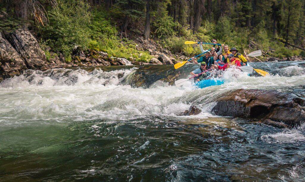
In the first mile of the stretch you reach a Class II boulder garden, Burnt Shanty Rapid. After another mile of flatwater, you'll enter Shotgun Eddy Rapids, a solid Class II that goes about one-quarter mile (one of the longest rapids on the Wolf). If you are using Shotgun Eddy Campground as a take-out, it comes at the end of this rapid. (These boulder garden rapids, in relatively wide sections of the river, are the reason for the relatively high 'minimum' recommended water level.)
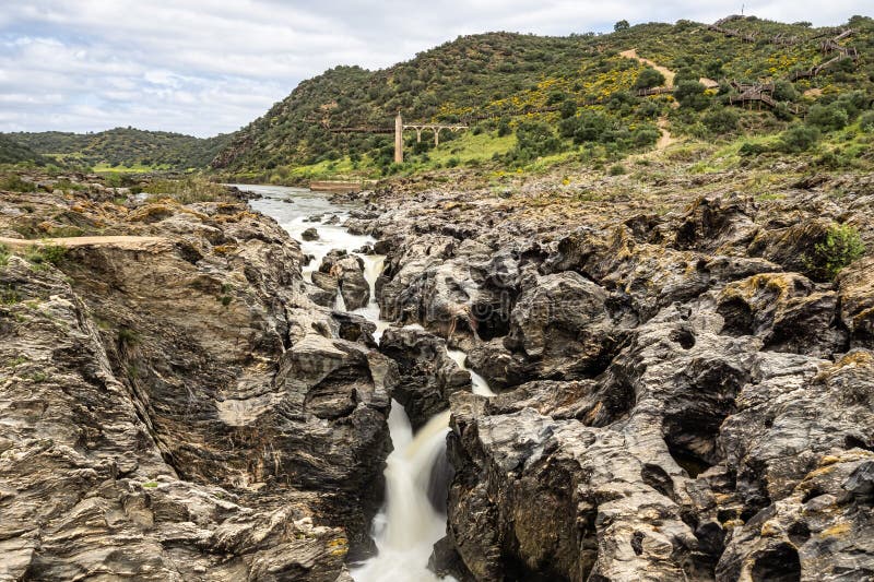
Pissmire Falls is a Class II (III) rapid about a mile downstream. It starts just above the County WW bridge, and contains a river-wide ledge just below the County WW bridge which creates a nasty hole at the bottom (one of the most aggressive holes on the Wolf). Scouting is recommended. There is about two miles of flatwater from here to the Otter Slide take-out.
Additional Information: Paddling Northern Wisconsin, by Mike Svob, Wisconsin Trails Press
Rapids in this Run (3)
Waterfalls (1)
Difficulty
Class II(III)
Length
5.8 mi
Gradient
13 ft/mi
max 39
Rapids
3
Access Points
Shuttle Info
Since this stretch is on the Menomonee Tribal lands, it is necessary to pay a 'trespass fee' and receive a wrist band. For this fee you generally also get shuttled to your put-in, leaving your vehicle at the take-out.
This section is very seldom done by private boaters . . . part of it is somewhat commonly rafted, ending at _Shotgun Eddy's Rafting & Campground)._ Private boaters who boat it are likely to do so only as a way of seeing more of this river, and will generally do so as an extension of the (already somewhat lengthy) trip on Section 4.
As a result of the above, the following shuttle map is relatively meaningless. There is nothing specifically stopping you from running your own shuttle, but DO NOT EVEN THINK ABOUT POACHING THIS RUN WITHOUT PAYING THE TRIBAL TRESPASS FEE!
Use the text-entry box to enter your home (or other starting location) address, and press "Calculate" to get time/distance and driving directions from there to the put-in for this reach.
Difficulty Classes
I Easy
II Novice
III Intermediate
IV Advanced
V Expert/Extreme
VI Unrunnable
Current Conditions
5-Day Forecast
Whitewater data from
American Whitewater
American Whitewater