G) Five Islands to Keshena Falls (9.5 miles) ** ACCESS ISSUES **
Gauge Conditions
Runnable: ? – ? CFS
Approximate reading: This gauge is 13.3 miles away on Wolf. Use as a general reference only.
Data from American Whitewater & USGS
Run Map
Run Time Estimate
Select put-in and take-out to estimate time.
Plan This Trip
See wind-adjusted speed maps, forecast planning, and detailed time estimates.
Sign in to generate an AI timing estimate for this run.
Whitewater timing varies with scouting, portages, and group pace. Use as a planning baseline.
Description
#### IMPORTANT!
This reach lies entirely within Menominee tribal lands. It is NOT LEGAL to paddle or walk to the drops described here for all non-Menominees. Driving smaller roads, such as most or all 'BIA' (Bureau of Indian Affairs) roads may also be not permitted. If in doubt in Menominee County, stick to paved roads. Arrest and conviction on trespassing charges in Menominee county may result in fine, imprisonment, and confiscation of materials used in the act of trespass up to and including vehicles! This reach is included for the sake of completeness and as warning against exploring this stretch. It is crucially important to note that there are areas which tribal history holds sacred, and your mere presence would be akin to defiling a church altar. Please respect tribal history and sensitivities!
While the section of the Wolf that may be paddled by the general public in Menominee County ends at Big Smoky Falls, the whitewater does not. The river retains the 'lake/drop' character it has on _Section 4_ but the distance between drops increases significantly in the lower portion of this reach. The river between Big Smoky Falls and Five Islands contains quietwater. The information contained below has been obtained through interpretation of available data and conversation with Menominee tribal members.
From Five Islands, visible roadside off Hwy 55, there is quietwater for a half mile until _Turtle Rapids_. Turtle Rapids seems to be a low grade boulderbed rapid. At 1.1 miles is _White Rapids_, a drop that occurs at a constriction and bend in the river. There is quietwater until _Big Eddy Falls_ at 3.0 miles.
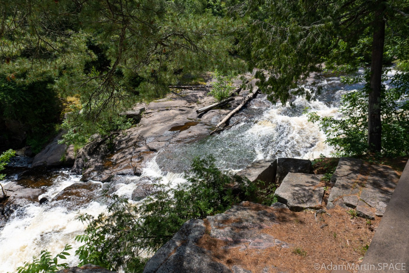
Light boulderbed should signal the entrance to Big Eddy Falls. The river constricts, then drops into a sizable hole. This is followed by about 100 yards of boulderbed before the main drop, a sloping ledge of perhaps 8'. There is a big, hungry looking hydraulic at the base of this ledge. In common usage, the word eddy sometimes refers to a hydraulic and this particular one is likely the basis for the name of this drop.
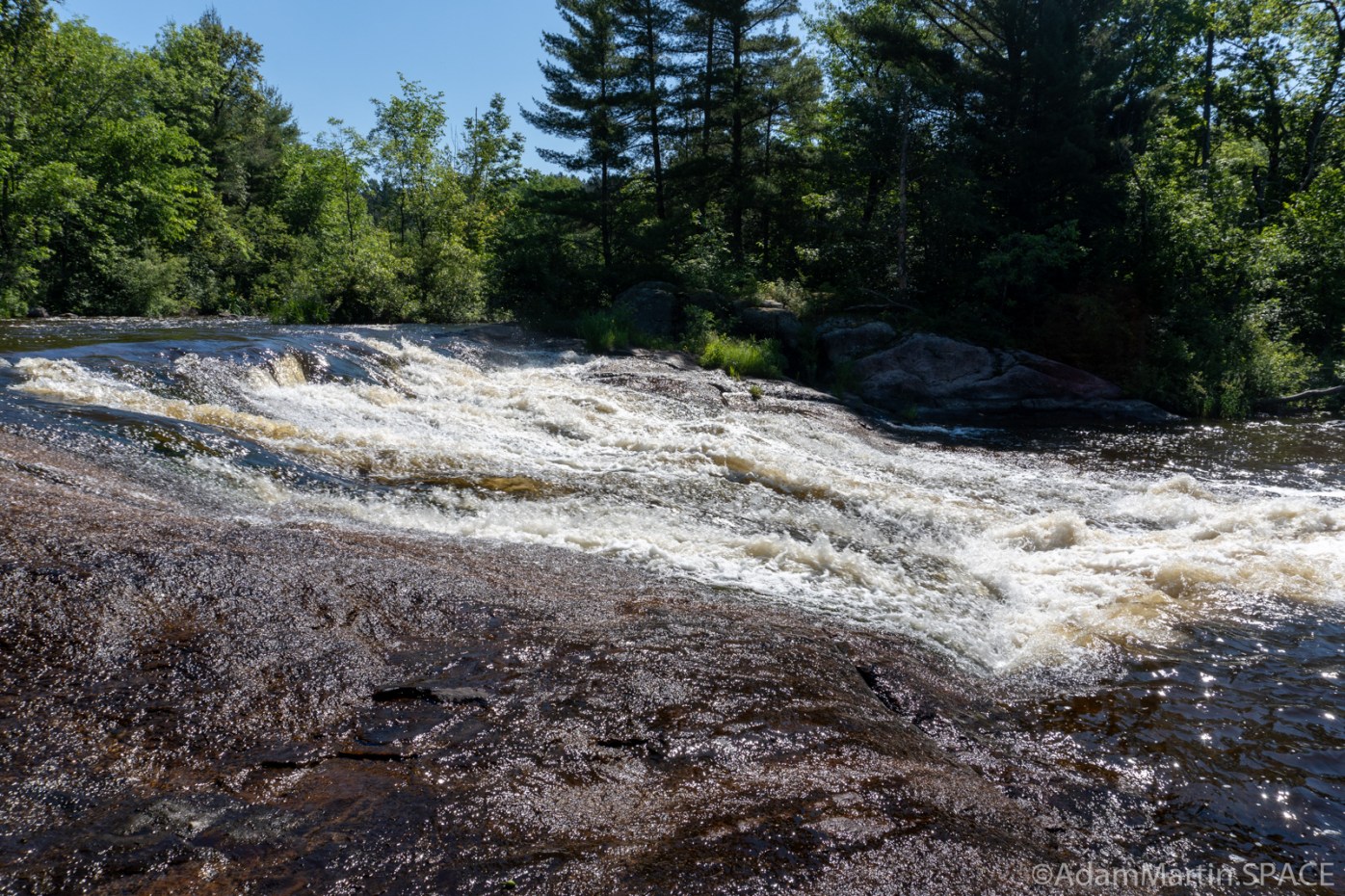
At 4.1 miles is the light boulderbed of _Wolf River Rapids_. The Camp 22 bridge is at 5.6 miles and the West Branch drops into the Wolf, river right, by way of Wayka Falls at 6.4 miles. There is a small rapid near _Spirit Rock_, source of Menominee legend, at 7.3 miles. A rapid occurs at a constriction and bend at 9.0 miles. _Keshena Falls_ comes at 9.4 miles and is viewable from a bridge on a side road off Hwy 55 a short distance north of Hwy 47. Keshena Falls, once site of a dam, begins with a fast moving flume followed by a broken ledge of about 6'. Staying high and to the far right would put one in a secondary channel which ends in a smooth, 5' slide. There is one more small rapid located just downstream of the Hwy 47 bridge and the whitewater on the Wolf ends.
Rapids in this Run (10)
Waterfalls (2)
Difficulty
Class I-III+
Length
9.0 mi
Gradient
7 ft/mi
Rapids
10
Access Points
Shuttle Info
Reach lies wholly within Menomonee Tribal lands. Trespass is punishable by fines, jail time, and (up to) confiscation of all gear and tangible goods (your shuttle vehicle(s)) used in commission of the trespass.
Even driving tribal roads or getting out of your car and 'exploring' beyond the _immediate_ road shoulders could be found to be in violation of trespass laws.
It is therefore recommended that boaters ignore this shuttle information until or unless arrangements with the tribe can be made for access to this area. They have not been in any way interested in opening discussions about doing so, as they consider many of these areas _sacred_.
Difficulty Classes
I Easy
II Novice
III Intermediate
IV Advanced
V Expert/Extreme
VI Unrunnable
Current Conditions
5-Day Forecast
Whitewater data from
American Whitewater
American Whitewater