Mead Rd to Lake Superior (L'Anse) (2 miles)
Gauge Conditions
Runnable: 200.0 – 500.0 CFS
Almost certainly too low for reasonable whitewater run.
Runnable: 7.5 – 10.0 FT
Data from American Whitewater & USGS
Run Map
Run Time Estimate
Select put-in and take-out to estimate time.
Plan This Trip
See wind-adjusted speed maps, forecast planning, and detailed time estimates.
Sign in to generate an AI timing estimate for this run.
Whitewater timing varies with scouting, portages, and group pace. Use as a planning baseline.
Description
Quick Facts
Location: L'Anse city limits to Downtown L'Anse
Put-in: 46.729810, -88.444458 (Mead Road)
Take-out: Falls River Parking L'Anse MI (S.Main Street)
Shuttle:: 3.3 miles/7 minutes
Video Link: _https://youtu.be/IUij1IEZE4A_
Put-in elevation is approximately 890'
Take-out elevation is approximately 600' (mean Lake Superior elevation).
Total drop is approximately 290'
Gradient: Average: 155 FPM; Max Full Mile: 175 FPM
IMPORTANT NOTE: Gradient values should be used for general comparative purposes only! Differences (even up to 15-20% and more) mean very little in the grand scheme of whitewater! (Streams with gradients in excesss of 50 FPM may be swiftwater with no meaningful rapids!)
Class/rating can also mean relatively little. Short, not overly complex rapids may be rated as III or IV (or even V), and may be run by inexperienced boaters without serious mishap! Conversely, there are complex, technical class II boulder-garden rapids which often cause upsets, injuries and even death among inexperienced boaters! Never rely solely on class/rating to decide if you should run a river/rapids!
Far more important than either gradient or class/rating are other less-quantifiable 'character factors' such as: (1) continuous versus pool/drop, (2) wide-channel with multiple routes versus narrow channel with essentially one route, (3) straight-shot routes versus complex technical maneuvering-required routes, (4) gradual river banks versus rocky shores or steep-walled gorges, (5) heavily wooded (prone to strainers, sweepers, deadfall) versus just shrubs, grasslands, or non-vegetated surroundings, et cetera.
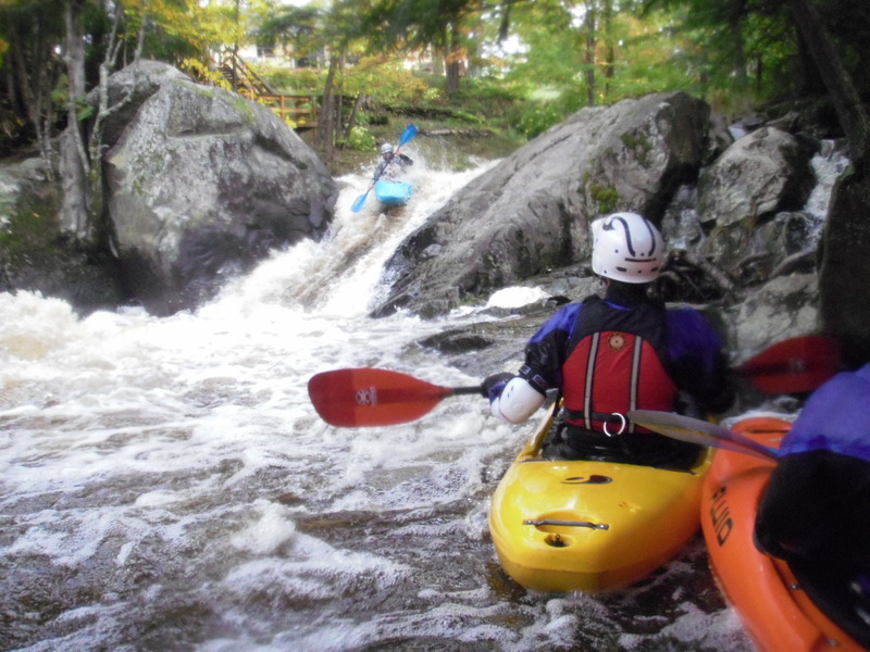
Character: Pool/drop (at normal flows), just about the greatest assortment of drops (slides, verticals) in a short in-town run; 'intro to creeking' run.
River banks: Generally steep rocky mini-gorge, with many areas of private property (especially river-right).
Typical width: 25-75 ft. (exclusive of pools/lakes)
Drainage area: 48 square miles (at Hwy.41)
General Description
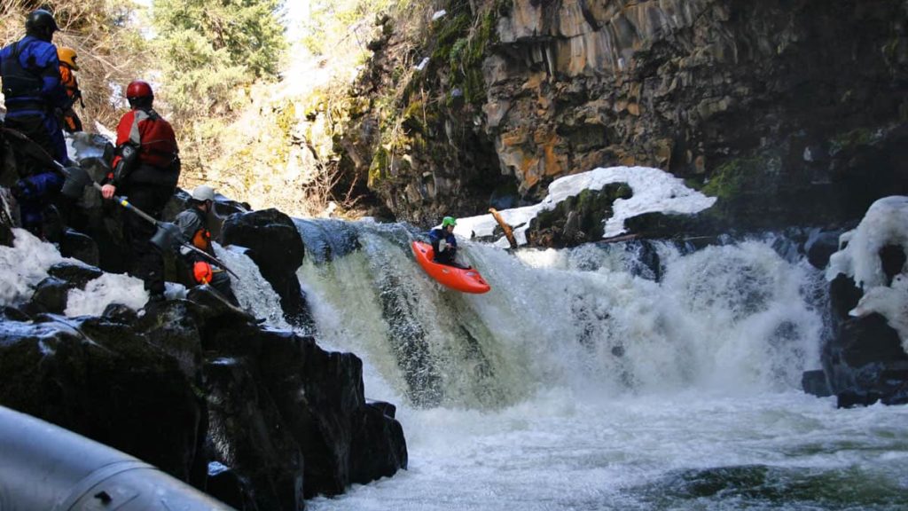
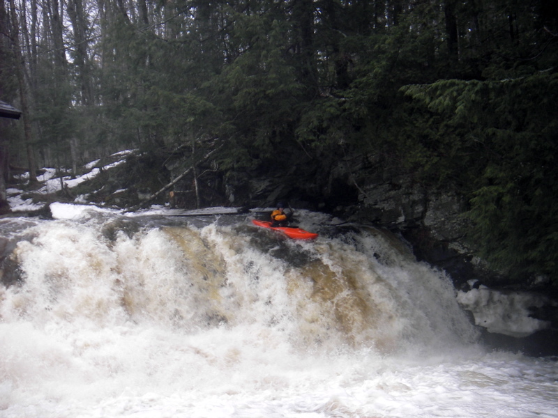
The Falls River is is aptly named, as most of the drops are of a ledge type. This is one of the classic South Shore creek runs and is a great intro to South Shore boating as it is about as forgiving as a stream with this gradient can be. It has near-continuous whitewater from the start with lighter whitewater between the more notable drops. The two drops of greatest consequence, 'Powerhouse Falls' (IV+) and 'Asshole' (IV), come early in the run.
Some may wish to use an alternate put-in below 'Powerhouse Falls', located by carrying in off Power Dam Rd to avoid a portage. Ledge type drops up to 10' ('Big Mo Falls') continue to the Hwy 41 bridge. From Hwy.41 to Lake Superior there's a staircase drop followed by a slide and finally a breached dam. Removal of a former hydro dam at the end of Power Dam Rd allows one to start at the head of the gradient off Mead Rd and adds a quarter mile of enjoyable warm-up water. As of Spring '00, the traditional put-in off Power Dam Rd was gated and the road in poor condition.
Google Maps has reasonably good resolution aerials of this reach. Go to the 'Map' tab, click on the put-in dot, click on 'Google Maps' (at the right), hover over 'Layers' then click to get 'Satellite', zoom ('+') to the maximum resolution (then back out ('-') one time for best image), then do a 'virtual tour' to 'walk' down the reach. Due to the narrowness of the river on this run, the nearby tree-cover, and not quite optimum resolution, many of the drops are obscured or otherwise not totally apparent.
Click here for Part 1 of an article from the AW Journal, way back in 1981!
Click here for Part 2 of the article.
The article describes the following: Michigan's, Upper Presque Isle, Lower Presque Isle, Middle Black, Lower Black, Upper Silver, Lower Silver, Falls, and Rock; and Wisconsin's Lower Brunsweiler, Montreal Canyon, and West Branch Montreal.
Rapids in this Run (4)
Waterfalls (5)
Hazards & Portages (1)
Caution: The following locations may require scouting or portaging. Always check current conditions.
Difficulty
Class III-IV+
Length
2.3 mi
Gradient
155 ft/mi
max 175
Rapids
4
1 Hazard
Access Points
Shuttle Info
The directions below route one across the river at the take-out. I'm not certain, but I don't think you can go that way. It is quite easy to head due east from the take-out on Main Street, to the main stop sign at Broad Street. Turn right and head uphill to the stop sign at Hwy.41 (by a gas station). Proceed as with the map's routing from there.
Difficulty Classes
I Easy
II Novice
III Intermediate
IV Advanced
V Expert/Extreme
VI Unrunnable
Current Conditions
5-Day Forecast
Whitewater data from
American Whitewater
American Whitewater