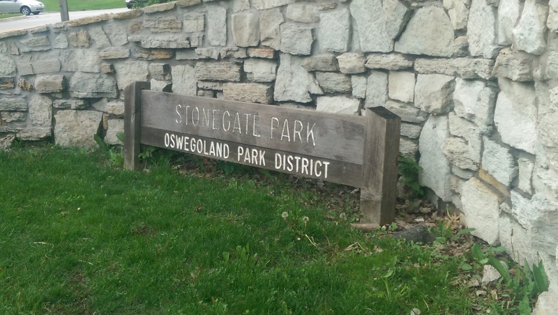
Oswego: Stone Gate Park to Fox River (0.54 - 2.2 miles)
Gauge Conditions
Runnable: 100.0 – 700.0 CFS
Too low for reasonable whitewater.
Data from American Whitewater & USGS
Run Map
Run Time Estimate
Select put-in and take-out to estimate time.
Plan This Trip
See wind-adjusted speed maps, forecast planning, and detailed time estimates.
Sign in to generate an AI timing estimate for this run.
Whitewater timing varies with scouting, portages, and group pace. Use as a planning baseline.
Description
Quick Facts:
Location: Oswego, IL (just south of Aurora, IL).
Shuttle Length: commonly 0.4 miles / 3 minutes drive, plus 0.25-0.3 mile walk (or up to 1.8 miles / 7 minutes drive)
Character: An short and sweet run on a small intimate stream in an urban setting.
Uppermost likely put-in is approximately 645' elevation.
Take-out is approximately 598' elevation.
Thus total elevation change is approximately 47', making overall gradient of 21.36 FPM.
Drainage at gauge: 19.1 square miles
Drainage at uppermost put-in: 20.43 square miles
Drainage at most likely used put-in: 27.5 square miles (Thus actual flow at this point could be 1.44 times gauge reading.)
General Overview
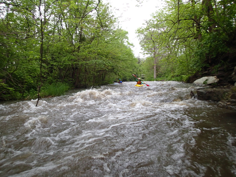
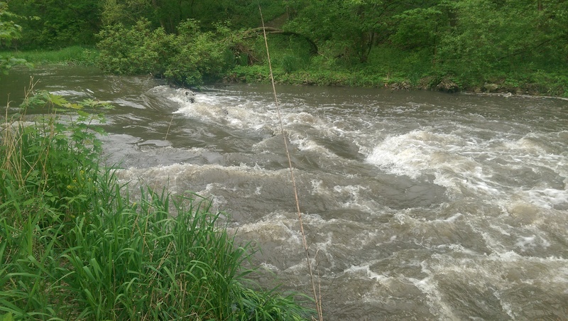
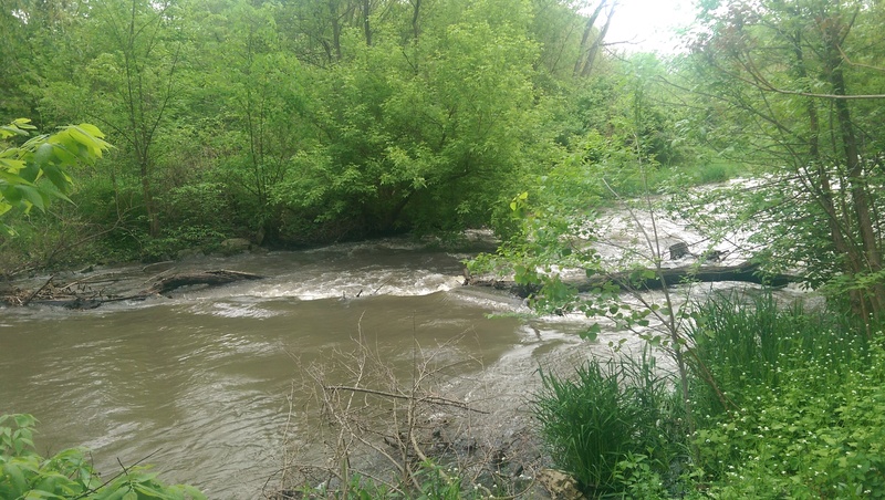
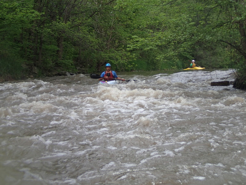
The Waubonsie is a small creek in Oswego which (with adequate water) comes up to a class II-III run. Upstream of Hwy.25 (AKA N.Madison Street), there are several distinct drops or rapids. Below Madison Street, especially at moderate-to-high flows, the gradient picks up making the final quarter-mile or so into almost continuous action.
Before we go further, a note about the name ... there seems to be discrepancy as to whether it is Waubonsie or Waubonsee. I've seen both spellings (looking across various maps and websites).
We also have minimal (and sometimes conflicting) information about the access points (and consequently the length) for the usual run. (See 'River Features' for more complete discussion.)
Craig Carlson provides (2006-10-22):
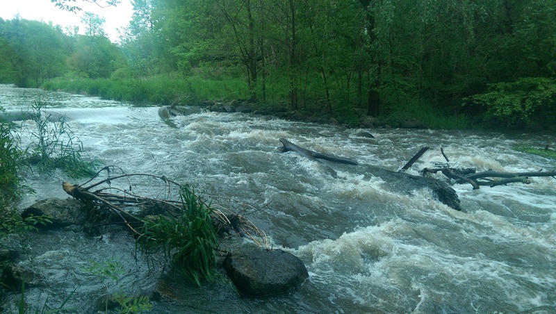
*The third of the four drops in Stone gate, when the water is up develops a nice little hole with good eddies on ether side. The fourth drop should be scouted before running. Depending on the water level, there may be several large rocks just under the surface and the chance of logs or large branches that tend to gather throughout the drop. Below the last drop, the creek makes a slight right turn with some riffles and a couple small holes, then leads under the Hwy. 25 bridge where for a couple years was a large strainer before the park service cleaned it out, but still should be checked out.*
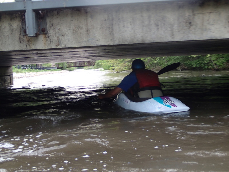
*After Hwy. 25 the creek makes a slight left turn and into a small canyon with small ledge drops and waves. In the middle of the canyon, when the creek makes a slight right turn, there are a couple of ledges that stick out of the left wall at head height. Just past the railroad bridge is a low bridge and when the water is up you‘ll only have about 3 feet clearance.*
For what it's worth, one area of *potential interest* lies upstream of our listed run. A spillway/dam may offer some 'park-and-play' potential at some flows. (See 'River Features' for location and description.)
Additional information about the watershed may be found at the IL USDA website.
Rapids in this Run (14)
Rapid
Possible Put In
 Rapid
Rapid
Maintainance / Golf Cart bridge (#1)
 Rapid
Rapid
Golf Cart bridge (#2)
 Rapid
Rapid
Golf Cart Bridge (#3)
 Rapid
Rapid
Bridge (#4)
 Rapid
Rapid
Golf Cart Bridge (#5)
 Rapid
Rapid
Golf Cart Bridge (#6)
Rapid
II
Nice Drop
 Rapid
Rapid
Golf Cart Bridge (#7)
Rapid
Pearce Cemetery
Rapid
Pfund Court
Rapid
MOST LIKELY PUT-IN: Uppermost extent of Stonegate Park?
 Rapid
Rapid
Madison Street / Stone Gate Park
 Rapid
II-
Rapid
II-
Library Waves
Playspots (7)
Hazards & Portages (1)
Caution: The following locations may require scouting or portaging. Always check current conditions.
Difficulty
Class II
Length
2.2 mi
Gradient
11 ft/mi
Rapids
14
1 Hazard
Access Points
Shuttle Info
Best options for parking and put-in are unknown to us at this time. Anyone who can provide details is encouraged to do so.
From GoogleMaps aerial shots, it appears there are some additional features in various locations upstream of the listed put-in. Alternate accesses (above Golf Course) _may or may not_ be viable, and (for that matter) may or may not offer any worthwhile additional interest. Specifically, it is likely that golf course bridges (perhaps as many as eight of them?) and other bridges and obstructions may be impassibly low (at best boatable flows).
41.7013, -88.3271 -- Pearces Ford -- 2.7 miles (parking at a tennis court?)
41.7088, -88.3177 -- Douglas Road -- 3.45 miles (good access from a park/parking lot off Saugatuck Rd)
41.7374, -88.2607 -- Fox Valley Drive - 7.35 miles; Dam (could be interesting or impossible?) Waubonsie Lake Park
above this point, you encounter Fox Valley Mall a big pond, and underground.
Difficulty Classes
I Easy
II Novice
III Intermediate
IV Advanced
V Expert/Extreme
VI Unrunnable
Current Conditions
5-Day Forecast
Whitewater data from
American Whitewater
American Whitewater