Point Rock Park to Jacobstown Road (at Scenic Bluff Rd) (6.2 miles)
Gauge Conditions
Runnable: ? – ? CFS
Approximate reading: This gauge is 16.7 miles away on Carroll Creek. Use as a general reference only.
Data from American Whitewater & USGS
Run Map
Run Time Estimate
Select put-in and take-out to estimate time.
Plan This Trip
See wind-adjusted speed maps, forecast planning, and detailed time estimates.
Sign in to generate an AI timing estimate for this run.
Whitewater timing varies with scouting, portages, and group pace. Use as a planning baseline.
Description
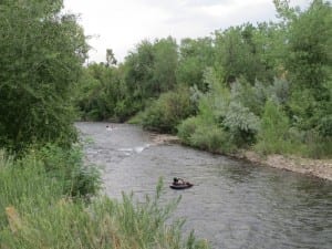
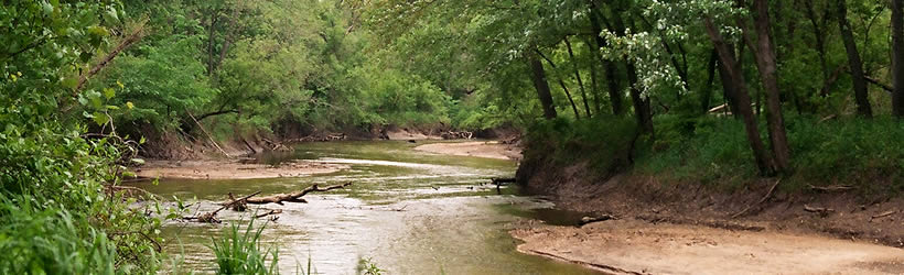
A very scenic creek, with relatively small watershed (meaning it will be hard to catch with enough water) offers a beautiful paddle trip.This is quite low gradient, so any rapids are likely to be simple shoals forming wave trains. Twists and turns with occasional undercut walls will challenge boaters, especially if you do catch it with moderate to high flows. At such times, boaters should have solid boating skills to maneuver safely down this stretch.
Check out a fine video from Morall River Films on YouTube:

Difficulty
Class I-II
Length
6.1 mi
Gradient
6 ft/mi
Rapids
6
Access Points
Difficulty Classes
I Easy
II Novice
III Intermediate
IV Advanced
V Expert/Extreme
VI Unrunnable
Current Conditions
5-Day Forecast
Whitewater data from
American Whitewater
American Whitewater