Rainsville to Twin Bridges (0.5-6.7 miles)
Gauge Conditions
Runnable: 250.0 – 5,000.0 CFS
Almost certainly too low for reasonable whitewater. (Flatwater may be paddled at almost any flow.)
Data from American Whitewater & USGS
Run Map
Run Time Estimate
Select put-in and take-out to estimate time.
Plan This Trip
See wind-adjusted speed maps, forecast planning, and detailed time estimates.
Sign in to generate an AI timing estimate for this run.
Whitewater timing varies with scouting, portages, and group pace. Use as a planning baseline.
Description
In what most folks think of as the 'flatlands' in Indiana, northwest of Indianapolis, this run has considerable merit for its play potential and its scenery.
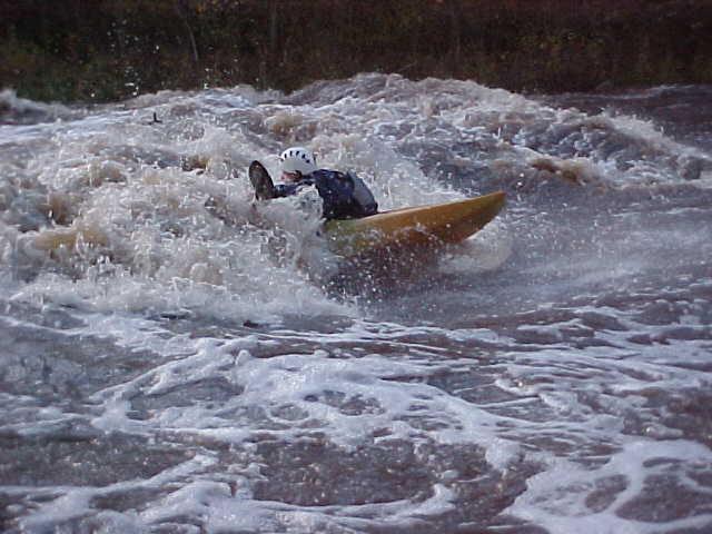
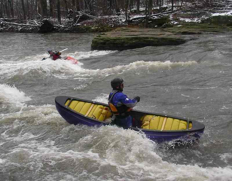
The run begins less than a mile southeast of Rainsville, where a gravel 'ford' (to cross thru the river at low water) exists. The creek is quite uniformly wide, and trips across a bedrock base in the next quarter-mile to create numerous playable waves. In general there is a lack of eddy service, so most features tend to be catch-on-the-fly, one-shot play, or a fight to regain, or a carry-up to re-play.
After the opening sequence, a few more playable waves (strung out a bit more than the first series) lead to _S-curve_. The river turns left, where it encounters a bedrock ledge extending at least halfway across the stream from river-right. At low water (under 2.5') the ledge will be dry, funneling all the water to the left, creating a playable wave/hole followed by good current through the large pool below, heading toward a wall of rock (the left bank) where it is diverted back to the right to proceed downstream. At high water (somewhere above 4'?) water will pour over the ledge on river right to create a potentially nasty, uniform hole. Beware!
The gradient then dies down for an extremely scenic float until the next features. The stream is regularly flanked on one or both sides by rocky bluffs (I believe mostly sandstone and shale). The presence of mostly deciduous trees make this an extraordinarily beautiful reach to paddle in fall. Eventually one encounters a few more playable features in the lower stretch. The best of these are _All Day Wave_ and _Hawaii 5-0_.
Many local boaters just do the initial 0.6 mile of river as a 'park-and-play', carrying up the country road which parallels this part of the river. However, the scenery of the rest of the run and the good eddy service for the playspots on the lower river make it worthwhile to do the full run. Note Park and Play down to the S-Curve is no longer an option. Parking is not allowed along the road at the S-Curve and the land around S-Curve is closed to the public.
At the take-out at Twin Bridge, a side stream (Fall Creek) flows through a Nature Conservancy preserve. It has cut a very interesting gorge filled with potholes in the bedrock, and makes an enjoyable side hike at the end of your trip. While it may appear tempting (if it has enough water) to carry up and boat this reach, be aware that all the best legal opinion suggests it is illegal to do so. There is a specific _'no swimming or wading'_ provision in force (subject to a fine, reportedly _$90 per violation_), as well as the fact that the stream is deemed _'not navigable'_ according to state law. For more information, check out the Natural Resources Commission - Navigability webpage: https://www.in.gov/nrc/2390.htm. Additional information about The Nature Conservancy, and this preserve, can be obtained at Nature.org, or by Email: Indiana@tnc.org.
Get a good feel for the run from this YouTube video of the first (main) sequence on a Feb.21, 2016 'ice breaker' run: https://youtu.be/ksat4efNMt0.
Difficulty
Class II+(III)
Length
6.4 mi
Gradient
13 ft/mi
max 39
Rapids
0
Access Points
Difficulty Classes
I Easy
II Novice
III Intermediate
IV Advanced
V Expert/Extreme
VI Unrunnable
Current Conditions
5-Day Forecast
Whitewater data from
American Whitewater
American Whitewater