Route 302 at Lower Bartlett
Gauge Conditions
Runnable: 4.5 – 7.0 FT
Data from American Whitewater & USGS
Run Map
Run Time Estimate
Select put-in and take-out to estimate time.
Plan This Trip
See wind-adjusted speed maps, forecast planning, and detailed time estimates.
Sign in to generate an AI timing estimate for this run.
Whitewater timing varies with scouting, portages, and group pace. Use as a planning baseline.
Description
The East Branch of the Saco is a II-V stream emptying into the Saco north of North Conway. There are four distinct sections of the river.
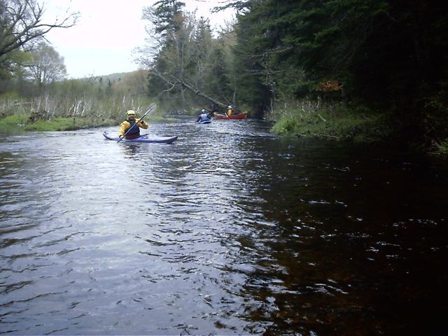
### Class II \[Upper Upper\] Section (1.25 miles)
The uppermost section is a shortish mostly flatwater run starting all the way into the woods at the trailhead. It's an easy put-in close to the trailhead with a lazy current. Wildlife is abundant. The run ends with two short class III rapids before coming to a bridge where the road crosses over the river.
Warning: As of 3-Nov-2018 the Upper and Middle Sections of this river is full of strainers requiring constant vigilance and frequent portaging. They start roughly 1-mile downstream of the put-in bridge, and continue all the way to the town hall bridge put-in for the lower. The Lower at this time was mostly clear.
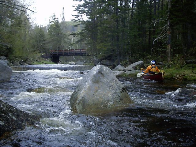
### Class V \[Upper\] Section (2.05 miles)
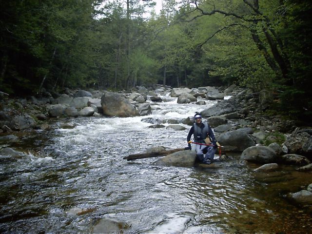
The most challenging section begins at the bottom of the class II section where the national forest road crosses over the river. This section starts with a runnable small dam followed by a couple class III drops. It then switches to continuous class IV punctuated by many class V drops. The river gradient of this section averages an astounding 273 feet per mile. As a fortunate safety feature the National Forest East Branch trail follows along river left for the majority of the run. The trail provides an easy take-out should one be necessary. Approximately one-half mile before the bottom of this section the trail turns left into the woods, crosses over to Slippery Brook (the main tributary of the East Branch Saco river), follows Slippery Brook along river right for a quarter mile, then crosses the brook to reach the trailhead and parking area for the Class IV put-in. To take-out at the bottom of this section, pull off on river left immediately above where Slippery Brook joins the main channel coming in from the left. Then drag/carry your boat thru the woods along the brook (river-right) two-tenths of a mile to where the East Branch trail crosses the brook to the trailhead and class IV put-in. Avoid crossing the brook until you reach the trail since the woods on the river-left side of Slippery Brook are thick and rocky.
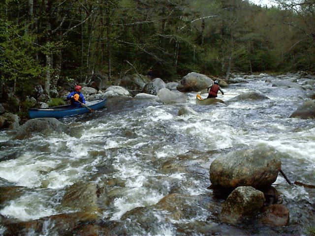
### Class IV \[Middle\] Section (3.4 miles)
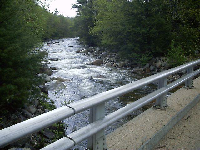
The two lower sections are the most commonly run parts of the river. When they're up, it's a busy five-and-a-half miles of solid class III-IV rapids; even at low levels. This middle section has a number of drops similar to the harder rapids on the lower section but generally narrower and with a higher gradient of 119 feet per mile. Paddlers in larger boats will have to react quickly to avoid being hung up in the tight areas. Put on at the trail-head of the National Forest East Branch Trail and paddle down Slippery Brook for 0.2 miles where the brook joins the main channel. The river then turns off into the forest with steep hills, thick woods, and no trails before swinging back and passing under the Town Hall Road bridge at the lower put-in. Be sure of your skills since it is not an easy walk out. (And if you must walk out, stay close to the river since it's the most direct route and the easiest way to avoid getting lost.) As you approach the bottom of the section be aware of a bad hole in river-center immediately upstream of the Town Hall Road bridge. This was the site of a fatality during very-high water in 2006.
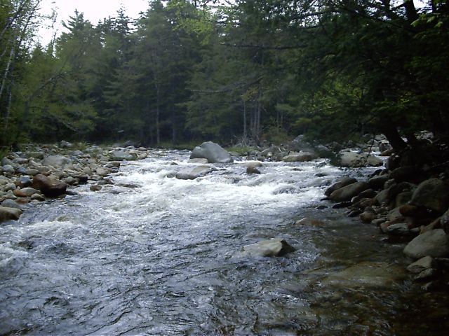
### Class IV \[Lower\] Section (2.25 miles)
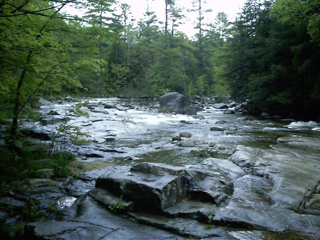
This is the most commonly run section. The gradient for this last section averages 78 feet per mile. There are a number of good rapids easily scoutable from the road.
### Class V?-VI? Slippery Brook Section (~2 miles?)
Slippery Brook is the main tributary of the East Branch Saco high in the mountains. It is often confused with the upper section of the East Branch Saco since it follows along the National Forest Road the same as the main channel does downstream. Boaters paddle both sections, but be aware that Slippery Brook is significantly more difficult and dangerous then the East Branch Saco river proper. This section has not been verified by AW Streamkeepers.
Flow info:
User observations incidate that the following guidelines be used to interpret the Saco gauge
Guage is Rising = 4.5 or higher is runnableGauge is Falling = 5.5 and under is too low Solid Bet = 6.0 seems to be a sweet spot
Difficulty
Class IV-V
Length
2.1 mi
Gradient
119 ft/mi
max 300
Rapids
8
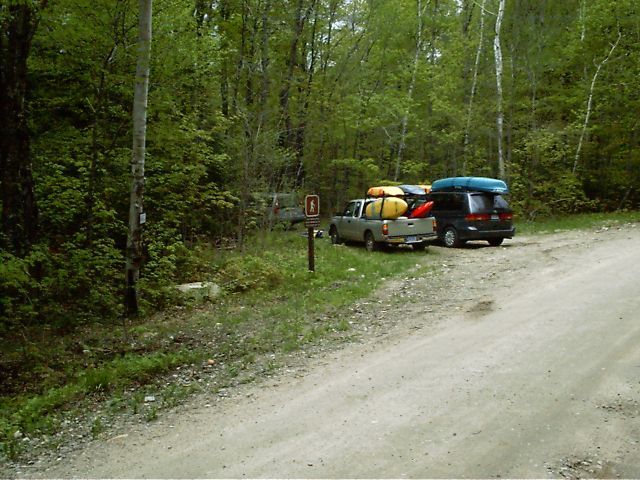
Access Points
Shuttle Info
Take-Out: Follow routes 16/302 north of North Conway & Intervale to the Route 302 bridge where the river passes under the road just upstream of the confluence with the Saco. The gage is here on the downstream-left side of the river-center abutment.
Alternate Take-Outs: Drive up Town Hall Road approximately one-third mile to Intervale Resort Loop Road. Take off either by the bridge going over the river or behind the Police Station & Town Offices where there is easy parking.
Lower Put-In: Drive up Town Hall Road and put on where the river passes under the road.
Middle Put-In: Continue up Town Hall Road to the trail-head of the National Forest East Branch Trail approximately two miles past the entrance gate. Put on in the woods a few feet up the trail.
Upper \[Class V\] Put-In: Drive up Town Hall Road approximately three miles past the National Forest entrance gate and the Middle Put In. Slippery Brook will appear on the left along the road. Turn left, crossing over Slippery Brook, then up over the hills and back down again. Put on where the road crosses the river.
Upper Upper \[Class II\] Put-In: Drive into the National Forest past the Middle Put-In. Turn left, driving past the Class V put in. Follow the road all the way to the end and the trail-head. Put on a short way up the trail.
Slippery Brook Put-In: Drive into the National Forest past the trail-head and Middle Put In. Slippery Brook appears on the left, following the road for several miles. Put on/take out anywhere along the road.
Difficulty Classes
I Easy
II Novice
III Intermediate
IV Advanced
V Expert/Extreme
VI Unrunnable
Current Conditions
5-Day Forecast
Whitewater data from
American Whitewater
American Whitewater