Sawmill Flat to bl. Town of Naches
Gauge Conditions
Runnable: ? – ? CFS
Approximate reading: This gauge is 3.4 miles away on Naches. Use as a general reference only.
Data from American Whitewater & USGS
Run Map
Run Time Estimate
Select put-in and take-out to estimate time.
Plan This Trip
See wind-adjusted speed maps, forecast planning, and detailed time estimates.
Sign in to generate an AI timing estimate for this run.
Whitewater timing varies with scouting, portages, and group pace. Use as a planning baseline.
Description
The Naches is a great river with some wonderful scenery, and good weather in the spring makes this a great day trip on the east side. You can easily turn the run into a two-day trip, starting out on the American, Bumping, or Little Naches, and spend the night at one of the campgrounds along the way. More typically the run is divided into sections which have their own characteristics.
For the first 7.6 miles in the National Forest the run starts out forested with a few cabins and a couple of small riverside communities at Cliffdell and Nile. The river leaves the National Forest shortly after you pass Cottonwood Campground and the trees start to diminish as you float into more arid country and agricultural lands for 18.4 miles down to the Tieton confluence. The geology is impressive throughout and the river provides a great escape for those hot days in late spring and early summer. After you pass the Tieton it's another 8.3 miles to the town of Naches through a rural landscape. You get a second shot at this section in the fall when the Tieton Reservoir starts releasing in early September.
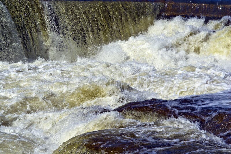
Be cautious of diversion structures on this river. There is one dam above the Tieton confluence and another just downstream of the confluence that is extremely deadly and must be portaged.
Logistics
One popular alternative for this run is to begin your day further upstream by starting on the Bumping at the FR 1709 Bridge (the road to Halfway Flat) or Little Naches. The standard put-in though is to access the Naches at Sawmill Flat Campground, about a mile downstream of where the Bumping and Little Naches join to form the Naches. Sawmill Flat Campground is at Highway 410 mile 93.3 and it has a picnic and day-use area with good river access (i.e. you don't have to hike through someone's campsite to get to the river). Highway 410 parrallels this run on river left and a series of local roads on river right provides different alternatives for access. Cottonwood Campground at Highway 410 mile 99.3 is about the last potential access before the river leaves Forest Service lands but unfortunately no designated access is provided and you have to find your way through a campsite to the water. There are some bridges upstream and downstream of this point and a number of places you can scramble up the bank to the highway.
Rapids in this Run (9)
Hazards & Portages (1)
Caution: The following locations may require scouting or portaging. Always check current conditions.
Difficulty
Class II-III
Length
44.0 mi
Gradient
35 ft/mi
Rapids
9
1 Hazard
Access Points
Difficulty Classes
I Easy
II Novice
III Intermediate
IV Advanced
V Expert/Extreme
VI Unrunnable
Current Conditions
5-Day Forecast
Whitewater data from
American Whitewater
American Whitewater