Section 4 - Route 76 Bridge to Tugaloo Lake Boat Ramp Wild
Gauge Conditions
Runnable: 0.9 – 2.5 FT
Data from American Whitewater & USGS
Run Map
Put-in
Take-out
Rapids/Hazards
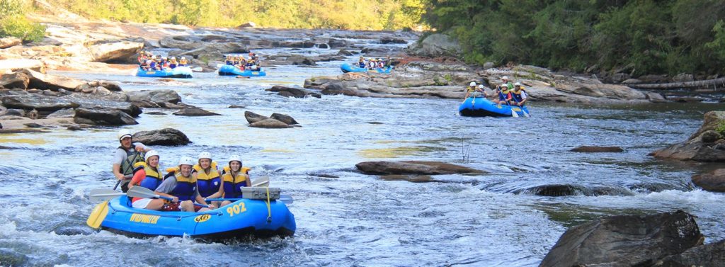
Wild
Scenic
Recreational
Run Time Estimate
Select put-in and take-out to estimate time.
Plan This Trip
See wind-adjusted speed maps, forecast planning, and detailed time estimates.
Sign in to generate an AI timing estimate for this run.
Whitewater timing varies with scouting, portages, and group pace. Use as a planning baseline.
Description
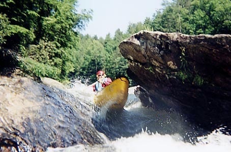
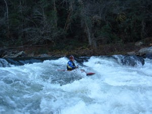
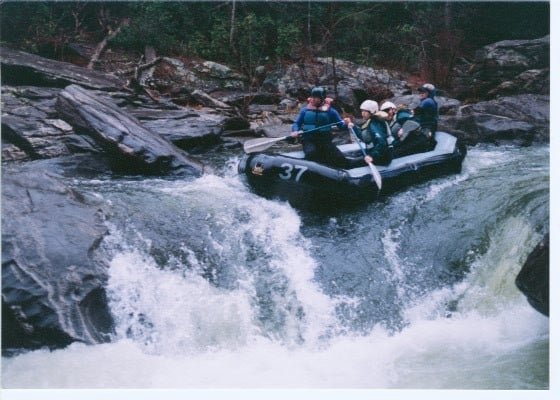
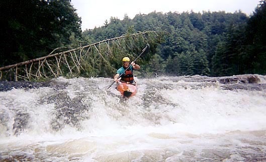
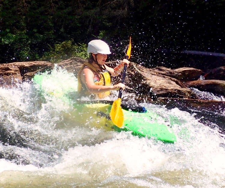
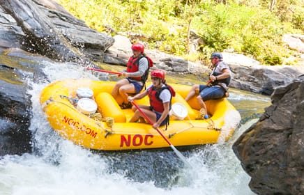
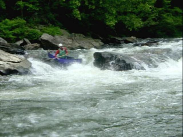
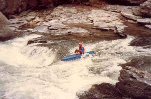
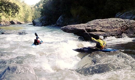
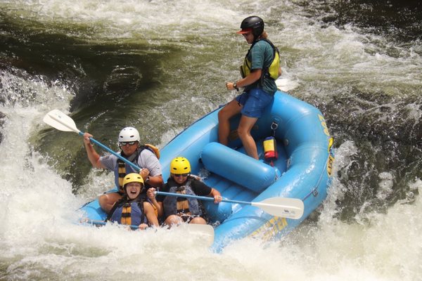
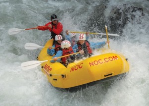
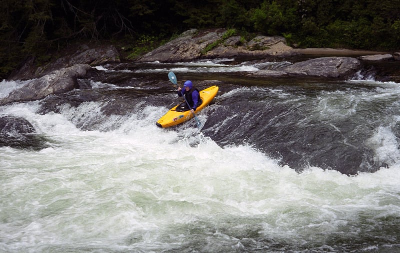
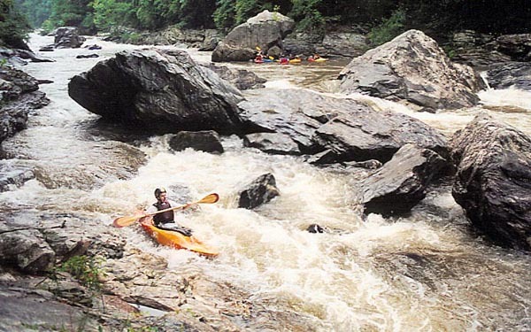
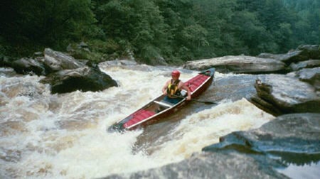
This is the Southeastern Classic! More legends exist about Five Falls of the Chattooga than almost any other set of rapids. Taken individually any of the 5 rapids of Five Falls would be significant named drops on any typical Southeastern river. They are far from the hair found on steep creeks and the legendary danger associated with these rapids arises in part from the long history of boating the Chattooga (40+ years). That said, approach these rapids with caution as they have killed and injured plenty of boaters.
This is the river where a portion of the classic 1972 movie _Deliverance_ was filmed.
The Chattooga became a National Wild and Scenic River on May 10, 1974.
Gauge Description: NOTE: The online gauge above reads differently than the paddler's gauge on the US 76 Bridge. Most paddlers refer to the bridge gauge. The online gauge reads about .15 higher than the bridge gauge at 2 feet, about .25 higher below two feet and the same at about 2.8 feet. It can be run down to .5 or even lower but is very scrapy. Above 2.0' Five Falls starts to bump up to class 5. It can certainly be run above 2.2', but only by experienced Section 4 paddlers. The Five Falls section gets much more difficult and dangerous at high water. The highest known run was August 17, 1994 at something between 9 and 10 feet from below Woodall to the Lake. According to USGS the river peaked at 17,500 cfs. Participants included Russ Kulmar, John Lesan, 'Snuffy' Hall, Kent Wiginton, and Richard Oldenquist.
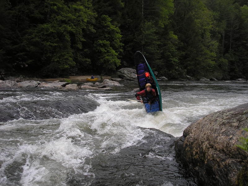
An Important note about Crack in the Rock rapid:
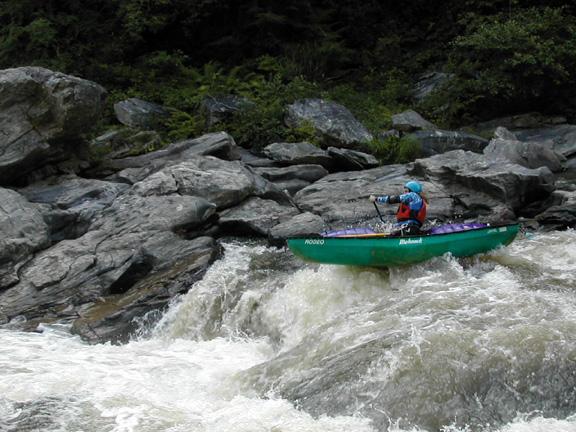
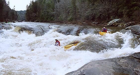
Most of the existing guidebooks in print still recommend right crack as the prefered route. This is no longer the case. A flood back around 1998 blew the original log out of the crack. Since then right crack has become an undercut boulder sieve. Boats and boaters have washed under the logs and rocks in right crack. On November 9, 2003 it was the site of a fatality. Any swim out of Corkscrew should be taken seriously. Left Crack has been the site of numerous fatalities and Right Crack is possibly more dangerous. If you swim, get to the bank quickly and do not swim into Crack in the Rock. Do nothing that involves hysteria--just swim to the bank. Most boaters run Crack below 2 feet through Middle Crack. Use your good judgement here. Running Left Crack when it has water flowing over the top is an easy move but do not get flipped at the top or you could get hurt or pinned. Middle Crack sometimes has debris. Far Right Crack is a blind rapid at high water and can accumulate debris. There is even a route over the right side of Right Crack if you are really careful. The good news is that the rapid can be portaged on both banks. Crack changes more than any other rapid on the river. Debris in the underwater sieve can change the pool height upstream of the drop and change the nature of the rapid. Center Crack changed in 2005 and became a 2-foot-tall pourover that can backender kayaks between the two boulders.
Finally, just remember that most of the large rocks in Five Falls are undercut.
## Putin and Shuttle Description
The put-in for this section of the river is located where US 76 crosses the river about 8 miles east of Clayton, GA near Long Creek, SC and forms the Georgia-South Carolina state line.
There are parking areas on both the Georgia and South Carolina side of the river.
On the Georgia side you will find a small hikers' parking area ($2.00 fee), which holds about 5 cars. You can put in here with a short walk down to the river. The walk is a little shorter than the paved road to the beach below Bull Sluice or the trail to that rapids. However, if you put in here you miss Bull Sluice rapid.
There is a large USFS parking lot on the SC side of the river with changing rooms and bathrooms and with no parking fee. Follow the paved path about 250 yards to the beach below Bull Sluice or take the trail off to the right and put in right above Bull Sluice. Boaters sometimes access this river via Stekoa Creek.
To get to the take-out:
From the put-in, head left out of the parking lot (east) for about 2.5 miles or so and turn right on Orchard Road. Follow Orchard Road until it dead-ends on Battle Creek Road (across from the Dixie Aluminum plant). Turn right on Battle Creek. Stay on Battle Creek; you will come to a sharp right turn in the road--stay on the paved road. You are now on Damascus Church Road. Just past the little white church on the left, bear right onto Bull Sluice Road. This is a dirt road and you will see a sign for the Tugaloo Boat Ramp. Follow this dirt road all the way to the end and park at the boat ramp. Round trip is about 45 minutes. There are other access points such as Tugaloo Dam, Possum Creek, and Camp Creek, but most of these are excessively strenuous.
At the put-in don't forget to fill out the self-registration forms.
Shuttle service / boating shop / Lake Shuttle.
Chattooga Whitewater Outfitters has a boating store and offers shuttle service to just about any paddleable portion of the Chattooga. So if you are coming from a distance, you can pack 4 or 5 boats onto one car and not have to worry about bringing that second car. It is a very good idea to call them a day in advance 864-647-9083. If you get to the river and find that you've forgotten your pfd, helmet, spray skirt, or paddle, they also rent equipment. They have a web site http://www.chattoogaadventures.com/ . They are located 2.6 miles on the South Carolina side of the river, just past the turnoffs for Earl's Ford and Woodall. You could even plug their street address into a GPS (14239 Long Creek Hwy, Long Creek, SC 29658) to get you very close to the river. Coming from Atlanta it will probably take you past route 76 bridge on the way. I know that it does from Asheville. Chattooga Sounds (a campground near the takeout) operates a lake shuttle service for those who would rather not paddle across the lake. The fee is $20 for the 1st (up to) 4 people and $5 / person after that. Their number is 864-647-6196. http://www.chattoogasounds.com/ You can make arrangements for them to bring your cooler of snacks & drinks when then meet you at the head of the lake.
Other links:
See also Section 3.
Rapids in this Run (15)
 Rapid
III
Rapid
III
Screaming Left Turn
 Rapid
III
Rapid
III
Rock Jumble
 Rapid
IV
Rapid
IV
7 Foot Falls
 Rapid
II+
Rapid
II+
Beaver Skull
 Rapid
III+
Rapid
III+
Stekoa Creek Rapid
 Rapid
III+
Rapid
III+
Deliverance Rock
 Rapid
II+
Rapid
II+
Tunnel of Love
 Rapid
III+
Rapid
III+
Little Woodall
 Rapid
Rapid
Camp Creek
 Rapid
Rapid
Five Falls
 Rapid
IV
Rapid
IV
Entrance
 Rapid
IV+
Rapid
IV+
Corkscrew
 Rapid
IV+
Rapid
IV+
Sock em Dog
 Rapid
III+
Rapid
III+
Shoulderbone
 Rapid
III
Rapid
III
Quaalude
Playspots (4)
Hazards & Portages (5)
Caution: The following locations may require scouting or portaging. Always check current conditions.
Difficulty
Class II-IV+
Length
8.4 mi
Gradient
34 ft/mi
max 117
Rapids
15
5 Hazards
Access Points
Difficulty Classes
I Easy
II Novice
III Intermediate
IV Advanced
V Expert/Extreme
VI Unrunnable
Permit Required
Be sure to sign in at the putin.
Current Conditions
5-Day Forecast
Whitewater data from
American Whitewater
American Whitewater