St.Charles: Burr Road to Leroy Oaks Forest Preserve (4.7-5.0 miles)
Gauge Conditions
Data from American Whitewater & USGS
Run Map
Run Time Estimate
Select put-in and take-out to estimate time.
Plan This Trip
See wind-adjusted speed maps, forecast planning, and detailed time estimates.
Sign in to generate an AI timing estimate for this run.
Whitewater timing varies with scouting, portages, and group pace. Use as a planning baseline.
Description
Quick Facts:
Location: Northeast IL, about 3.5 miles NW of St.Charles, between Elgin & Aurora.
Shuttle Length: 3.8 miles. (See details in 'Directions' Tab.)
Character: Flatwater punctuated by a number of weir/dam drops. Starts in Royal Hawk CC (golf course), enters woods, and threads backyards of estate homes.
Drainage: 52 sq.mi. (at gauge site immediately downstream of take-out).
Put-in is approximately 745' elevation.
Take-out is approximately 710' elevation.
Thus total elevation change is approximately 35'.
General Overview
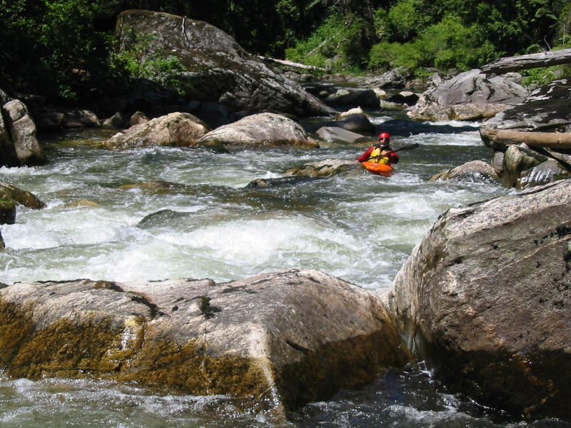
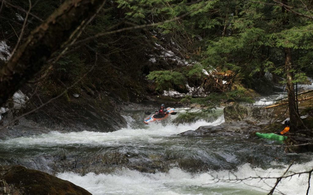
This reach consists of flatwater punctuated by a number of weir/dam drops. Do not be deceived or discouraged by the low gradient! The drops will definitely get your attention and merit your trip! The early going winds through Royal Hawk Country Club (golf course), before entering heavily wooded area, then threads through backyards of estate homes. Caution: at moderate-to-high flows, some (many) of the weir/dams will become quite 'sticky', and merit scouting and possibly portaging!
Notes:
Shoulders on Bolcum Road (around the put-in as suggested by a user) are virtually non-existent. All property in the vicinity appears to be privately owned. It would seem necessary to get permission to leave a vehicle on some private property to use this location. Alternate put-in access (as listed) further upstream has (at least minimally parkable) shoulders. It adds largely uneventful length to the run, though you may have to deal with additional deadfall and snags in this additional early going.
For early season runs, the listed take-out may not be accessible (due to the park gates still being closed). Alternate take-out is available by continuing 0.2 mile downstream to S.Randall Road. Parking at a church at the top of the hill nearby (Crane Road) has generally not been a problem. This does make for a bit of a hike up, but probably no worse than you normally have at the listed take-out. So, in fact, many folks may prefer this take-out, especially since it is so easy to identify from the river. (At least one group of paddlers has blown by their intended take-out in the park and ended up down to this take-out anyway!)
Richard DeGroat provides:
*Unfortunately there is a lot of blowdown, but all in all, a great place for an intermediate paddler (or novice, if with a more experienced paddler) to practice. There are several 'drops' which at different levels become interesting. Beginner/novice paddlers should be very cautious due to numerous strainers present. Be prepared to portage!*
Google Maps has excellent resolution aerials of this reach. We highly recommend going to the 'Map' tab, clicking 'Satellite', double clicking near (not on, but near) the put-in location icon, zooming to the maximum resolution (without losing image), and doing a 'virtual tour' to 'walk' down the reach. (Though it can be a bit difficult following the creek in the wooded portion of the run.)
Two small dams were removed in a project: 'The Davoust Dam is a rock dam comprised of boulders which were hand modified so they now allow passage for aquatic organisms during all stream flows. The Creek Bend Forest Preserve Dam was also removed and bank stabilization work completed during this project that ended in the Fall of 2010.' Additional info and photos about that project are at Fox River Ecosystem.org.
Rapids in this Run (12)


Waterfalls (2)
Playspots (1)
Hazards & Portages (1)
Caution: The following locations may require scouting or portaging. Always check current conditions.
Difficulty
Class I-II(III)
Length
4.8 mi
Gradient
10 ft/mi
Rapids
12
1 Hazard
Access Points
Shuttle Info
Put in is reportedly on Bolcum Road, parking a bit away from the river at a school parking lot.
Take out is usually in Leroy Oakes County Park. However, the park road is typically gated in winter (through March), making a fairly long walk out to a parking area just outside the gate.
For early-season runs, it may be best to continue downstream to Randall Road. Taking out on river-left, you can carry up the cement drainage spillway, to the bikepath, and to a church parking lot (marked as 'Hosanna Church' on the topo maps). Your carry will be about 1050' (0.2 mi.).
Difficulty Classes
I Easy
II Novice
III Intermediate
IV Advanced
V Expert/Extreme
VI Unrunnable
Current Conditions
5-Day Forecast
Whitewater data from
American Whitewater
American Whitewater