Stevens Bridge to Craigs Beach River Access Wild
Gauge Conditions
Runnable: 1,000.0 – 6,000.0 CFS
Data from American Whitewater & USGS
Run Map
Interactive run map
Loads as you approach this section.
Put-in
Take-out
Rapids/Hazards
Wild
Recreational
Run Time Estimate
Select put-in and take-out to estimate time.
Plan This Trip
See wind-adjusted speed maps, forecast planning, and detailed time estimates.
Sign in to generate an AI timing estimate for this run.
Whitewater timing varies with scouting, portages, and group pace. Use as a planning baseline.
Description
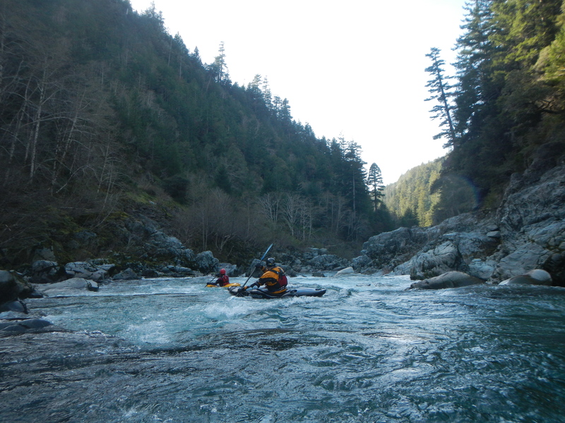
This is the classic Class III run on the Wild and Scenic South Fork Smith River. Multiple access points along the way allow boaters to paddle varied sections.
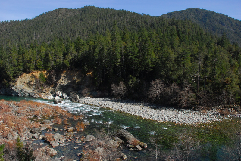
You will be hard pressed to find more beautiful and clearer water than that of the Smith River watershed. It is the only first-order river system in California with no dams or diversions between its sources and the sea (other river systems in California have no dams or diversions but feed into larger ocean-going rivers that do).
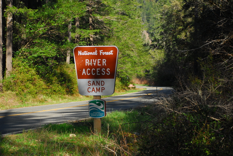
The standard Class III roadside run on the South Fork Smith goes from Stevens Bridge to Craigs Beach River Access. For a shorter run, put in at Sand Camp River Access instead of Stevens Bridge.
Boulder Creek is one of the notable drops near the top of the run where a large midstream boulder divides the flow. Sand Camp Access is a possible intermediate access point that is a good option particularly when flows are lower or if you are continuing on down through the gorge and just looking for a warm up for that.
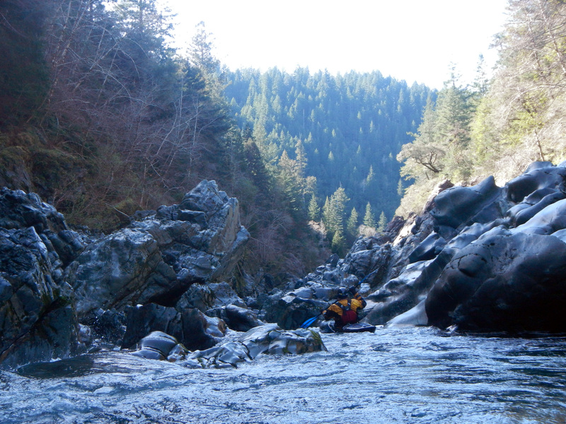
Below Sand Camp the road crosses over to river right to avoid the landslide-prone slope on river left. There's a fun Class III rapid in this section between the two bridges.
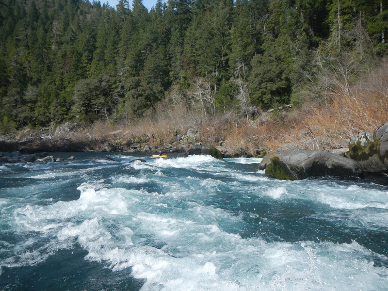
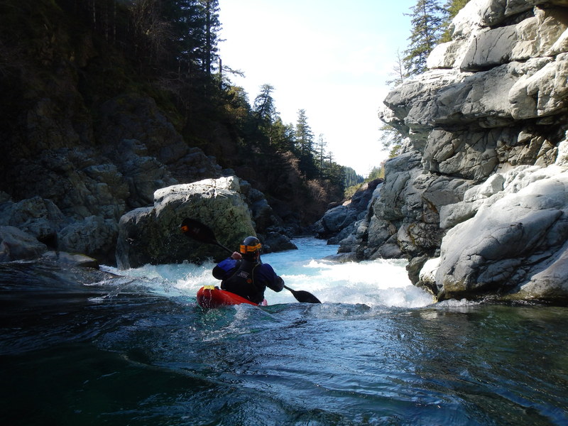
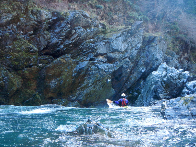
As you pass Coon Creek, you will come to Coon Creek Rapid, a straightforward Class III with a boulder towards the end of the drop on river right that is easy to navigate around. Broken Paddle is next and, although it is a named rapid, it is characteristic of several of the unnamed Class III rapids along this section.
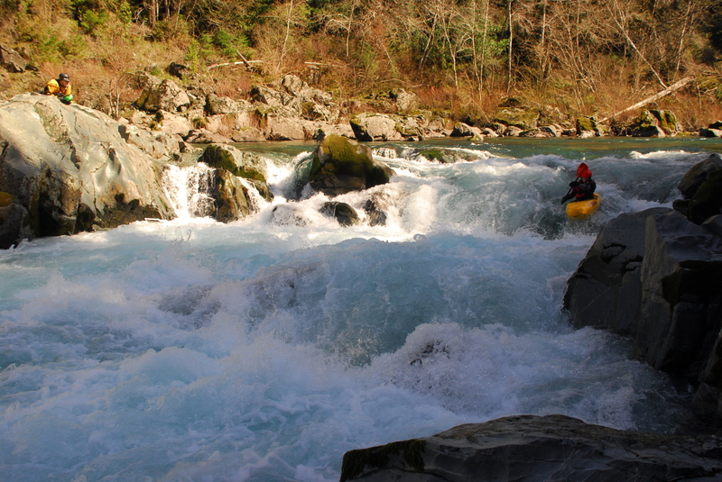
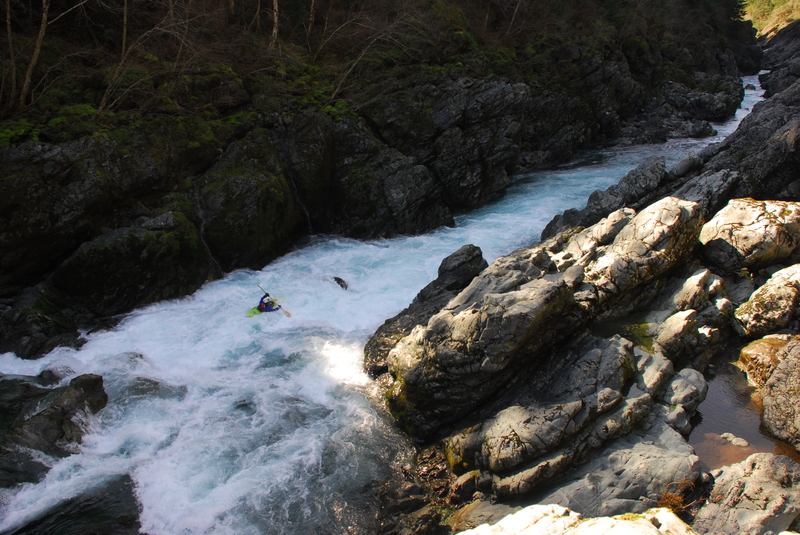
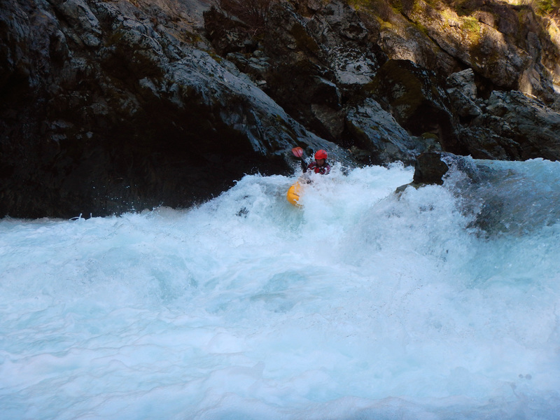
The most challenging rapid on this run comes near the end at Surprise, a fun Class III at an obvious horizon line on a sharp left bend. Scout from river right. A hole forms on the river right so the preferred line is generally down the left where you may need to negotiate a rock outcrop towards the bottom of the drop. At higher flows, the rapid is characterized by two large holes in the center of the flow. It's easy to portage this drop on river right.
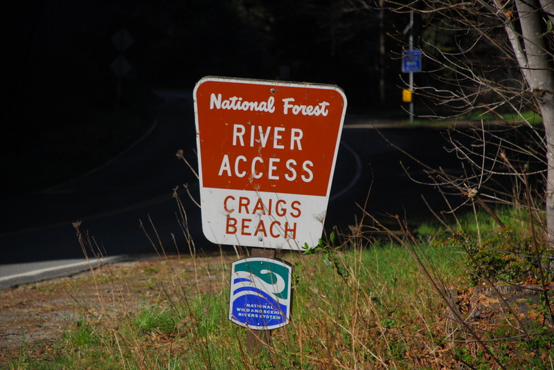
Not far below Surprise, Craigs Creek enters on river right. A sizable stream, it signals that the Craigs Beach take-out is within sight on the left. Run the riffle at Craigs Beach and eddy left immediately to take out. A single-track trail connects to the parking area of the designated Craigs Beach River Access. It is a challenging carry for rafts. This is also the put-in for the Class IV/V South Fork Gorge run.
Logistics
A mile and a half upstream of Hiouchi on Highway 199, turn south onto South Fork Road. Cross the Middle Fork bridge and at 0.2 miles down the road you will reach the Smith River Forks River Access; this is the take-out for both the South Fork Gorge and the Middle Fork (Oregon Hole) Gorge. Unless you are extending the Class III Stevens Bridge Run to include the Class IV/V South Fork Gorge, stay on South Fork Road and continue past the Forks River Access.
Cross the South Fork Bridge then bear left after the bridge to stay on South Fork Smith Road. In about 1.7 miles, you will arrive at Craig's Beach River Access on the left. This is the take-out for the Stevens Bridge Run (and put-in for the South Fork Gorge). Scout the take-out beach/river bar if you're unfamiliar with it.
Continuing upriver on South Fork Road, at 5.2 miles from Craigs Beach, you will reach the Sand Camp River Access. There is a large parking area, vault toilet, and gently sloped trail to the river. This access is a common put-in for those seeking a shorter run than the full 12-mile Stevens Bridge Run. This makes for a nice warm-up and a good day-trip with plenty of fun whitewater before you reach the Gorge.
To do the full run, continue another 5.4 miles upriver on South Fork Road to reach the Steven Bridge put-in. The bridge also serves as the take-out for the Upper South Fork Gorge Run.
Rapids in this Run (13)
 Rapid
IV
Rapid
IV
Boulder Creek Rapid
 Rapid
Rapid
Sand Camp Access
Rapid
II+
G-Spot
 Rapid
III
Rapid
III
Coon Creek
Rapid
III
Broken Paddle
 Rapid
III+
Rapid
III+
Surprise
 Rapid
Rapid
Craigs Beach River Access
 Rapid
IV
Rapid
IV
Slalom Course
 Rapid
IV
Rapid
IV
Gorge Entrance (#1)
 Rapid
V
Rapid
V
Good Luck! (#2)
 Rapid
IV
Rapid
IV
The Boof (#3)
 Rapid
IV
Rapid
IV
Slot (#4)
 Rapid
IV
Rapid
IV
Final Rapid (#5)
Difficulty
Class II-IV+
Length
12.0 mi
Gradient
31 ft/mi
max 41
Rapids
13
Access Points
Difficulty Classes
I Easy
II Novice
III Intermediate
IV Advanced
V Expert/Extreme
VI Unrunnable
Current Conditions
5-Day Forecast
Whitewater data from
American Whitewater
American Whitewater