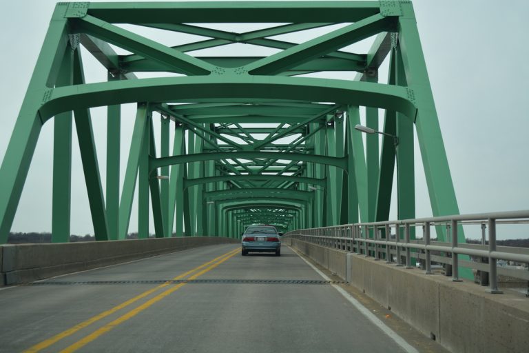
How's Your
River
×
Explore
Explore Map
Water Bodies
Gauges
Access Sites
Tidal Stations
Whitewater
Pricing
Login
Sign Up
Hazard Warning:
Hazard information may be user-submitted and unverified. Conditions change frequently. Always scout rapids and obstacles yourself.
Whitewater
Georgia
Etowah - 3 - Highway 9 to Castleberry Bridge. Etowah Falls Section.
Castleberry Bridge
Hazard
GA
Castleberry Bridge
Etowah - 3 - Highway 9 to Castleberry Bridge. Etowah Falls Section. (GA)
Monitor this Rapid
Water Body
This Run
Other Rapids
Gauge
Gauge Conditions
Etowah River at GA 136, near Landdrum, GA
Downstream
Primary
Runnable: 200.0 – 1,000.0 CFS
Data from
American Whitewater
&
USGS
Photo
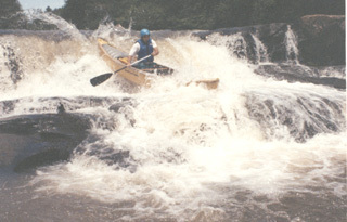
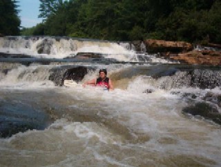
Photo courtesy of
American Whitewater
Description
Take out on river right, at or shortly below the large rocks, for easiest walk to road. Alternative is to run small rapid and take out under bridge.
Other Rapids on This Run (9)
Rapid
Highway 9 (Lumpkin County)
0.0 mi
Hazard
II
Chuck Shoals
0.8 mi
Waterfall
IV
Etowah Falls
4.0 mi
Hazard
II
Lower Drop of the Falls (a/k/a Rocky Road)
4.0 mi
Hazard
II
Island Shoals
5.6 mi
Hazard
II
Middle Shoals
5.8 mi
Hazard
II
Castleberry Rapid
5.9 mi
Hazard
II+
Etowah Tunnel
9.5 mi
Rapid
Highway 136 Bridge
14.8 mi
Type
Hazard
Mile Marker
6.0 mi
View Full Run
3 - Highway 9 to Castleberry Bridge. Etowah Falls Section.
Etowah
II(IV)
7.2 mi
Hazard
— Exercise extreme caution in this area.
Whitewater data from
American Whitewater