Waterfall
AL
Desoto Falls
Save this feature with the run it belongs to.
Gauge Conditions
Runnable: 175.0 – 1,000.0 CFS
Upper limit for best boatability uncertain. Please help your fellow boaters with a comment or report.
Data from American Whitewater & USGS
Photo
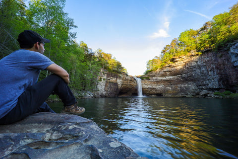
Photo courtesy of American Whitewater
Description
After the hike in paddlers are rewarded with putting in and getting to paddle around the base of and behind Desoto Falls. Bring a camera, this is a magical and photogenic moment (and a great place to make those pictures/video of flatwater moves look cool).
Location
Interactive river map
Loads as you approach this section.
Other Rapids on This Run (2)
View Full Run
1. Desoto Falls to Cloudmont
Little, W. Fork
I-II(IV)
1.8 mi
Hazard — Exercise extreme caution. Portage recommended — scout before running.
Current Conditions
5-Day Forecast
Whitewater data from
American Whitewater
American Whitewater