Drainage: 5.73 sq.mi.
Save this feature with the run it belongs to.
Gauge Conditions
Probably too low for good whitewater (may be passable in a boat).
Photo
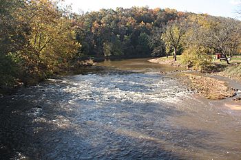
Description
Drainage area at our listed (short run) put-in is 5.73 sq.mi. (as calculated via USGS StreamStats Beta software).
The nearest USGS gauge (on as similar as possible drainage area) is ~20 miles due south in Missouri, with drainage of 31 square miles. Flow here might be (on average) just less than 1/5th (0.18387 times) the reading on this gauge.
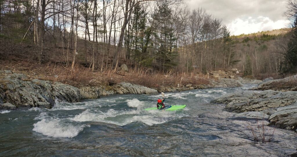
However, any online gauge will be nearly worthless for catching this run! USGS gauges update online usually just once per hour, and when data is posted it is already 20-30 minutes old. By the time you see that data, gather your gear, get to the creek, gear up and get on ... you've likely missed the peak flow!
It is likely the only realistic way to catch this run is (1) you have to already be within a half-hour or so drive from the creek, (2) you have to be watching weather radars online, (3) you need to have your boat and gear packed and ready to go, (4) you need to roll out as soon as the heaviest rain has passed.
Location
Other Rapids on This Run (4)

Current Conditions
5-Day Forecast
American Whitewater