Rapid
CO
End of Features in Confluence Park - Cherry Creek and South Platte
Save this feature with the run it belongs to.
Gauge Conditions
Runnable: ? – ? CFS
Approximate - nearest available gauge. Use as general reference only.
Data from American Whitewater & USGS
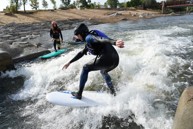
Photo
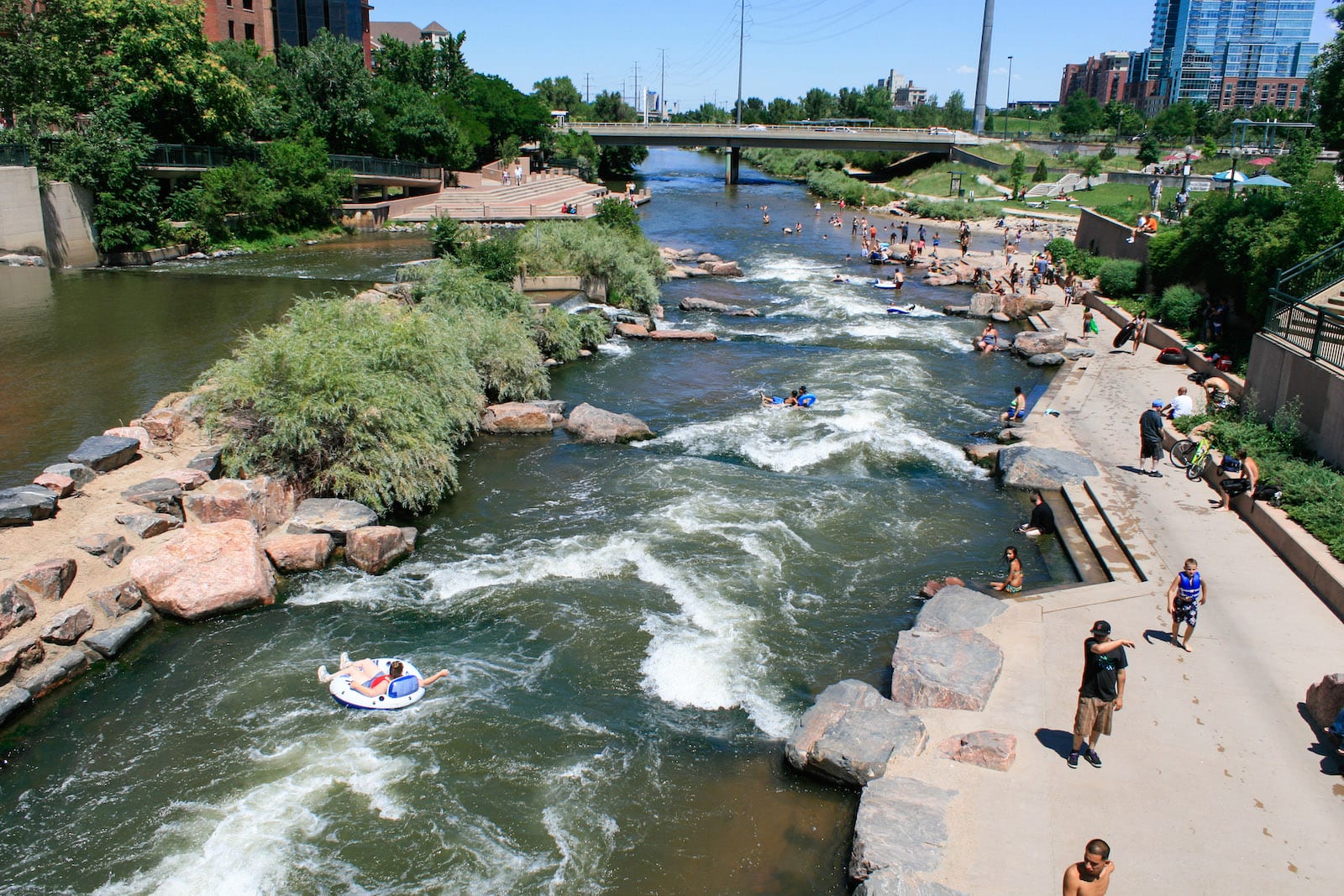
Photo courtesy of American Whitewater
Description
At the confluence of Cherry Creek and South Platte River in downtown Denver, this urban rapid marks the transition between two waterways, creating unpredictable currents and potential hydraulic features. The urban environment and potential debris make navigation challenging, with water levels and flow significantly impacting the rapid's characteristics. Paddlers should be aware of potential obstacles, urban infrastructure, and rapidly changing water conditions in this metropolitan setting.
Location
Other Rapids on This Run (6)
 Rapid
N/A
Rapid
N/A
Put In - First Section of Rapids - Hep A and Hep B
 Playspot
N/A
Playspot
N/A
First Rubble Dam - Waymay Wave at 16th St. Bridge (Hep C)
 Playspot
N/A
Playspot
N/A
Start of Second Series of Features - 19th St. Masterblaster (Hep D)
 Playspot
N/A
Playspot
N/A
End of Second Series - First Take Out Option
 Playspot
N/A
Playspot
N/A
One more rubble dam - The Trestle Wave
 Rapid
N/A
Rapid
N/A
2nd and Last Take Out - Exit Bike Path - Trestle Wave
View Full Run
07. Confluence Park (of South Platte with Cherry Creek)
South Platte
II-III
1.0 mi
Current Conditions
5-Day Forecast
Whitewater data from
American Whitewater
American Whitewater