Rapid
MT
Glacier Rim Access
Save this feature with the run it belongs to.
Gauge Conditions
Data from American Whitewater & USGS
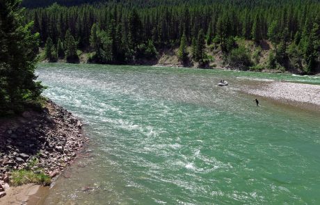
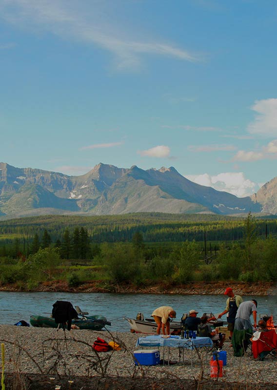
Photo

Photo courtesy of American Whitewater
Description
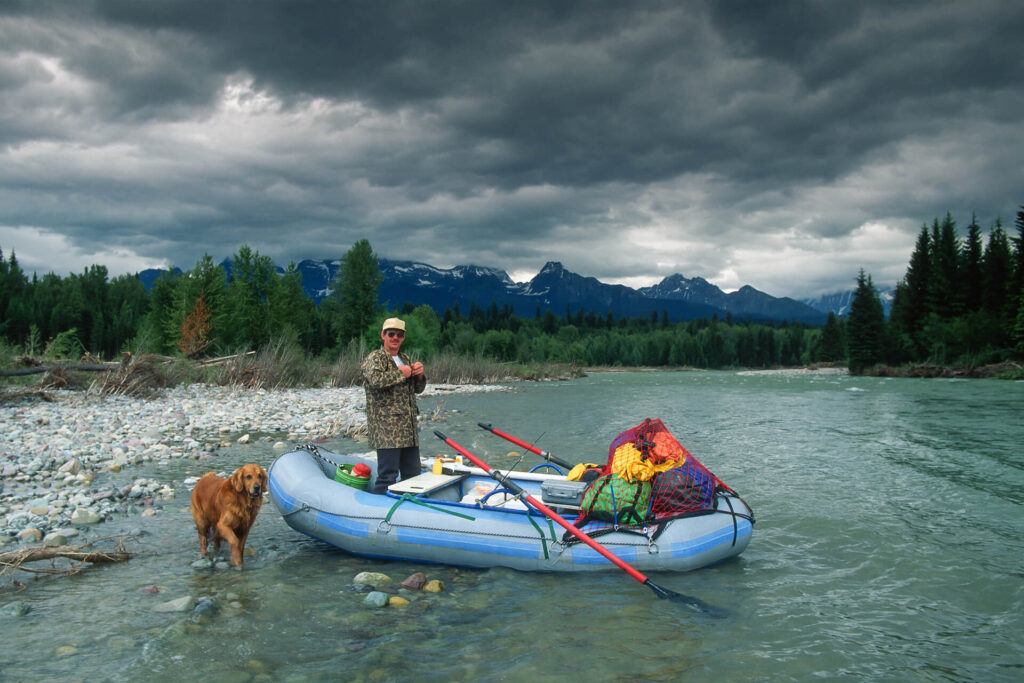
Glacier Rim Access serves as a strategic alternate take-out point on the North Fork Flathead River, providing paddlers with a convenient exit option in a remote wilderness section. While specific rapid details are limited, the location likely offers challenging navigation typical of North Fork terrain, with potential rocky riverbed and swift current requiring careful maneuvering.
Location
Other Rapids on This Run (14)
 Rapid
N/A
Rapid
N/A
Border Access, Put-In
 Rapid
II
Rapid
II
Upper Kintla Rapids
 Rapid
II
Rapid
II
Lower Kintla Rapids
 Rapid
N/A
Rapid
N/A
Ford Access
 Rapid
N/A
Rapid
N/A
Polebridge Access
 Rapid
N/A
Rapid
N/A
Big Creek River Access
 Rapid
II
Rapid
II
rapid
 Rapid
N/A
Rapid
N/A
Great Northern Flats
 Rapid
N/A
Rapid
N/A
rapid
 Rapid
III
Rapid
III
rapid
 Rapid
III
Rapid
III
Upper Fool Hen Rapids
 Rapid
III
Rapid
III
Lower Fool Hen Rapids
 Hazard
III
Hazard
III
The Ledge
 Rapid
N/A
Rapid
N/A
Blakenship Bridge, Take-Out
View Full Run
1. Canadian Border to Blankenship Bridge
Flathead, North Fork
I-II+(III)
58.0 mi
Current Conditions
5-Day Forecast
Whitewater data from
American Whitewater
American Whitewater