Take-out
WA
Hyas Creek Take Out
Save this feature with the run it belongs to.
Gauge Conditions
Data from American Whitewater & USGS
Photo
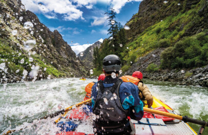
Photo courtesy of American Whitewater
Description
Take out on river right just past the confluence of Hyas Creek. There is a pull out along Forest Road 29 that provides space for a couple cars to park and a trail down to the shoreline.
Location
Interactive river map
Loads as you approach this section.
Other Rapids on This Run (3)
View Full Run
Rugged Ridge Trail to Hyas Creek
Calawah, S. Fork
III-IV
7.5 mi
Current Conditions
5-Day Forecast
Whitewater data from
American Whitewater
American Whitewater