Interstate Falls
Save this feature with the run it belongs to.
Gauge Conditions
Runnable: ? – ? CFS
Approximate - nearest available gauge. Use as general reference only.
Data from American Whitewater & USGS
Photo
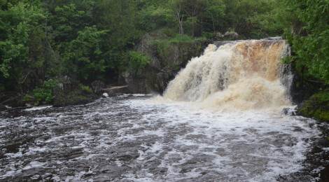
Photo courtesy of American Whitewater
Description
At 1.4 miles, an island is encountered. Immediately at the end of this island lies the run-up to Interstate Falls. There is a house river-right at the falls -- please respect private property.
Location
Interactive river map
Loads as you approach this section.
Other Rapids on This Run (3)
View Full Run
A) Hwy. 2 at WI/MI state line to Nylund Road (3.6 miles)
Montreal
II-IV(V)
3.4 mi
Current Conditions
5-Day Forecast
Whitewater data from
American Whitewater
American Whitewater