Hazard
WI
Island
Save this feature with the run it belongs to.
Gauge Conditions
Runnable: ? – ? CFS
Approximate - nearest available gauge. Use as general reference only.
Data from American Whitewater & USGS
Photo
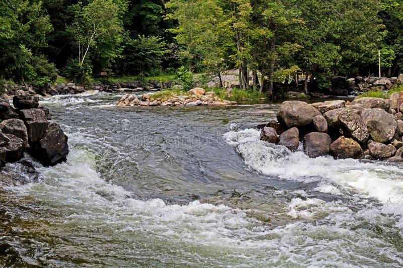
Photo courtesy of American Whitewater
Description
Not far downstream, a large (relative to the size of this stream) island splits the flow. It is very likely that wood will accumulate at the head of this island, as well as in each of the narrower channels downstream. (It appears the right channel is smaller, and has a ledge-drop in the early going as well as a drop as the island ends, whereas the left channel (carrying a bit more of the flow) has nothing apparent (though hard to tell through the trees in the aerial view) until the end of the island, where there appears to be a fine ledge-drop into the flow from the other channel.
Location
Interactive river map
Loads as you approach this section.
Other Rapids on This Run (6)



View Full Run
Wequiock Falls to Nicolet Drive (1.25 miles) *Access Issues*
Wequiock Creek
II-IV
1.2 mi
Hazard — Exercise extreme caution in this area.
Current Conditions
5-Day Forecast
Whitewater data from
American Whitewater
American Whitewater