Put-in
WV
Keyser North Branch Public Stream Access -- Put-in/Take-out.
Save this feature with the run it belongs to.
Gauge Conditions
Data from American Whitewater & USGS
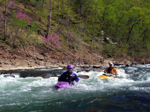
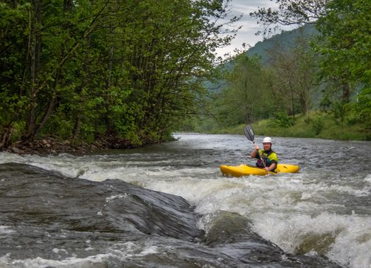
Photo
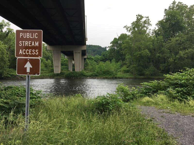
Photo courtesy of American Whitewater
Description
Keyser North Branch Public Stream Access - West Virginia side. The Scenic portion of the run begins below Keyser WV starting with Queen's point overlook on the Maryland side (river left) which continue with several rock outcroppings, some of which extend down to the water on the West Virginia side (river right). The rock outcroppings extend along the ridge on the West Virginia side extend for the next 4.4 miles - almost all the way down to the Gary Yoder river access take-out.
Location
Interactive river map
Loads as you approach this section.
Other Rapids on This Run (13)
Rapid
N/A
Put In - Bloomington, MD
 Hazard
N/A
Hazard
N/A
Westvaco dam
Rapid
N/A
Put-in - Piedmont, WV
Rapid
N/A
Put In - Westernport, MD
Rapid
II
"Westernport" rapid
Rapid
II
"Corner" rapid
Rapid
II+
"Kelly's" rapid
Rapid
N/A
McCoole River Access -- Put-In/Take-Out
Rapid
II-
"Keyser Ford" rapid
Rapid
I
"Lover's Leap"
Rapid
N/A
Western Maryland 21st Bridge.
 Rapid
N/A
Rapid
N/A
Waxter Ridge Rock Outcroppings
Rapid
N/A
Take Out - Black Oak (Gary Yoder River Access)
View Full Run
5. Bloomington, MD to Black Oak (Gary Yoder River Access) Nr. Rawlings, MD
Potomac, North Branch
II
12.0 mi
Current Conditions
5-Day Forecast
Whitewater data from
American Whitewater
American Whitewater