How's Your
River
×
Explore
Explore Map
Water Bodies
Gauges
Access Sites
Tidal Stations
Whitewater
Pricing
Login
Sign Up
Hazard Warning:
Hazard information may be user-submitted and unverified. Conditions change frequently. Always scout rapids and obstacles yourself.
Whitewater
California
Yuba, North - 1. Wild Plum Campground to Downieville
Ladies Canyon Rapid
Waterfall
CA
Class V
Ladies Canyon Rapid
Yuba, North - 1. Wild Plum Campground to Downieville (CA)
Monitor this Rapid
Water Body
This Run
Map
Other Rapids
Gauge
Weather
Directions
Gauge Conditions
N Yuba River below Goodyears Bar CA
Downstream
Primary
Runnable: 250.0 – 2,500.0 CFS
Data from
American Whitewater
&
USGS
CDEC Flow Data
California
N YUBA R BLW GOODYEARS BAR
GYB
Primary
Elevation: 2,453 ft
Data from
California Data Exchange Center
(CDEC)
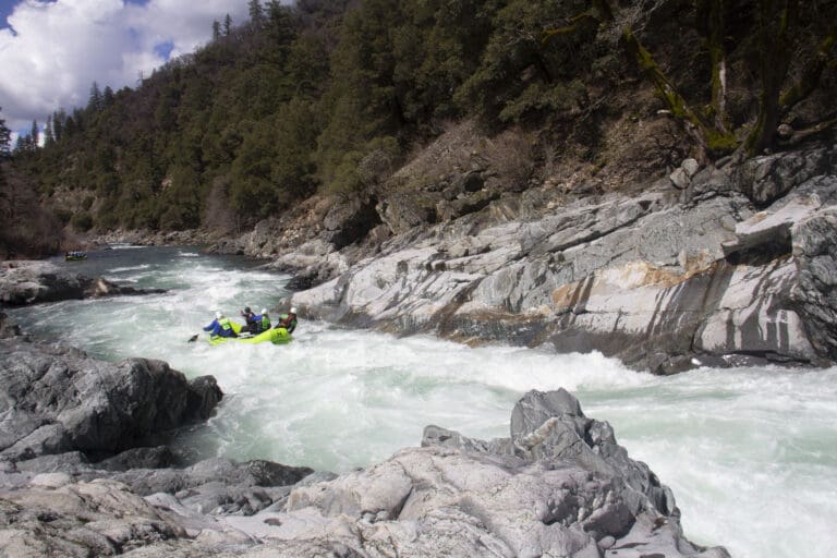
Photo
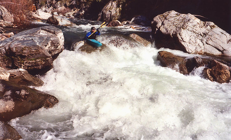
Photo courtesy of
American Whitewater
Description
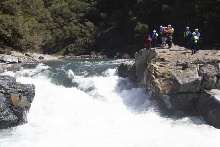
Scout this rapid from the road on the way up. Or, scout river left. 
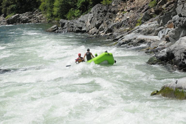
Caution: higher flows cause Ladies Canyon hole to be riverwide. This is a hole that you want to be upright after hitting because you are headed directly into action.
Location
Radar
Counties
Cell
Verizon
AT&T
T-Mobile
Dark
Satellite
Terrain
Other Rapids on This Run (11)
Rapid
Put-In
0.0 mi
Waterfall
V
Loves Falls
0.0 mi
Waterfall
IV
Whorehouse
2.4 mi
Hazard
IV
Gillespie Dam
2.9 mi
Rapid
IV
Highway Rapid
5.1 mi
Rapid
III
Union Flat Campground
7.0 mi
Waterfall
V
Moss Canyon
9.1 mi
Waterfall
V
Boss Moss
9.2 mi
Waterfall
IV
Floss Moss
9.3 mi
Rapid
III
Shangri-La
10.5 mi
Rapid
III
Downie Creek
12.9 mi
Type
Waterfall
Difficulty
Class V
Mile Marker
6.5 mi
Directions
Navigate
View Full Run
1. Wild Plum Campground to Downieville
Yuba, North
IV-V
14.5 mi
Current Conditions
5-Day Forecast
Whitewater data from
American Whitewater
Ladies Canyon Rapid