Hazard
NC
Low-head Dam
Save this feature with the run it belongs to.
Gauge Conditions
Runnable: 2.0 – 6.0 FT
Upper limit for best boatability uncertain. Please help your fellow boaters with a comment or report.
Data from American Whitewater & USGS
Photo
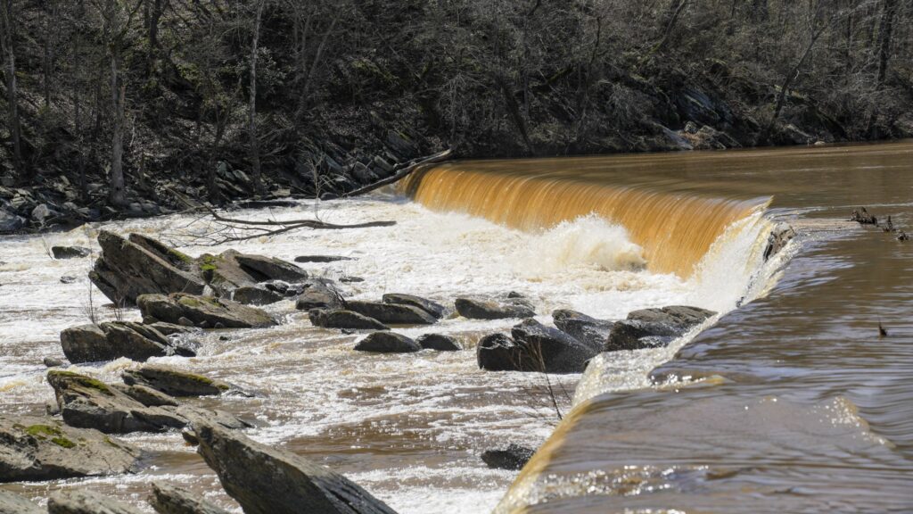
Photo courtesy of American Whitewater
Description
There is a small low head dam that doesn't pose a threat at low water but can become a mean hole at higher level. This also where you park your car and another takeout point.
Location
Interactive river map
Loads as you approach this section.
Other Rapids on This Run (4)
View Full Run
1. Forest Service Road 475-A @ Cove Creek to Low Head Dam
Davidson River
III-IV
1.5 mi
Hazard — Exercise extreme caution in this area.
Current Conditions
5-Day Forecast
Whitewater data from
American Whitewater
American Whitewater