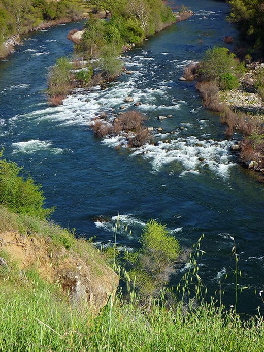
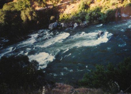
Mule Tail & Mule Rock
Save this feature with the run it belongs to.
Gauge Conditions
Runnable: ? – ? CFS
Approximate - nearest available gauge. Use as general reference only.
Data from American Whitewater & USGS
CDEC Flow Data California
Data from California Data Exchange Center (CDEC)
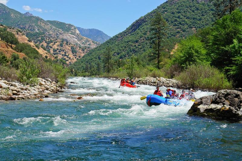
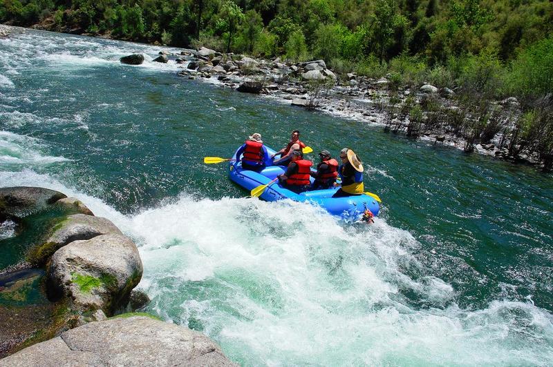
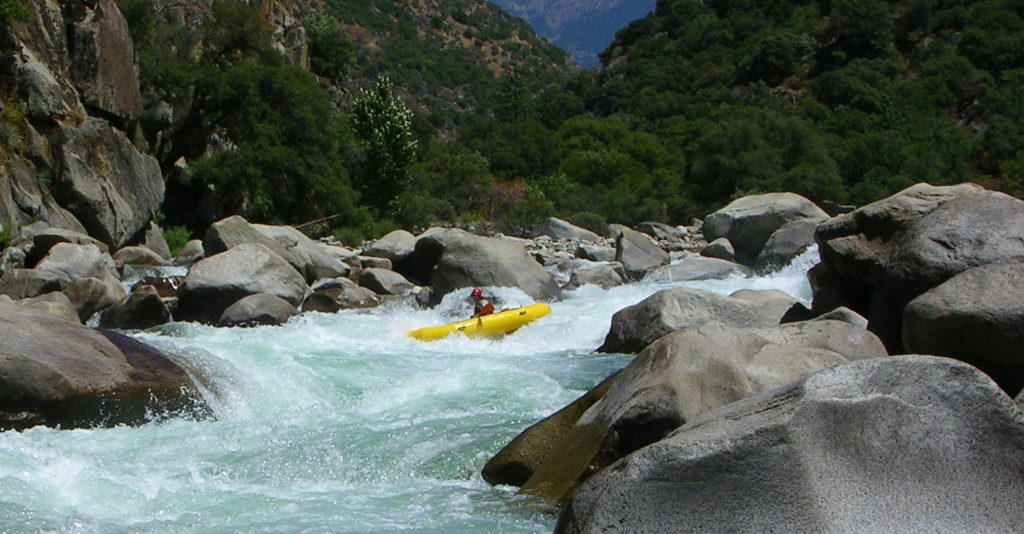
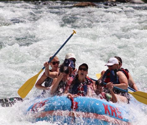
Photo
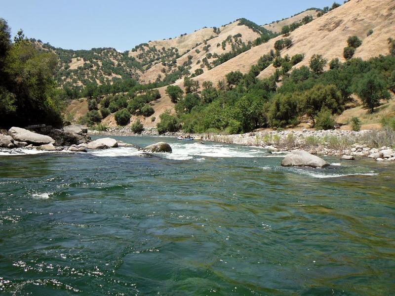
Photo courtesy of American Whitewater
Description
The river gradually curves to the right, then down a moderate drop with a nice wave train that leads into a large keeper hole. May be the best raft flipping trap on the river as it is difficult to see from upstream in the rapid until you are staring into the maw. Oops! At higher flows a seperate channel opens up on river right, avoiding the hole.
Location
Other Rapids on This Run (20)
 Rapid
Rapid
Garnet Dike
 Rapid
III
Rapid
III
Wild Wolf Chute
 Hazard
III+
Hazard
III+
Bear Wallow Rapid;
 Rapid
II+
Rapid
II+
Upper Skunk Pit
 Rapid
III
Rapid
III
Hermits Rapid
 Rapid
Rapid
Hermit's Put-in
 Rapid
III
Rapid
III
Bump City
 Hazard
II
Hazard
II
Big Momma
 Rapid
II
Rapid
II
Coyote Joe's Rapid
 Rapid
II
Rapid
II
Pipeline
 Rapid
II
Rapid
II
Widow Maker Rock
 Rapid
III+
Rapid
III+
Tail Twister Rapid & Raft Ripper Rock
 Rapid
II+
Rapid
II+
Racoon Gulch
 Rapid
Rapid
Bay Horse Flats
 Rapid
II
Rapid
II
Rattlesnake Rapid
 Rapid
III+
Rapid
III+
Fangtooth
 Rapid
II+
Rapid
II+
Badger Bend
 Rapid
I
Rapid
I
Rock Weir
 Rapid
Rapid
Mill Flat Creek
 Rapid
Rapid
Lizard Lip
View Full Run
2. Garnet Dike Campground to Kirch Flat Campground
Kings
III
9.2 mi
Current Conditions
5-Day Forecast
Whitewater data from
American Whitewater
American Whitewater