Gauge Conditions
Data from American Whitewater & USGS
Photo
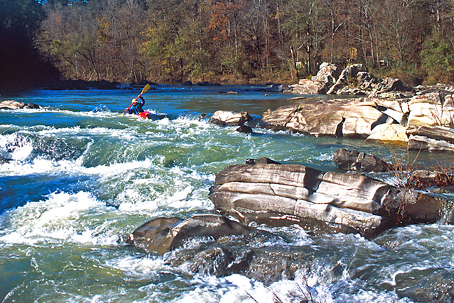
Photo courtesy of American Whitewater
Description
Put In marks the starting point for the lower Cossatot River section, offering paddlers immediate entry into the river's challenging terrain. While not a specific named rapid, this access point requires careful boat positioning and an awareness of potential submerged rocks and initial current dynamics that can set the tone for the downstream run.
Location
Other Rapids on This Run (1)
View Full Run
2) Hwy 246 to Ed Banks Road (3.1 miles)
Cossatot
II+
3.2 mi
Current Conditions
5-Day Forecast
Whitewater data from
American Whitewater
American Whitewater