Rapid
MN
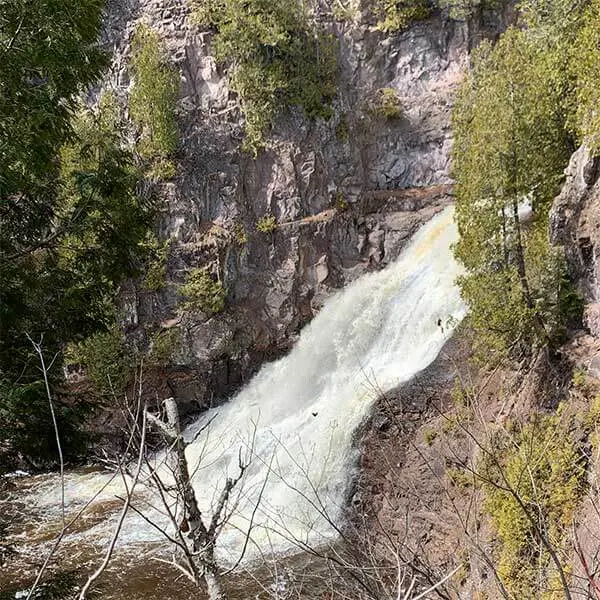
Superior Hiking Trail (SHT) bridge
Save this feature with the run it belongs to.
No sufficiently local live gauge linked. 1 automated match was excluded because the closest is 30.4 miles away. Use the parent run and local sources before making a trip decision.
Photo
Photo courtesy of American Whitewater
Description
The Superior Hiking Trail bridge crossing on the Caribou River creates a potential hazard for paddlers due to its low clearance and potential debris accumulation. Careful scouting and potential portage are recommended, as the bridge structure and surrounding terrain can create unpredictable water dynamics that require precise navigation.
Location
Interactive river map
Loads as you approach this section.
Other Rapids on This Run (5)


View Full Run
Co.Hwy.8 to Hwy.61 (6.66 miles)
Caribou
II-IV(V+)
6.2 mi
Current Conditions
5-Day Forecast
Whitewater data from
American Whitewater
American Whitewater