Gauge Conditions
Runnable: 6.0 – 10.0 FT
Unknown! Help us out! Add a comment about best runnable levels!
Data from American Whitewater & USGS
Photo
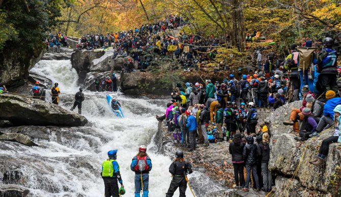
Photo courtesy of American Whitewater
Description
Take Out rapid on Hurricane Creek is characterized by its location near the takeout point, potentially marking the end of a challenging river run. While specific details about the rapid's features are limited, paddlers should be prepared for potential obstacles or changes in water flow near the takeout area. Local knowledge and current river conditions are crucial for safely navigating this section of Hurricane Creek.
Location
Other Rapids on This Run (1)
View Full Run
Shores Lake to Hwy 215 (1 or 9 miles)
Hurricane Creek (Franklin County)
II+
11.9 mi
Current Conditions
5-Day Forecast
Whitewater data from
American Whitewater
American Whitewater