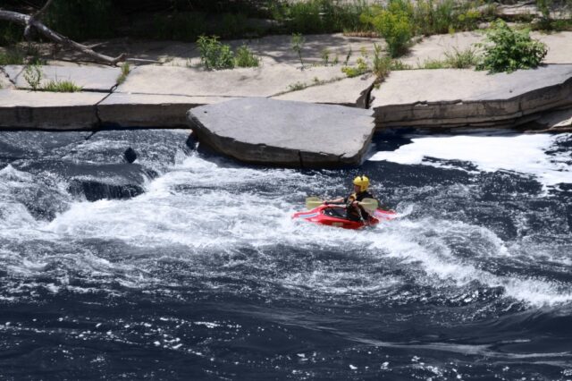
How's Your
River
×
Explore
Explore Map
Water Bodies
Gauges
Access Sites
Tidal Stations
Whitewater
Pricing
Login
Sign Up
Hazard Warning:
Hazard information may be user-submitted and unverified. Conditions change frequently. Always scout rapids and obstacles yourself.
Whitewater
Illinois
Tyler Creek - Elgin: Eagle Heights Park to Fox River (4 miles) *** Access Issues ***
USGS Gauge
Rapid
IL
USGS Gauge
Tyler Creek - Elgin: Eagle Heights Park to Fox River (4 miles) *** Access Issues *** (IL)
Monitor this Rapid
Water Body
This Run
Map
Other Rapids
Gauge
Weather
Directions
Gauge Conditions
Tyler Creek at Elgin, IL
Downstream
Primary
Runnable: 100.0 – 500.0 CFS
Too low.
Data from
American Whitewater
&
USGS
Description
Latitude 42°03'30", Longitude 88°18'14"
Kane County, Illinois, Hydrologic Unit 07120006Drainage area: 38.9 square milesDatum of gage: 745.00 feet above sea level
Location
Radar
Counties
Cell
Verizon
AT&T
T-Mobile
Dark
Satellite
Terrain
Other Rapids on This Run (4)
Rapid
N/A
Put In
0.0 mi
Playspot
II
Wing Park Wave
2.2 mi
Rapid
N/A
Judson College Wave
3.6 mi
Rapid
N/A
Take Out
3.9 mi
Type
Rapid
Mile Marker
0.0 mi
Directions
Navigate
View Full Run
Elgin: Eagle Heights Park to Fox River (4 miles) *** Access Issues ***
Tyler Creek
I-II
3.9 mi
Current Conditions
5-Day Forecast
Whitewater data from
American Whitewater
USGS Gauge