Rapid
MI
White Road
Save this feature with the run it belongs to.
Gauge Conditions
Runnable: 100.0 – 1,200.0 CFS
Possibly tame whitewater. *HELP YOUR FELLOW BOATERS BY PROVIDING A COMMENT ABOUT GAUGE READING AND BEST RANGES FOR BOATABILITY*
Data from American Whitewater & USGS
Photo
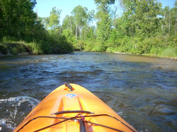
Photo courtesy of American Whitewater
Description
White Road rapid on Michigan's Sturgeon River presents minimal technical challenges, with mostly smooth flow and limited obstacles. Paddlers should be aware of potential fallen timber and shallow sections during low water periods, which may require careful navigation and precise boat positioning.
Location
Interactive river map
Loads as you approach this section.
Other Rapids on This Run (20)
Rapid
N/A
Put In
Rapid
N/A
Possible Put-in?
Rapid
N/A
Alternate Put-in #1
Rapid
N/A
Trowbridge Road
Rapid
N/A
Interstate 75
Rapid
N/A
Trowbridge Road
Rapid
N/A
Freeway Trail
Rapid
N/A
Sturgeon Valley Campground
Rapid
N/A
Possible obstruction/feature?
Rapid
N/A
Nomisteco Rd
Rapid
N/A
Deadfall?
Playspot
N/A
Confluence with West Branch
Rapid
N/A
USGS Gauge: 192 sq.mi.
Rapid
N/A
Deadfall?
Rapid
N/A
Possible Access
Rapid
N/A
Zig-Zag Snag
Rapid
N/A
Caught in the act!
Rapid
N/A
Haakwood State Forest Campground
 Rapid
N/A
Rapid
N/A
Rondo Road
Rapid
N/A
North Central State Trailhead
View Full Run
Trowbridge Road to Indian River (up to 20.5 miles)
Sturgeon (Cheboygan)
I-II
18.8 mi
Current Conditions
5-Day Forecast
Whitewater data from
American Whitewater
American Whitewater