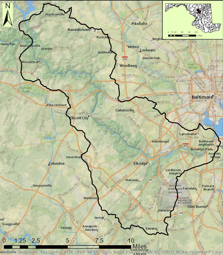
1. Gaither Rd. to Henryton Rd.
Gauge Conditions
Runnable: ? – ? CFS
Approximate reading: This gauge is 6.7 miles away on Patapsco. Use as a general reference only.
Data from American Whitewater & USGS
Run Map
Run Time Estimate
Select put-in and take-out to estimate time.
Plan This Trip
See wind-adjusted speed maps, forecast planning, and detailed time estimates.
Sign in to generate an AI timing estimate for this run.
Whitewater timing varies with scouting, portages, and group pace. Use as a planning baseline.
Description
Note: read below and/or click the Map tab to see the multiple access points for this section.
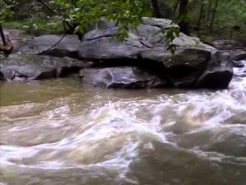
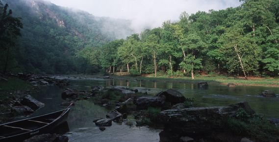
This seldom paddled, (and seldom paddleable), little gem flows through a progressively deepening gorge that separates Howard and Carroll County and makes a delightful jaunt for either a day trip, or for a much shorter paddle when done in sections. Difficulty consists of a good deal of moving flatwater, a great selection of class 2+ ledges, and a couple of easy class 3's. Pray for rain though; it's going to be a long day without enough water.
Put-on at Gaither Road (2.2 miles from Gaither Road to River Road just past Sykesville; 5.4 miles from Gaither Road to Henryton Rd.) the river now begins to reach its potential, cutting into a gorge that continues to shelter it all the way to the confluence and beyond. Rapids are frequent and mostly easy with tumbles down boulder piles and ledges with a lazy, flat, but moving current in between. On no other place in the Patapsco watershed can you find as many class 2 to 2+ rapids. There are some slightly technical, mini-boulder gardens and an occasional (but almost never river wide) strainer, but the trip is mostly just an interesting and highly entertaining ride all the way down into Sykesville.
After picking a line down the last rapid, you'll notice Baldwin Station, a restaurant built on the edge of the train tracks, dead ahead on river left. Outdoor dining in the summertime usually provides a small audience in case you decide to crash and burn. Proceed past (through?) downtown Sykesville to either the Main Street bridge, or the far larger Route 32 overpass for good takeout spots at both places. Or enjoy a series of continuous, rocky rapids into the Patapsco State Park. River Road, visible through the trees on river right, is also a good place to take out/put in, depending on where you're headed to/from. When the river takes a sharp right over a steep gravel bar, and then abrupt left to avoid flowing into the roadway, take care in picking a line. At high water, the current will try and put you directly into the (ragged concrete) river right bank, which would love to borrow a good deal of your unprotected skin. Shortly below that a creek comes in from river right which is the River Road (short) Take-out.
A few boulder gardens and several riffles later, the river returns to a narrow, placid, winding waterway that wanders through the park. Scenery is very good here, and the rapids are mild. There are some narrow passages, and strainers do live here from time to time, but not with the frequency of their larger, more irritating, river-wide kin upstream. After a mile or so, notice a modern, barn-like structure through the trees on river left. This marks the beginning of three drops, the third of which is the steepest and longest (see 'Lower Labyrinth' in the rapid section).
Past these obstacles, the river continues to wind until comes to a area where the river bed is very unstable. Here, look for at least one riverwide strainer, requiring a portage, and particularly after a hard rain, a spectacular jog jam. The current is very strong through (and under) here, and a flip could be bad for your health. Keep an eye out and be ready to portage.
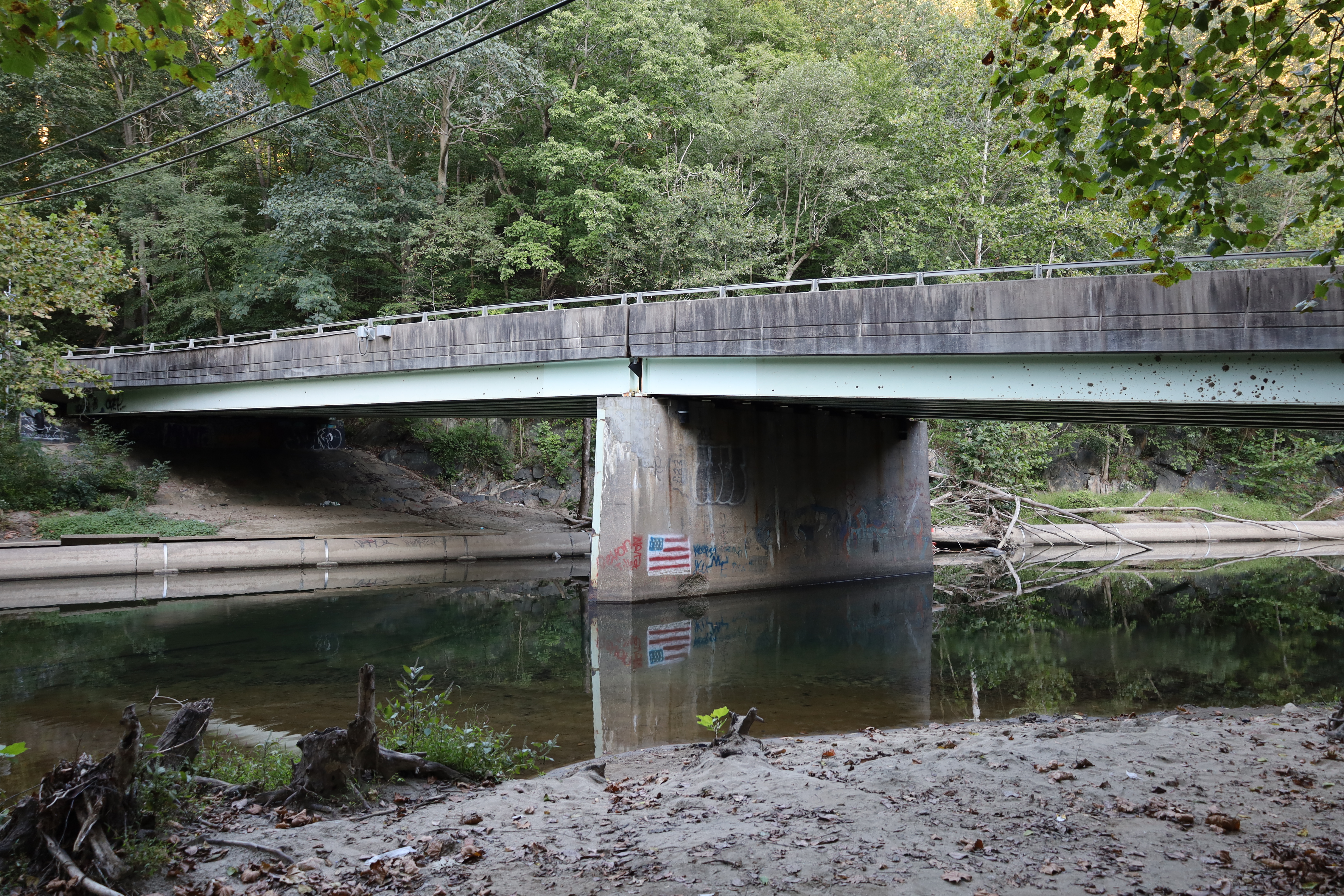
Another mile or so provides another take-out opportunity at Henryton Road. Look for the remnants of an old bridge on both sides of the river, and a cement pipe that creates a surfable hydraulic at some levels.
Although Henryton Road is the usual lower take-out for this run, Marriottsville Road is downstream from Henryton Road for an additional 1.3 miles of moving water/flat water with the occasional strainer. There's no particular reason why a whitewater boater would want to run this additional length, unless for some reason, the Henryton Road access is unavailable. If you decide to add this additional length, be aware that the railroad bridge about halfway down tends to attract wood/strainers.
Rapids in this Run (3)
Playspots (3)
Hazards & Portages (2)
Caution: The following locations may require scouting or portaging. Always check current conditions.

Difficulty
Class II+(III)
Length
5.4 mi
Gradient
17 ft/mi
Rapids
3
2 Hazards
Access Points
Difficulty Classes
I Easy
II Novice
III Intermediate
IV Advanced
V Expert/Extreme
VI Unrunnable
Current Conditions
5-Day Forecast
Whitewater data from
American Whitewater
American Whitewater