1: Hwy 11 to Flat Shoals Bridge
Gauge Conditions
Runnable: 2.0 – 8.0 FT
Upper limit for best boatability uncertain. Please help your fellow boaters with a comment or report.
Data from American Whitewater & USGS
Run Map
Description
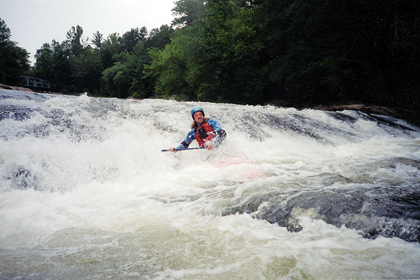
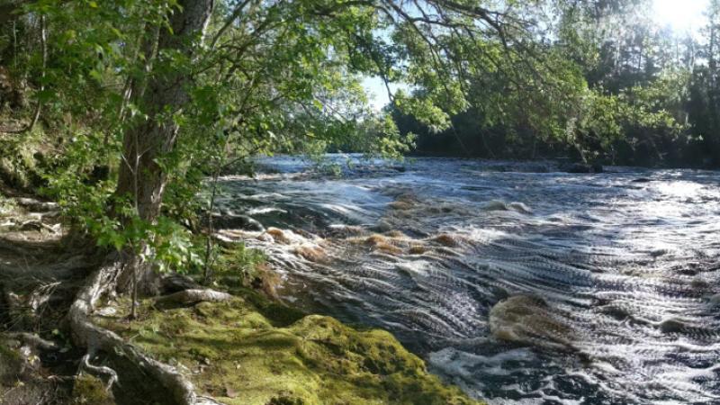
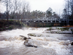
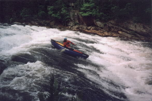
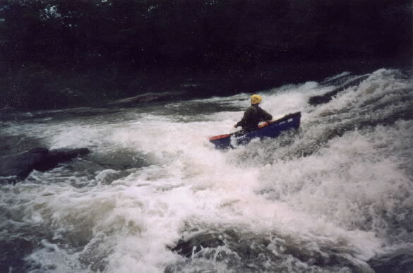
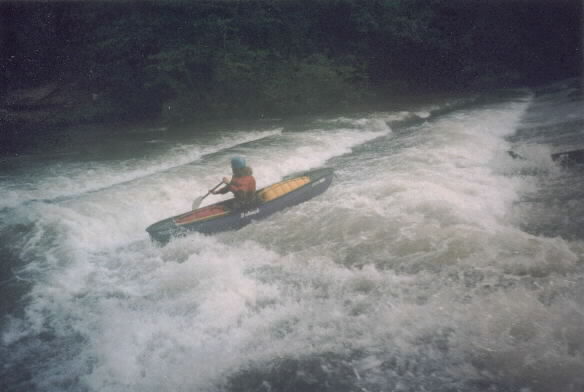
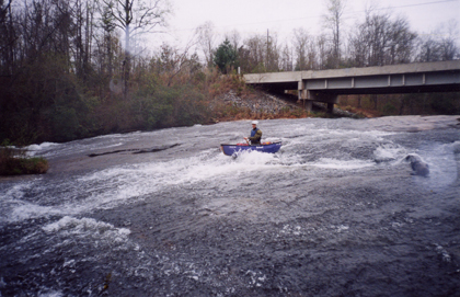
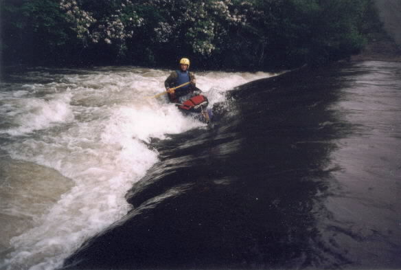
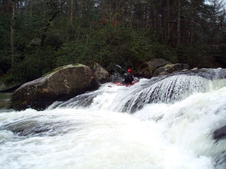
Flat Shoal starts off with quite a bang. The put in is a submerged old roadbed that forms a nice hydraulic and possible play spot at most flows. There are a few small play holes about twenty meters downstream and then the river goes under an iron bridge and plunges over Flat Shoal Falls. The first drop is a nearly vertical ten-foot ledge. Be careful when running any of the ledges because there are up thrust rocks at the base of most drops. There is no doubt that from this point to the edge of downstream view the river is dropping at an incredible gradient. Next three rapids are a quick succession of nearly vertical slides and ledges. Some of these drops have alternate lines and pining rocks so be careful and scout often. Trees also get stuck in the rapid after floods. The river makes a sharp turn after the falls and appears to calm down. Don't be fooled because another potentially dangerous rapid can creep up after the next island. Flat Shoals then slides over some additional rapids before flattening out for about a mile. The river picks up briefly immediately above the Little River Lane access point on river right. Contrary to the topographic maps there are no bridges between the falls and Flat Shoals Bridge at the takeout. After Little River Lane the river flows over several small ledges before plunging over a big 20 to 30 sliding waterfall. Flat Shoal then picks up gradient again and produces a few more class II rapids before flowing over the sliding drop at the takeout.
In order to clarify the lines the following comments were given in a recent email by Will Reeves
So here are my takes on the steepest section of falls on Flat Shoal - 1.
As a disclaimer I am an open boater and only assume my lines work for kayakers.
The first drop is immediately past the steel bridge. It has some concrete additions that make the drop almost even across the top on the right. I have not scouted the drop at low flow to determine if any rebar remains from the old dam.
At really high flows I would suggest running off the left side of the drop with a left angle in order to catch the big left eddy. (That was the line on Tuesday evening in the flood). Catching the eddy prevents you from being stuck in the speed trap hole, which forms about 10 feet from the base of the drop. If you miss the eddy you will be swept over the remainder of the falls on the left. This is not fatal or anything but could be unpleasant if you get stuck in any of the holes or piton into the rocks.
At normal flows I would suggest taking the main tongue down the left side of the drop with a slight left angle to catch the eddy. The eddy is not essential at the level you would have seen the run yesterday.
The second big drop is extremely chaotic at high flows. On Tuesday afternoon we just looked at that drop and opted not to run it.
At an average flow like the one you saw yesterday the far right side of the second drop is a smooth slide. The left side is also a slide but the rocky ledges might cause problems for some boat designs.
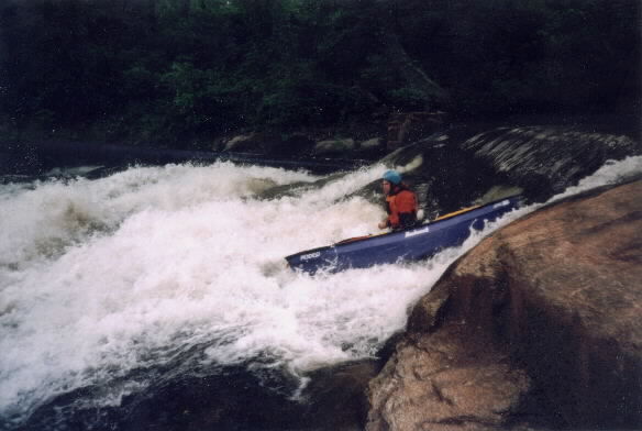
The third drop has several lines, but in my view only one is really optimal.
The optimal line is to slide down the right side of the slide. That line is a simple slide.
The far left has a nasty slot followed by a short slide. This is on the left side of the river up against the bank. If you are on line it is fine but you can get pinched by the rocks in the slot. I imagine these could shred a shirt off a kayak. You could also end up on the upstream side of the undercut in the middle of the river if your not careful.
The middle line over the slide looks obvious but the big pillowing hole/wave at the base of the drop is really an undercut rock. I would avoid that line but my friend Kevin Miller ran it yesterday.
The last drop of the falls is easy. Just don't go down the left side aiming left and you are fine.
At high water there is a hole.
I don't know if you continued downstream but the rapid around the corner has a huge but obvious undercut rock. I would suggest you run the left side of the river off the launch pad.
There is also an alternate takeout on Little River Lane, which is a small dirt road off Horseshoe Rd on your way to Flat Shoals Rd. I don't mind paddling all the way to Flat Shoals Rd because there are some additional big sliding waterfalls interspersed on the remainder of the river.
Rapids in this Run (2)
Waterfalls (6)
Playspots (2)
Hazards & Portages (4)
Caution: The following locations may require scouting or portaging. Always check current conditions.
Difficulty
Class I-III(IV)
Length
3.4 mi
Gradient
60 ft/mi
max 200
Rapids
2
4 Hazards
Access Points
Difficulty Classes
I Easy
II Novice
III Intermediate
IV Advanced
V Expert/Extreme
VI Unrunnable
Current Conditions
5-Day Forecast
Whitewater data from
American Whitewater
American Whitewater