4 - Deer Creek Ramp to Banks
Gauge Conditions
Runnable: 800.0 – 4,000.0 CFS
Approximate reading: This gauge is 20.0 miles away on South Fork Payette River. Use as a general reference only.
Data from American Whitewater & USGS
Run Map
Run Time Estimate
Select put-in and take-out to estimate time.
Plan This Trip
See wind-adjusted speed maps, forecast planning, and detailed time estimates.
Sign in to generate an AI timing estimate for this run.
Whitewater timing varies with scouting, portages, and group pace. Use as a planning baseline.
Description
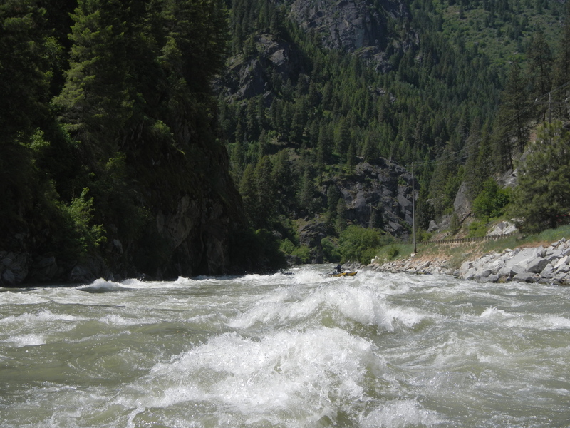
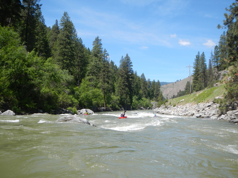
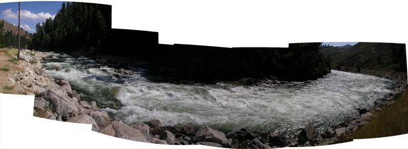
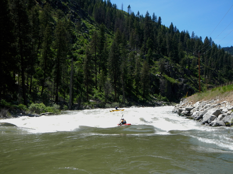
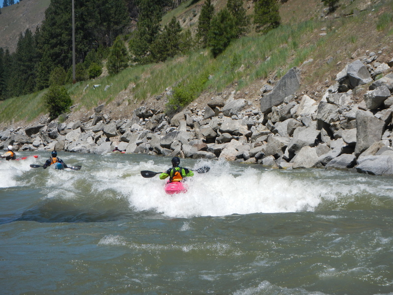
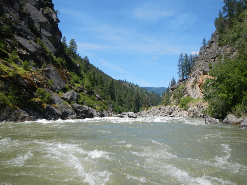
Character: There are several rapids along this stretch with Bronco Billy (Class III+, with a road pullout that is used for a nearby hot springs), Staircase (Class IV), and Slalom (Class IV-) being the standouts. Rapids are described in more detail below. The Banks-Lowman Road is next to the river through this canyon making it easy to scout the entire run.
Staircase Run can have significant swings in character, at high flows this turns into a fast big-water river with giant waves and holes. Cleaning up a swimmer would be problematic in the 'mellowest' parts. At low flows, this run gets very 'creeky,' with lots of slipping between rocks and little ledge drops. Be ready to bounce off rocks if you flip over your kayak. Perfect flow for a paddler looking to break into Class IV for the first time would be about 1200 to 2000 cfs.
Another possible hazard to be aware of is jet skis and jet boats. Jet boating is increasingly popular at higher flows. Jet boat operators report that they can navigate the entire Staircase run above 5000 cfs, and at higher flows they can even get up past Little Falls on the Canyon run. Jet skis have also been up as far as Little Falls.
Logistics: From Boise drive north on State Highway 55 about 32 miles to Banks which is at the confluence of the North and South Fork Payette (Highway 55 mile 78.8). Shuttle can sometimes be a pain during the busy summer months, Westbound traffic on Banks-Lowman road stacks up at the intersection with Highway 55, grinding shuttles to a crawl. Flaggers are sometimes deployed by the state on weekends; which helps mitigate this issue.
Put in: From Banks, head east upstream along the South Fork Payette on the Banks-Lowman Road (Highway 17) that parallels the river and provides an opportunity for a road scout. The typical access point is Deer Creek Ramp, at mile 4.5. This is a fee site. Another option further upstream is the Upper Deer Creek Ramp at mile 4.8. Immediately upstream of this point the run is flatwater through Garden Valley, but additional access points can be found.
Take Out: Banks. Under the Highway 55 bridge and just past the confluence of the South Fork Payette and the North Fork Payette is the takout on river right. This is a sand bar with a large eddy. Main parking area has boat trailer access, toilets, and changing rooms. Banks can get very busy in the summer months, since it is also the put in for the Upper Main Payette. Kayakers often take advantage of an alternate takeout that is called 'Free Banks' or 'Kayaker Takeout.' This take out is on river right just before the river passes under the Highway 55 Bridge. Free Banks has free parking and avoids the chaos of the Banks ramp at the main parking lot. This also bypasses the traffic jams at the busy intersection if you are going to drive eastbound on Banks-Lowman road; perfect for multiple laps. Free Banks has a nice area to hide boats and gear from the road while shuttling, although there have been thefts reported in the past.
PENDING UPDATE: State is planning updates to the Banks intersection and main parking lot with construction starting in 2024.
Rumored changes include:
\- The main parking lot will be expanded
\- Boat ramp will be paved
\- Intersection will get turning lanes, does this mean Free Banks will be going away?
\- A traffic light
\- Eventually, widened bridges
Rapids in this Run (5)
Playspots (1)
Hazards & Portages (1)
Caution: The following locations may require scouting or portaging. Always check current conditions.
Difficulty
Class IV
Length
4.8 mi
Rapids
5
1 Hazard
Access Points
Difficulty Classes
I Easy
II Novice
III Intermediate
IV Advanced
V Expert/Extreme
VI Unrunnable
Permit Required
No permit needed, but user fees are required at the put in and take out facilities. A season pass can be obtained at the Banks store and Cafe for $20. EDIT: A season parking pass for the payette river system must be purchased online, the pass is tied to the vehicle's license plate, so they can't be transfered between vehicles. Day pass still works the same; bring dollar bills to use this.
Get Permit
Current Conditions
5-Day Forecast
Whitewater data from
American Whitewater
American Whitewater