A) Snake Trail Rd (FR 194) to Marengo Lake Rd (FR 384) (6.6 miles)
Gauge Conditions
Runnable: ? – ? CFS
Approximate reading: This gauge is 2.4 miles away on Marengo. Use as a general reference only.
Data from American Whitewater & USGS
Run Map
Interactive run map
Loads as you approach this section.
Run Time Estimate
Select put-in and take-out to estimate time.
Plan This Trip
See wind-adjusted speed maps, forecast planning, and detailed time estimates.
Sign in to generate an AI timing estimate for this run.
Whitewater timing varies with scouting, portages, and group pace. Use as a planning baseline.
Description
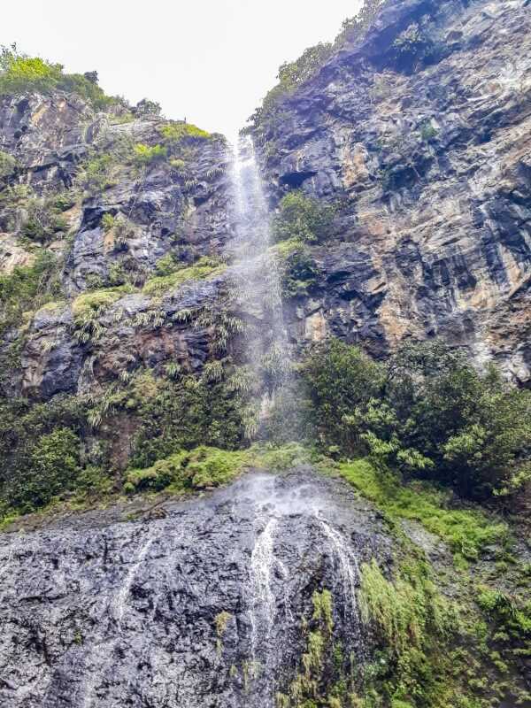
The Marengo River this high in the watershed is tiny and (at the Snake Trail Rd put-in) will appear not much more than a drainage ditch, snaking off into the alders. Why bother with such a small stream? A little over a mile and a half downstream of the put-in lies perhaps the largest 'unknown' waterfall in the State of Wisconsin.
Paddle the initial mile and a half of moving water through the bushes. When the water starts picking up speed and rock rises beside the river, you'll want to exercise caution as you are in the approach rapids to _Marengo Falls_. The river goes to class II, then class III, then plunges 40'-50' over the falls. Parts of this may be runnable, just be certain you can stop in time. Marengo Falls is a sloping, cascading drop which is possibly V+, likely a scenic portage for most. In addition to the challenge of this drop itself, there is a tendency for wood to collect here, making running the drop out of the question.
Portage on the left down to a pool below the main drop. (The land here may be a private inholding within the National Forest so please execise respect and stick close to the river when portaging.) The pool below the main drop is just above a secondary drop of about 10'-12' which may be run, though the width of the drop may cause it to be somewhat boney. From this point the river takes off at a fairly steady class II pace with parts pushing towards class III for the next two miles until the Wisco Rd (FR 198) bridge. The maximum gradient listed above includes the falls but there is a mile in here that drops ~60', close to that max but without the drama. Be wary of wood as this is a small stream.
Wisco Road may serve as a take-out for an abbreviated run of 3.9 miles and if water levels are a bit thin, this may be a preferred course. If water is sufficient, continue the remaining 2.9 miles to the Marengo Lake Rd bridge. I'm not aware of this having been paddled yet but gradient is steady through this lower section, pushing into the 60'/mile range in the final mile where there is indication of more 'interesting' water.
Thanks to Mike Schroeder for the information on this reach.
Rapids in this Run (7)
Waterfalls (1)
Difficulty
Class II-III(V+)
Length
6.6 mi
Gradient
38 ft/mi
max 77
Rapids
7
Access Points
Difficulty Classes
I Easy
II Novice
III Intermediate
IV Advanced
V Expert/Extreme
VI Unrunnable
Current Conditions
5-Day Forecast
Whitewater data from
American Whitewater
American Whitewater