B) Co.Rd.CG to 1.2 mile above CR565 (10.8 miles,+1.6 miles for lower)
Gauge Conditions
Runnable: ? – ? CFS
Approximate reading: This gauge is 9.4 miles away on Escanaba. Use as a general reference only.
Data from American Whitewater & USGS
Run Map
Description
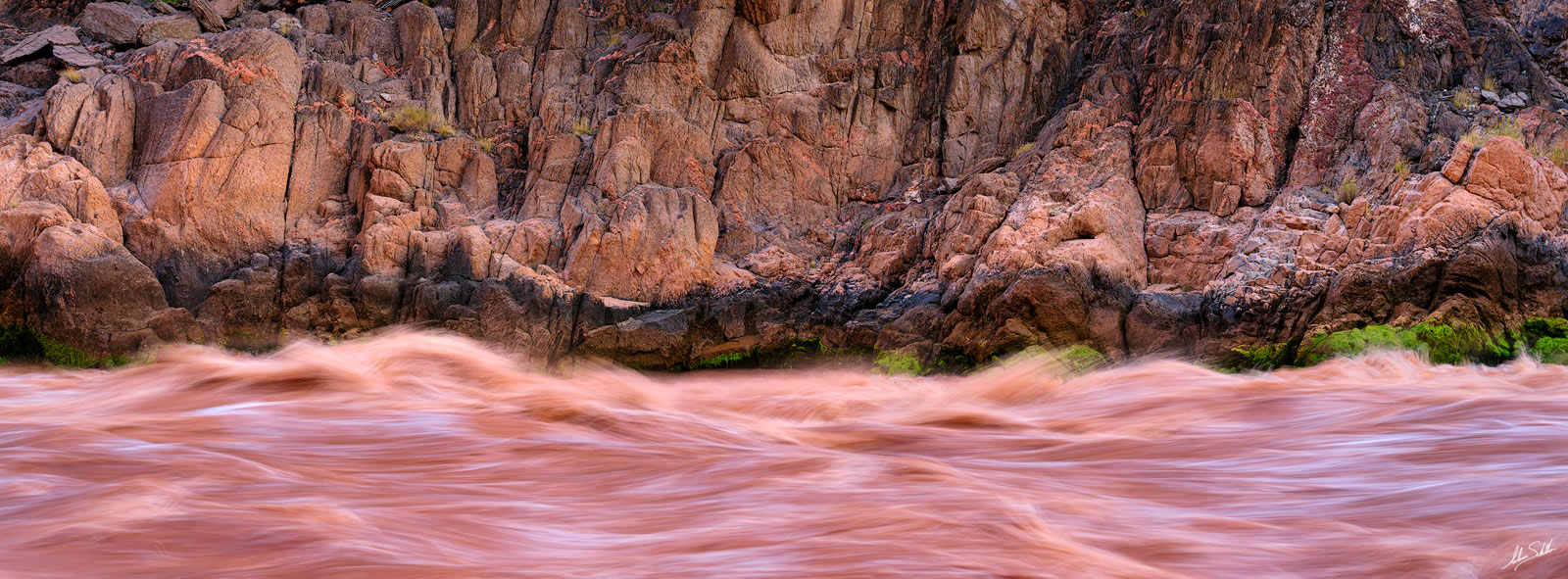
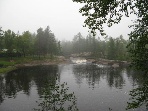
More like 'drop/lake' than 'drop/pool'. (Much flatwater between drops, but the drops are good and the flatwater sections are a beautiful wilderness river.) The first three drops (while not overly complex) can be the most troublesome (i.e., most likely to be portaged, or likely to cause major thrashings). With high water, almost all of the drops on the run will be plenty intense!
Since this is a rather long run, with extended flatwater between drops (one stretch of nearly 3 miles, another nearly 2 miles, and three others over a mile each), feelings about this run tend to divide into two categories. Many boaters will 'pass', or do it once or twice and say 'Never again!' Others will consider the flatwater a reasonable price to pay for the variety and challenge of drops it contains, and will keep it on their list of favorites to hit regularly. This is especially true since this river tends to have a longer season (runs a bit later or more often) than most of the U.P. creeks.
* * *
The aerial resolution on mapping apps for this river is quite good. We highly recommended going to the 'Map' tab, clicking on 'Topo' to change it to 'Satellite', clicking the '+'/'-' to (or pinch/zoom in and out), and doing a 'virtual walk' of this reach (using the arrow keys on keyboard, or using the drag/scroll movement on your touchscreen device)! Yes, you will see the long stretches of flatwater, but you will also get a feel for the configuration of most of the drops.
* * *
The bulk of this route, especially through the main waterfalls, now goes through posted private property on both sides of the river and falls. Historically, boaters had put-in from a gated, dead-end road (labeled County Road PPE on GoogleMaps, but I'm not sure if you'll find any signage indicating that designation anywhere in real life). It was possible to park in one of a couple of wide spots (which would allow other vehicles to be able to pass). Early/Late-season (when owners may be less-likely to be present), put-in may still be possible here. However, given how extremely boater-NON-friendly the owners of the property at White City Falls have been, we can not recommend parking here, nor taking the hike down the road (past the gate, to where the river gets within 30 yards of the road) to put-in.
Our recommended put-in is at the bridge at Co.Rd.CG, which adds 1.5 miles of flatwater to the start of this long trip.
Take-out is at a dead-end road which branches west from CR565 about a mile north of the river. (This is labeled County Road MWD on GoogleMaps, but again, I'm not sure if you'll find on-location signage.) Land at our listed take-out is privately held, but the owners (when we have found them home) have generally been friendly. Please be on your best behavior, be very respectful of the private property, and leave no trace of your passing, so we may continue in their good graces to use this access. That said, most boaters who do this run will wish to continue to the next 1.6 miles (the Lower M.Br.Escanaba run). Alternately, boaters looking for a short run (with minimal flatwater) may wish to consider just doing that run instead (using this site as their put-in).
Regardless which put-in and take-out are used, the 'upper' is a long run, and a long shuttle. If at all possible, _plan to meet at your chosen take-out_. Change into your boating gear, leave dry clothes and drop-vehicle(s) there (if possible, with enough space for all boaters, and rack space (and straps!) to handle all boats). Put all boats/boaters on/in other vehicle(s) and drive to the put-in. _This will save time by avoiding the need to leave people sitting and waiting (well over an hour for the round-trip!) while shuttle drivers run vehicles down and back before the run_. (Obviously, some vehicle(s) will need to make the trip back to the put-in to pick up the vehicle(s) left there, but the point is, that is done after boating rather than delaying boating!)
Mapping/routing apps are likely to show various alternate routes. A south route (on Hemmings Lake Road) is a dirt road through the woods, and is likely to have areas of mud with severe ruts. GoogleMaps' default shuttle-route/directions may try to take you on mining roads which are private and gated. For these reasons, we detail the following recommended shuttle route:
Head east (0.8 mi) on County Rd MWD.
Turn left onto Hwy.565 (also labeled Missouri Road).
After 3.9 miles, turn left (to stay on Hwy.565/Missouri Road) for another 1.4 miles.
Turn (hard/sharp) left onto County Road 476, proceeding 5.5 miles.
Turn left onto County Road PG, for 2.4 miles.
Turn left onto County Road 581 for 2.2 miles.
Turn left onto County Road CG, for 2.2 miles, to arrive at bridge/put-in.
Rapids in this Run (1)
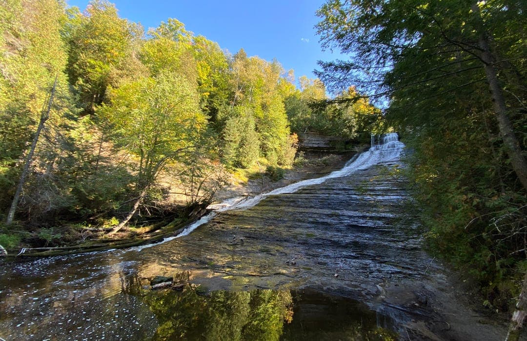
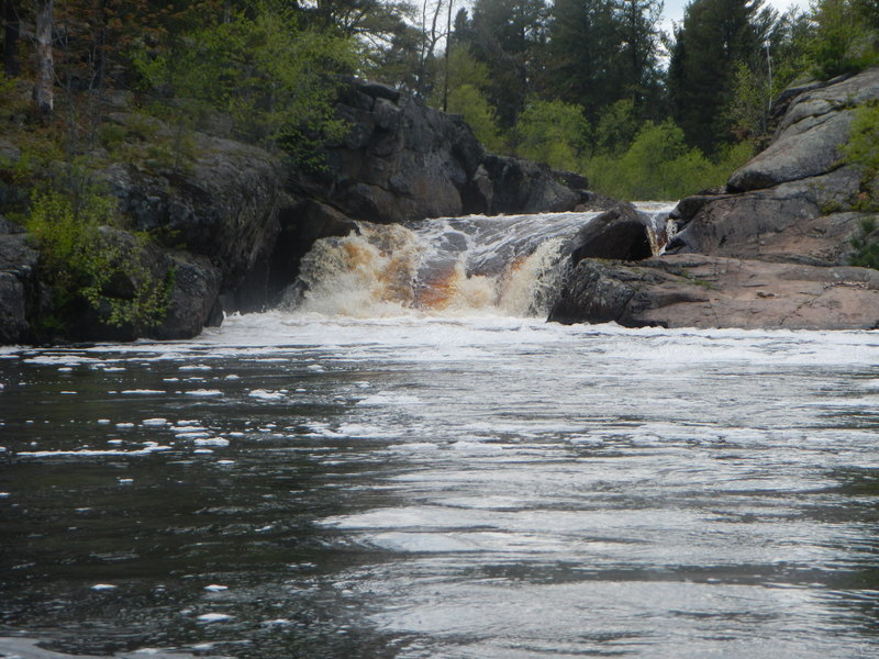
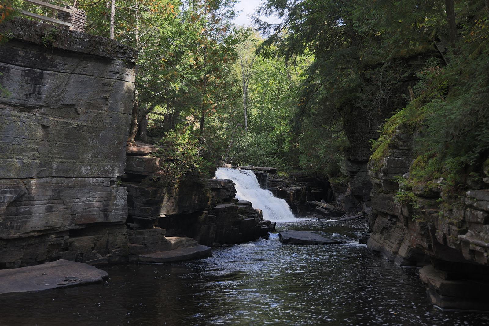
Waterfalls (5)
Difficulty
Class II-IV+
Length
10.4 mi
Gradient
18 ft/mi
max 50
Rapids
1
Access Points
Shuttle Info
Shuttle Information: Distance (each way): 18.4 miles, Approximate Time: 36 minutes (each way, thus over an hour round-trip!)
Historically, boaters had put-in from a gated, dead-end road (labeled County Road PPE on GoogleMaps, but I'm not sure if you'll find on-location signage) where they'd park in one of the few wide spots (to allow other vehicles to be able to pass). Early/Late-season (when owners may be less-likely to be present), put-in may still be possible here. However, given how extremely boater-NON-friendly the owners of the property at White City Falls have been, we can not recommend parking here, nor taking the hike down the road (past the gate, to where the river gets within 30 yards of the road) to put-in.
Our recommended put-in is at the bridge at Co.Rd.CG, which adds 1.5 miles of flatwater to the start of this long trip.
Take-out is at a dead-end road which branches west from CR565 about a mile north of the river. (This is labeled County Road MWD on GoogleMaps, but again, I'm not sure if you'll find on-location signage.) Land at our listed take-out is privately held, but all reports are that the owners there have been very boater-friendly. Please be on your best behavior, be very respectful of the private property, and leave no trace of your passing, so we may continue in their good graces to use this access. Most boaters who do this run will wish to continue to the next 1.6 miles (the Lower M.Br.Escanaba). Alternately, boaters looking for a quick run (with minimal flatwater) may wish to consider just doing that run instead (using this site as their put-in).
Regardless which take-out is used, it's a long run, and a correspondingly long shuttle. If at all possible, plan to meet at your chosen take-out. Change and leave dry clothes and drop-vehicle(s) there (if possible, with enough space for all boaters, and rack space (and straps!) to handle all boats.) Put all boats/boaters on/in other vehicle(s) and drive to the put-in. This will save time by avoiding the need to leave people sitting and waiting (well over an hour for the round-trip!) while shuttle drivers run vehicles down and back before the run. (Obviously, some vehicle(s) will need to make the trip back to the put-in to pick up the vehicle(s) left there, but the point is, that is done after boating rather than delaying boating.)
Mapping/routing apps are likely to show various alternate routes. A south route (on Hemmings Lake Road) is a dirt road through the woods, and is likely to have areas of mud with severe ruts. GoogleMaps' default shuttle-route/directions is on mining roads which are private and gated. For this reason, we have set this directions page to default to show drive time, distance, and directions from your home zipcode. You can use the text-entry box and option buttons to select directions from any other location to get to this run.)
The best/preferred shuttle-route (using paved roads) from listed take-out to put-in is:
Head east (0.8 mi) on County Rd MWD.
Turn left onto Hwy.565 (also labeled Missouri Road).
After 3.9 miles, turn left (to stay on Hwy.565/Missouri Road) for another 1.4 miles.
Turn (hard/sharp) left onto County Road 476, proceeding 5.5 miles.
Turn left onto County Road PG, for 2.4 miles.
Turn left onto County Road 581 for 2.2 miles.
Turn left onto County Road CG, for 2.2 miles, to arrive at bridge/put-in.
Difficulty Classes
I Easy
II Novice
III Intermediate
IV Advanced
V Expert/Extreme
VI Unrunnable
Current Conditions
5-Day Forecast
Whitewater data from
American Whitewater
American Whitewater