B) Horlick Dam to Quarry Park (0.2 - 0.6 mile)
Gauge Conditions
Data from American Whitewater & USGS
Run Map
Run Time Estimate
Select put-in and take-out to estimate time.
Plan This Trip
See wind-adjusted speed maps, forecast planning, and detailed time estimates.
Sign in to generate an AI timing estimate for this run.
Whitewater timing varies with scouting, portages, and group pace. Use as a planning baseline.
Description
Quick Facts:
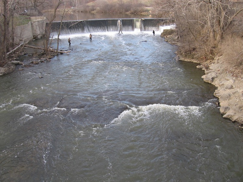
Location: northwest edge of city of Racine.
Put-in: 42.7520, -87.8235 (Root River Dam, Old Mill Road, Racine, WI)
Take-out: 42.7462, -87.8218 (3340 Northwestern Court, Racine, WI) (Quarry Lake Park, Racine)
Shuttle: 0.2-0.6 miles (For short-run: just carry-up in Quarry Park. For full run; either carry, or car shuttle to parking at dam.)
Video Link: *https://youtu.be/U53g71\_0PtQ?t=35*
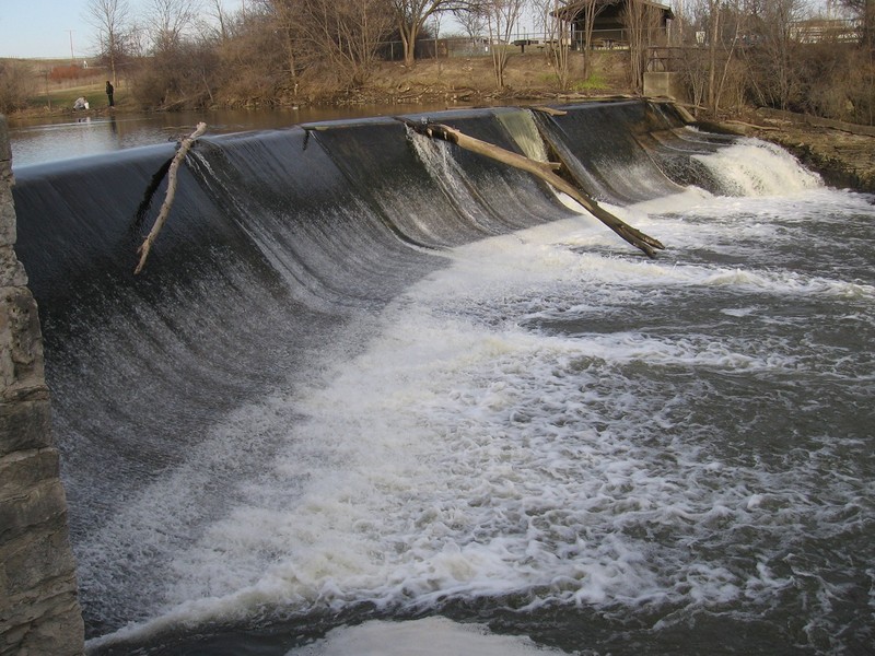
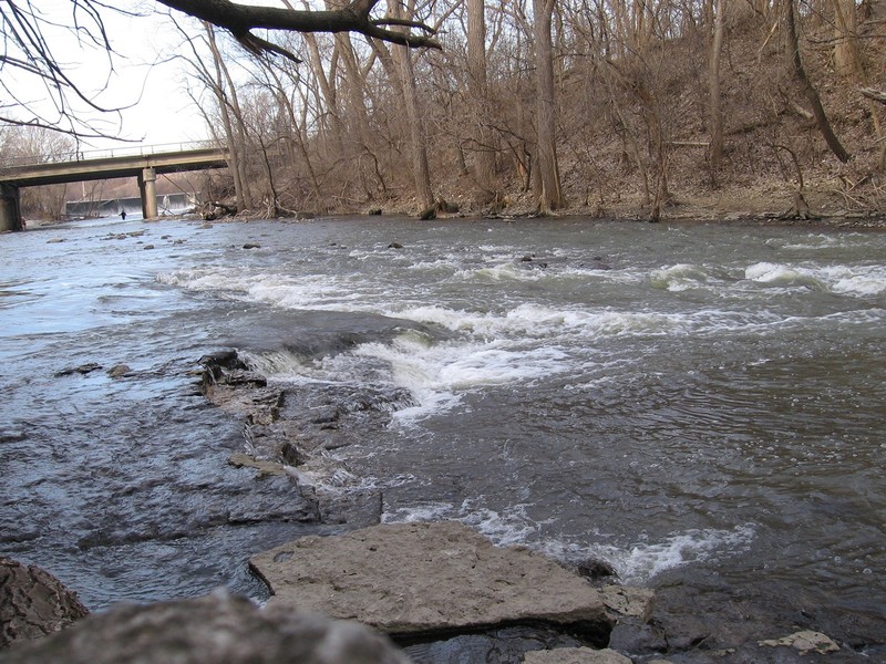
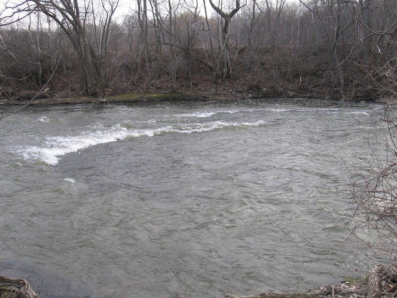
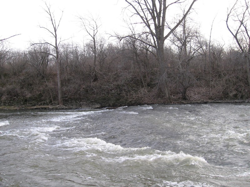
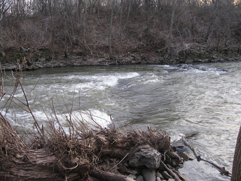
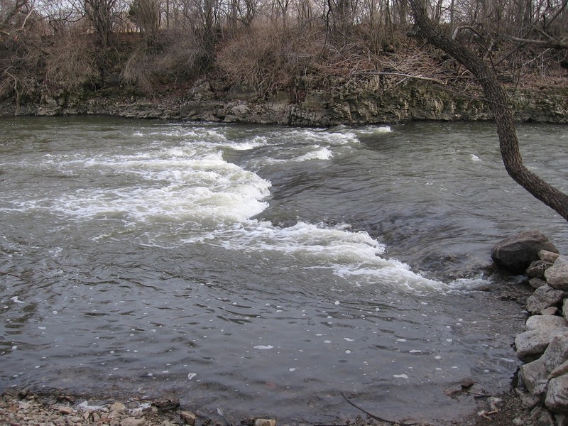
Character: Sloping bedrock (with virtually no instream rocks until the pool at the end of the run) creates fine playable features in fairly uniform-width channel.
River banks: Relatively steep limestone rock, tree-lined banks provide almost a 'up-north wilderness' feel in a county park within city limits.
Typical width: 70-120 ft.
Put-in is approximately 620' elevation.
Take-out is approximately 600' elevation.
Thus total elevation change is approximately 20'.
Drainage area: 190 square miles
10/85 Gradient Upstream of Put-in: 2.2 fpm (Low upstream gradient means rain in the upper watershed will take a day or two to bring this section to 'peak'.)
Percent Developed Upstream of Put-in: 30% (Low/Moderate development means runoff pattern will change seasonally; winter/spring will take much less to kick up flow, summer/fall will take considerably more rain to kick things up, since general lack of impermeable surface will soak up most light-to-moderate rainfall.)
10% Flow Exceeds: 419 cfs (I.E., on average, about 36 days per year should exceed this flow)
90% Flow Exceeds: 10 cfs
10/90 Flow Ratio: 41.9 (I.E., this is a fairly 'flashy' river (wide range of flows); summer storms can take flow from 10 cfs to over 3,000 cfs in two days, and (once past peak) flows can drop as much as 500-600 in 24 hours.)
Flow Info (using USGS flow data 2015-2025):
Average days per year above 200 cfs: 92
Average days per year above 400 cfs: 47
Average days per year above 900 cfs: 14
Average days per year above 1,200 cfs: 8
Average days per year above 1,500 cfs: 4.7
Average days per year above 2,000 cfs: 2.3
NOTE regarding flows: There is a gauge about 20 miles upstream (Root River at 8 Mile Road) which can be a predictor of flows in this section about 24-36 hours later. (Not saying it's 100% accurate, just that it's pretty good.) That gauge is used on the upstream section of the Root which is (primarily) a fine canoe and recreational kayak section.
General Overview
Shallow bedrock ledges in a fairly uniform width, unobstructed channel create a sweet series of green (ok, more like brown) waves for surfs and (at high water) major freestyle action. Many who have done this reach (at levels above 1400-1800 cfs) have proclaimed the play waves here to be among the best in the state! Not bad, considering it's in the southeast corner of the state where one would not expect to find good whitewater!
Access and parking are convenient both at the upper put-in by the Horlick Dam and at the take-out in Quarry Lake Park. (Most boaters just park at the take-out and do the short (~0.2 mile) carry up to put-in above 'Upper Pipeline.)
In winter or early spring when the water is up, don't let a windy, raw day discourage you from boating this reach. High banks flank the river, sheltering you from almost all wind conditions while on the water. (It will only be a factor as you carry up the paved path in the park.) I've boated it with the temperature in the low 30's, and wind-chills of single-digits or teens, and have been fine while on the river.
Additionally, the existence of the dam and its millpond (at the head of this reach) holds back ice in winter. The stretch that we boat downstream of the dam will often flush free of ice after a day or two of winter warming, allowing for reasonably safe boating. (Always check for ice-shelves in pools before putting on in winter!)
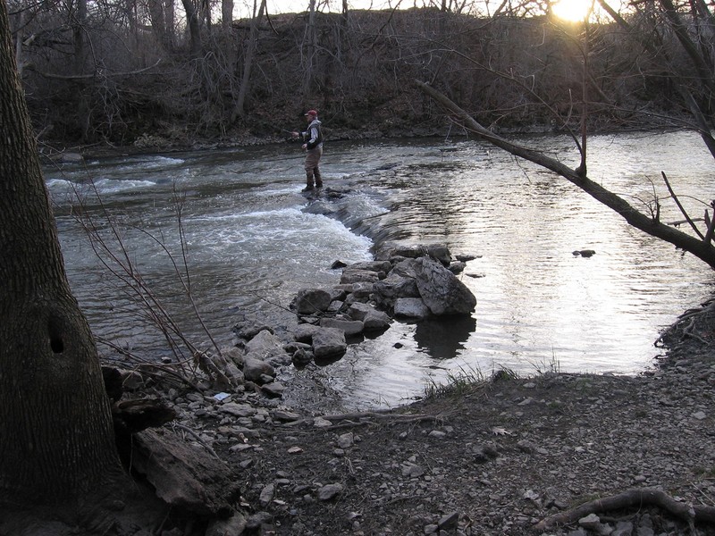
Be aware this is a VERY popular fishing stream. During spring (March/April) and fall (October +/- 2weeks) when the Steelhead, Salmon, Trout, etc., are running, be prepared to share the river with scores of anglers. Fortunately water levels most conducive to boating are generally unfavorable for fishing, so there is seldom a problem. Most fishermen will be found up by the dam (down to the first bend), and in the pool below the final playspot (and along the golf course river-frontage downstream). Do your best not to interfere too much with their fishing. When possible, wait until they are pulling-in their line (or changing tackle) before passing them (whether going downstream or coming up an eddy they are in). Most fishermen will return courtesy if you show them courtesy. Occasionally you'll encounter a more belligerent one who does not want to share the river, and will take any whitewater boater's presence as a personal affront. It is likely nothing you do or say will change such an attitude. When you encounter this, it's likely best to stay well-away, and move elsewhere on the river as soon as possible.
Rapids in this Run (4)
Waterfalls (1)
Playspots (10)
 Playspot
Malted Milk (MM) / Horlicks Extra Lite (HEL)
 Playspot
Diagonal Slice (DS)
 Playspot
Slab Wave (SW)
 Playspot
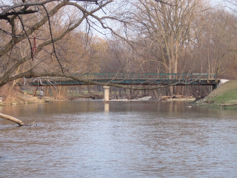
Quarry Bridge Pier
 Playspot
Upper Pipeline (UPL, UPR)
 Playspot
Lower Pipeline (LP) & Tundra
 Playspot
Lazy Willow (LW)
 Playspot
Hanging Willows (HW)
 Playspot
Fenceline (FL), Right Hip Pocket (RHP), Good Intentions (GI), Mid-Evil (ME)
 Playspot
Lesser Evil (LE), Greater Evil (GE), Between the Evils (BTE), All Evil (AE)
Hazards & Portages (1)
Caution: The following locations may require scouting or portaging. Always check current conditions.
Difficulty
Class II(III)
Length
0.6 mi
Gradient
20 ft/mi
Rapids
4
1 Hazard
Access Points
Shuttle Info
Shuttle is (usually) via carrying up a foot-path which runs between the quarry/lake and the river. Most boaters, most times, will just do the 'short reach' (0.2 mile), avoiding having to carry about 2.5 times as far. Beginners who wish a bit longer a float and some easier warm-up before the main action (especially at levels above 500 cfs) may be best off doing the 'full run' (0.5 mile, from just below the dam). Experienced boaters may find some worthwhile action at the upper put-in at these levels as well. At levels between 1000-2000 cfs, the first wave ('Malted Milk', by the highway bridge) provides some of the sweetest surfing opportunities on the river.
Put-in for the 'short reach' is at fence crossing the path.
To do the 'full run', in the past there had generally been no problem with carrying around the fence (despite signage suggesting "Authorized personnel only") and up the path between the quarry/lake and the river. During summer days when life-guards are present, they will zealously notify you via bullhorn that you are 'trespassing' if you walk this part of the park!). If you carry up inside the park, stick to the well-worn path, as the early going is flanked by massive patches of poison ivy, and the later stretch is flanked by stinging nettle (a concern mostly if the river happens to come up in June to late summer). As you near the highway, carefully carry down around another fence (watch your footing -- the banks are steep, and may be muddy and slippery). You may then either carry back up to the road (via a rough cement splash apron for the road ditch) and deal with the busy traffic to cross the highway, or carefully traverse the boulder field under the bridge. As of Fall, 2009, the county has upgraded (and extended) the fence (both at the lower put-in at 'Upper Pipeline' and near the highway bridge and USGS gauge building). There is an increase in enforcement of this area being 'off limits'. Sheriffs/Deputies are not likely to be present most times when boaters are likely to use the path, but be aware you could be ticketed for trespass. The park supervisor advised that if county sheriffs/deputies are present, they will ticket fishermen and boaters as well as kids back there to jump off the cliffs into the quarry.
**\-\- Therefore, --**
Instead of carrying up that path between the Quarry and the river you could carry out of the park (past the gate you drove in through) and up the sidewalk along Northwestern Avenue (a good bit longer, but it avoids the various concerns on the path).
Or, when we're feeling lazy, or when conditions are particularly raw, when a shuttle-bunny/buddy is available, we may actually drive the shuttle. All the streets in the immediate area are boulevards (have center curb dividers), so driving back and forth between put-in and take-out can be slightly hampered where one cannot get across the divider to head in the the correct direction.
NOTE: DO NOT take boats which have been in the river and then paddle in the quarry. The river (being connected with Lake Michigan) is "affected water" for VHS (Viral Hemorrhagic Septicemia), while the quarry is NOT. Any boat used in the river needs to be thoroughly cleaned (rinsed in bleach!) before using it in the quarry, or you could be subject to a fine. By the same token, boaters are advised they should not jump into or swim in the quarry after having been in the river without first taking a thorough shower with soap (available in the park pavilion when it is open). Actual enforcement of this is would be (I believe) only by DNR personnel, who do routinely come through during the peak fishing periods, and probably occasionally at other times.
See the map below for an overview, and to get directions from your home or other location.
Difficulty Classes
I Easy
II Novice
III Intermediate
IV Advanced
V Expert/Extreme
VI Unrunnable
Current Conditions
5-Day Forecast
Whitewater data from
American Whitewater
American Whitewater