Upper Pipeline (UPL, UPR)
Save this feature with the run it belongs to.
Gauge Conditions
Photo
Description
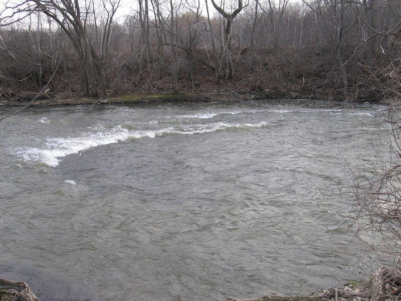
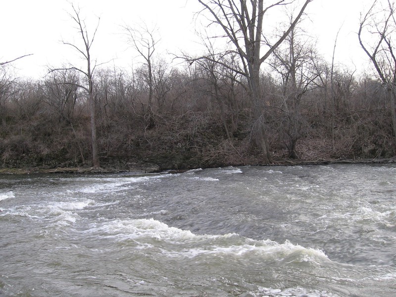
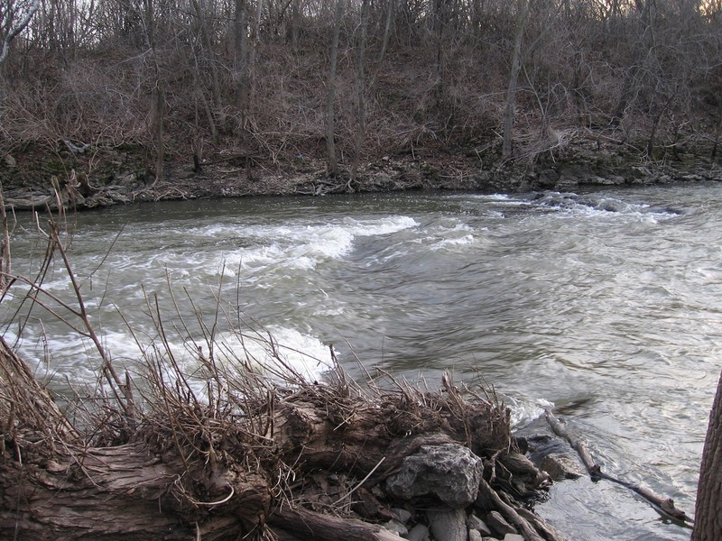
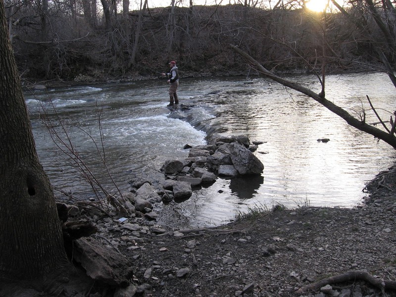
This is the first feature on the lower part of the run (the 'short run'). Most boaters will just put in here for most runs at most levels, foregoing the upper features since they hardly justify the extra carry-up/shuttle at many levels.
A shoreline eddy/pool to put-in from (or eddy-out into) exists among the trees on river left above the features. (Generally it is recommended to carry upshore a ways beyond the fence to make it easier to ferry across to catch the river-right eddy.)
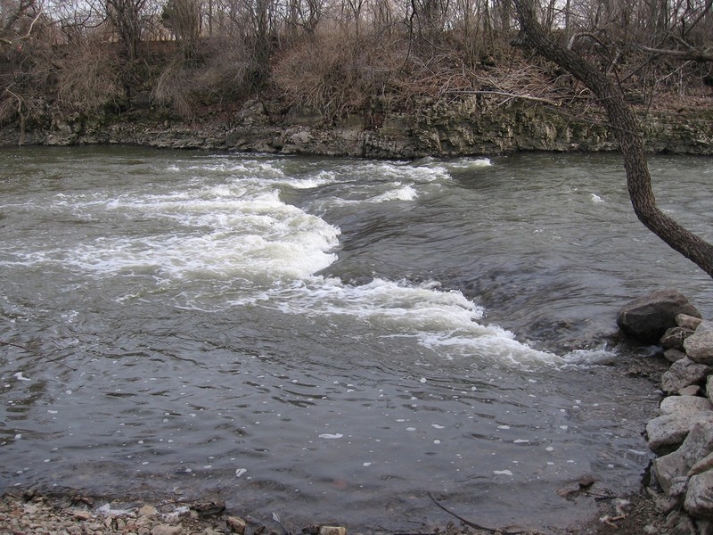
At low-to-moderate levels (200-700 cfs), a river-right pocket-wave/hole ('Upper Pipeline Right' or 'UPR') exists, with a decent width, but somewhat short shoreline eddy. Surfs and flatspins can be done at will, but you have to paddle hard for the eddy when you come off the wave or you will be flushed too far downstream to be able to regain it.
There is also a river-left wave/hole ('Upper Pipeline Left' or 'UPL'). At low levels, this one is exceedingly shallow and scrapey, and only scarcely worth much attention. As the level rises, the UPR washes out, but UPL builds quite nicely. At higher water (1000 cfs and up) this one becomes a sweet surf. Again, there is only a narrow and short shoreline eddy, so you have to come off the wave in good control and paddle hard for the eddy or you will be flushed too far downstream to be able to regain it. Additionally, at the downstream end of the eddy, there are trees on the shore overhanging the river which can become quite worrisome. Strong, confident paddlers who are swept back close to these trees may be able to 'throw their back into them' and push off to secure the eddy. However, more paddlers (as soon as you realize you are not being able to make it into the eddy) will quickly paddle hard (away from shore) to avoid tangling with them.
Since the flood of June, 2008, the eddy for UPL will not extend far enough upstream (at lower flows) to allow repeat play. As levels reach somewhere around 1100-1200, water spreads across what is normally shore, making it possible (not easy, but possible) to 'pull' your way up this eddy. As levels exceed 1300 (+/-) the eddy gets much more manageable.
Location
Other Rapids on This Run (16)
 Waterfall
III+
Waterfall
III+
 Playspot
II
Playspot
II
 Playspot
II
Playspot
II
 Playspot
N/A
Playspot
N/A
 Playspot
I
Playspot
I
 Playspot
II+
Playspot
II+
 Playspot
II
Playspot
II
 Playspot
II
Playspot
II
 Playspot
II
Playspot
II
 Playspot
III+
Playspot
III+
 Hazard
N/A
Hazard
N/A
Current Conditions
5-Day Forecast
American Whitewater