B) Upper: Ramsey (Mill St) to Gabbro (Baker) Falls (2.42 miles) Scenic
Gauge Conditions
Runnable: ? – ? CFS
Approximate reading: This gauge is 4.5 miles away on Black. Use as a general reference only.
Data from American Whitewater & USGS
Run Map
Put-in
Take-out
Rapids/Hazards
Scenic
Run Time Estimate
Select put-in and take-out to estimate time.
Plan This Trip
See wind-adjusted speed maps, forecast planning, and detailed time estimates.
Sign in to generate an AI timing estimate for this run.
Whitewater timing varies with scouting, portages, and group pace. Use as a planning baseline.
Description
Quick Facts:
Location: Western Upper Peninsula, Michigan, between Bessemer & Wakefield (about 8.5 miles ENE of Hurley/Ironwood).
Shuttle Length: 3 miles. (See details in "Directions" Tab.)
Drainage area at gauge: (a few miles downstream of take-out for this reach) 200 square miles.
* * *
Note: Boaters may wish to combine this reach with all or part of the section upstream to make for a longer trip.
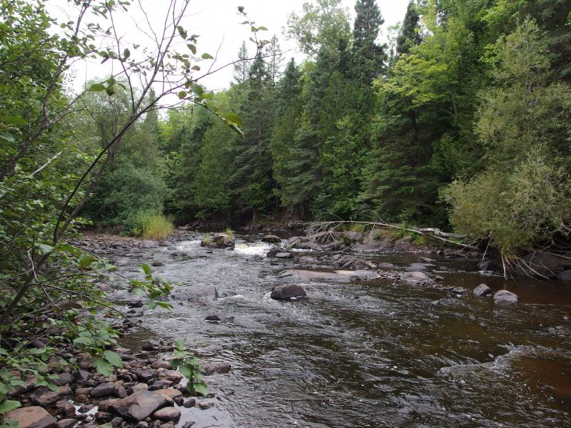
This reach is characterized by fairly continuous class II rock and boulder bed rapids leading into some entertaining sequences of small ledges in the final mile. There is a Neepikon Falls shown on many maps downstream (north) of the Hwy.2 bridge, but it is difficult to ascertain which portion of the small ledges is the "falls".
Take-out is at an underground pipeline right-of-way which may be reached by driving to the Blackjack ski area on Blackjack Rd, crossing the covered bridge over the river, turning left in the parking area and following the road back upstream to an obvious clearing at the top of the hill. Walk down to the river at this point to mark or make certain that you can recognize it from the river as this is only a short distance upstream of Gabbro Falls. At higher flows and/or with less experienced paddlers, it may be prudent to use another pipeline clearing about a quarter mile upstream to minimize the potential of a paddler being flushed into this potentially fatal falls.
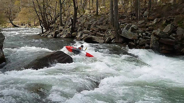
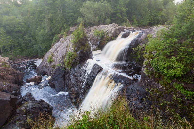
There is one more good drop just downstream of the recommended take-out that may be run with caution as this places one very close to the brink of Gabbro Falls. Known locally as Baker Falls, Gabbro has an initial drop of about 10' onto rock, immediately spilling another 25' into a narrow slot, with the river turning 90 degrees to the right at the base of the falls (see photo above). The exit from this mini-canyon is a constriction of about 10' that drops onto and behind a large boulder. The whole sequence is well worth taking a look at when in the area, even if you do not intend to boat this reach.
Note: Part or all (it is unclear from the write-up on their 'blog') of this drop was run in April, 2007 by Tao Berman & Eric Boomer. Photos verify running of the first two pitches (10' and 25'), but it appears wood (and other concerns) may have had them rope out before finishing the rest of the drop.
There is about a third of a mile of rockbed rapid downstream of Gabbro to the covered bridge at the entrance to Blackjack ski area, and the confluence with Jackson Creek. While it is possible to portage Gabbro (recommended on river-right) and run this final stretch, it is not easy, thus the recommended carry-out above the falls.
The following video (via YouTube, courtesy of 'Duck Wild Producktions') features a very snowy run of much of this section at 576 cfs.
Rapids in this Run (7)
Waterfalls (1)
Difficulty
Class II-III
Length
2.4 mi
Gradient
50 ft/mi
max 59
Rapids
7
Access Points
Difficulty Classes
I Easy
II Novice
III Intermediate
IV Advanced
V Expert/Extreme
VI Unrunnable
Current Conditions
5-Day Forecast
Whitewater data from
American Whitewater
American Whitewater