C) Morgan Lake Rd to Hwy 101 (5.4 miles)
Gauge Conditions
Runnable: 200.0 – 1,000.0 CFS
Too low for reasonable whitewater. (May be paddled as a scenic float trip, but all gradient will be a scrape or carry.)
Data from American Whitewater & USGS
Run Map
Interactive run map
Loads as you approach this section.
Description
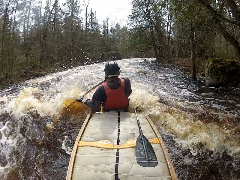
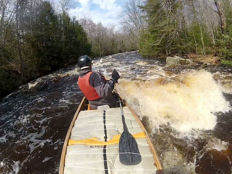
Easy access. Best whitewater section of Popple. 27% of length is 14 rocky rapids(II) with two falls (III) over ledges. Trip 1.5-2.5 hrs (avg 1.9)
Little input (30cfs) to flow from groundwater (springs) is a limiting factor for this river. The best water levels are usually not from snowmelt, but from early spring rains that come when the ground is still frozen until trees fully leaf-out (April-May). A rain of 1” at this time will provide excellent water levels, while from summer through fall it may take a 3” rain.
In 1965 the Popple River became a \*State of Wisconsin designated) “Wild River.” This state designation pre-dated and was the model for the national Wild and Scenic River program. The issue that rallied public support for the creation of a protected, Wild Rivers designation was the 1961 proposal to build a dam across Big Bull Falls that would have impounded waters (to be named Aspen Lake) for nearly the entire length of this section of the river (all the way back to Little Bull Falls) and turn this spectacular stretch of river into a lake for private development (see image 888955 under photos tab). The dam was not permitted, Wild Rivers legislation passed, and today over 90% of the land along this stretch of the Popple is owned and protected by the WI DNR.
Geologically the bedrock outcrops at each falls along this stretch is metamorphosed basalt and intruded volcanic granite that originally solidified off the ocean floor south of the equator nearly 2 billion years ago. It is some of the oldest rock in North America. The unique values of ancient bedrock and wildness add value to your run down this action-packed stretch of river.
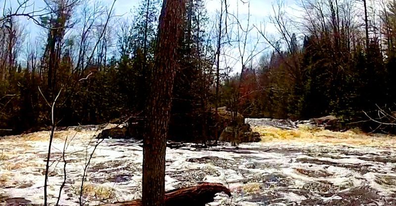
Drops include Little Bull Falls (II+) and Big Bull Falls (III). Both have marked portage trails that facilitate scouting. Big Bull Falls can also be viewed from the signed hiking trail off of West River Rd (from Hwy 101). Neither of these are "falls" in the traditional, vertical sense.
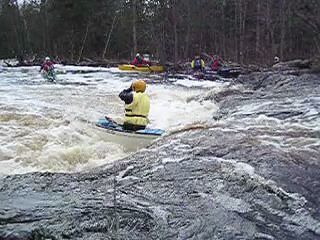
Little Bull is a curved ledge with underlying bedrock features that create a deceptively sticky, boiling pourover. (It claimed a life 2008.06.14, at 340 cfs, and nearly 2 more 2011.06.24 at 510 cfs).
Big Bull divides around a bedrock island (well worth exploring). The right side, with two consecutive ledge drops, is the preferred run at flows below 5-600 cfs. At higher flows (over 700) the left channel may become preferable.
Twelve separate rocky rapids (II) are spaced out into 3 extended groupings; above-and-below Little Bull Falls, mid-run, and above-and-below Big Bull Falls.
This run has a 6-mile paved-road shuttle allowing paddle-down-bike-back option (50 min. avg. bike ride, hill climbs included).
If an extension of this section is desired, easiest would be to start upriver on Newald Tower Rd. (adding 4.7 miles and 2-3 hours of in-river time with only 3.5 miles more to the shuttle). See Popple River Section B) Newald Tower Rd to Morgan Lake Rd.
Rapids in this Run (10)
Hazards & Portages (4)
Caution: The following locations may require scouting or portaging. Always check current conditions.
Difficulty
Class II-III+
Length
5.1 mi
Gradient
20 ft/mi
max 45
Rapids
10
1 Hazard
3 Portages
Access Points
Shuttle Info
There is either a 6.2-mile direct shuttle via 101 to Maple Drive to Morgan Lake Rd. or a 7.6-mile shuttle via 101 to County C and Morgan Lake Rd that brings you past the Fence Post convenience store for gas, snacks, a beer and bison burger lunch, but not much more. Both routes are paved but involve hill climbs (for bike-back trips)..
Difficulty Classes
I Easy
II Novice
III Intermediate
IV Advanced
V Expert/Extreme
VI Unrunnable
Current Conditions
5-Day Forecast
Whitewater data from
American Whitewater
American Whitewater