D) 'Bottom Presque': South Boundary Rd to Lake Superior (1.1 miles) Scenic
Gauge Conditions
Runnable: 6.2 – 7.0 FT
Almost certainly too low for whitewater run.
Data from American Whitewater & USGS
Run Map
Put-in
Take-out
Rapids/Hazards
Scenic
Recreational
Run Time Estimate
Select put-in and take-out to estimate time.
Plan This Trip
See wind-adjusted speed maps, forecast planning, and detailed time estimates.
Sign in to generate an AI timing estimate for this run.
Whitewater timing varies with scouting, portages, and group pace. Use as a planning baseline.
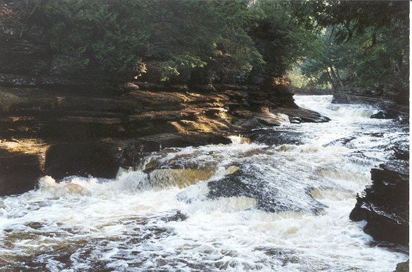
Description
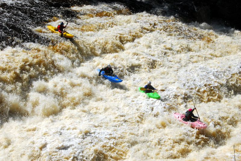
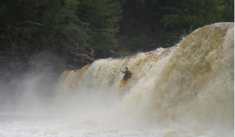
This short section contains four big drops: Nawadaha, Manido, Manabezho, and Swinging Bridge (along with a few lesser drops). All can be run by confident, experienced paddlers. All others will enjoy the impressive views (perhaps before or after running some upper reaches of this river).
The following video gives a good view of the drops on this run at ~550 cfs:
https://youtu.be/\_lU-Z5t2\_bw
Rapids in this Run (2)
Difficulty
Class IV-V
Length
1.1 mi
Gradient
115 ft/mi
max 123
Rapids
2
Access Points
Difficulty Classes
I Easy
II Novice
III Intermediate
IV Advanced
V Expert/Extreme
VI Unrunnable
Current Conditions
5-Day Forecast
Whitewater data from
American Whitewater
American Whitewater