E1800 (E.18th Rd.) to Hwy.71 (6.5 miles)
Gauge Conditions
Runnable: 1,600.0 – 99,999.0 CFS
Likely less than 100 cfs ... Likely way too low to boat. (Please use "Reports" to help define/refine ranges!)
Runnable: 12.0 – 18.0 FT
Most likely very low. Must be confirmed by visual inspection.
Data from American Whitewater & USGS
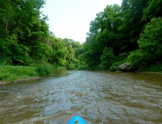
Run Map
Run Time Estimate
Select put-in and take-out to estimate time.
Plan This Trip
See wind-adjusted speed maps, forecast planning, and detailed time estimates.
Sign in to generate an AI timing estimate for this run.
Whitewater timing varies with scouting, portages, and group pace. Use as a planning baseline.
Description
Do not park or put-in on upstream side of E1800 (18th Road) bridge, and do not paddle upstream of bridge, at request of property owner.
Alternate put-in is near Pine Hills Golf Course near Stoneyville. (Beware golfers with a mean slice on 4th hole!)
This can be a lot of eddy hopping and surfing fun if you catch it when other rivers in the area are starting to come up (Vermilion) or are running good (Little Vermilion). Due to the small watershed it's normally the first river in the area to lose boatability after a big rain. It normally takes a good rain (2 inches or so in one day) to get it up to the 'higher' levels which can be a BLAST! When there is sufficient water, this makes a fast fun warm-up or 'chaser' for a run on the Vermilion. Much swiftwater, riffles and rips, and a few good playable rapids.
A user warns (Aug 24, 2018):
_At the second busted low head dam once you get to the golf course, \[at\] the island ... don’t go right unless you have a chain saw and a crew of guys to clear out the mess!_
Our reference gauge for this run is the Mazon River (another tributary of the Illinois River, more-or-less parallel to Covel and about 30 miles to the East). At its gauge, the Mazon has drainage area of 455 sq.mi. vs 63 sq.mi. at the put in for Covel. Thus, **flow here may be just over 1/8th (0.138\*) the flow on the Mazon gauge.** For what it's worth, using the full history of this gauge, flow only exceeds 914 cfs 10% of the time (I.E., roughly 36 days a year). With our presently listed guess on the minimal baseline for runnability here (1600 cfs at Mazon, likely corresponding to roughly 200 cfs on Covel), figure that means likely fewer than 18 days a year (on average) for Covel to be runnable. (Small drainage flashy creeks such as these likely have runnable periods measured in hours, rather than days.)
Rapids in this Run (10)


Hazards & Portages (1)
Caution: The following locations may require scouting or portaging. Always check current conditions.
Difficulty
Class II(III)
Length
6.5 mi
Rapids
10
1 Hazard
Access Points
Difficulty Classes
I Easy
II Novice
III Intermediate
IV Advanced
V Expert/Extreme
VI Unrunnable
Current Conditions
5-Day Forecast
Whitewater data from
American Whitewater
American Whitewater