Fowler Camp to McCloud Reservoir
Gauge Conditions
Runnable: ? – ? CFS
Approximate reading: This gauge is 4.2 miles away on McCloud. Use as a general reference only.
Data from American Whitewater & USGS
Run Map
Run Time Estimate
Select put-in and take-out to estimate time.
Plan This Trip
See wind-adjusted speed maps, forecast planning, and detailed time estimates.
Sign in to generate an AI timing estimate for this run.
Whitewater timing varies with scouting, portages, and group pace. Use as a planning baseline.
Description
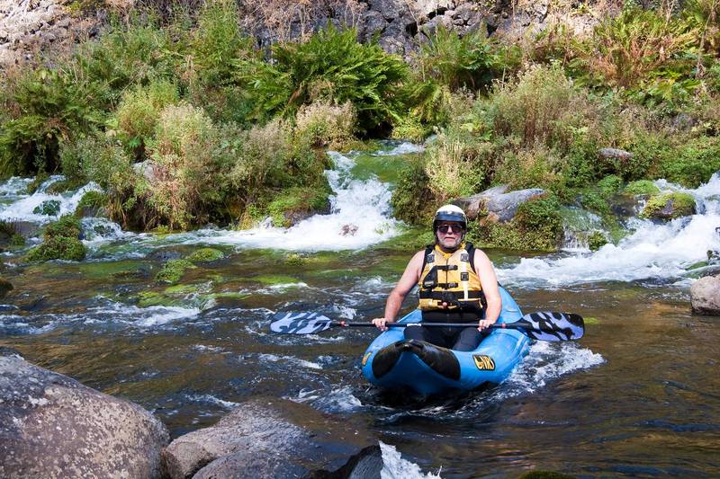
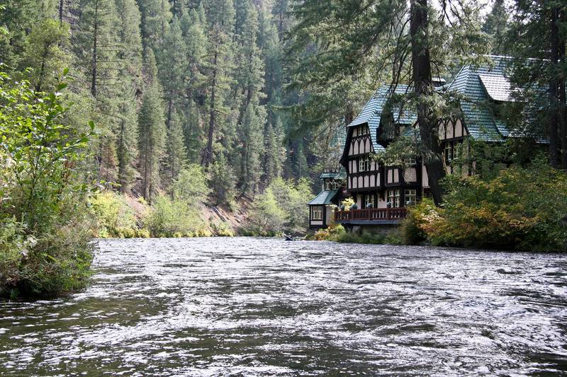
A unique run with beautiful scenery, terrific water quality and clarity, and fantastical architecture from the 1% (all of the run past the put in is bordered by private property – 'Wyntoon' – owned by the Hearst Corporation).
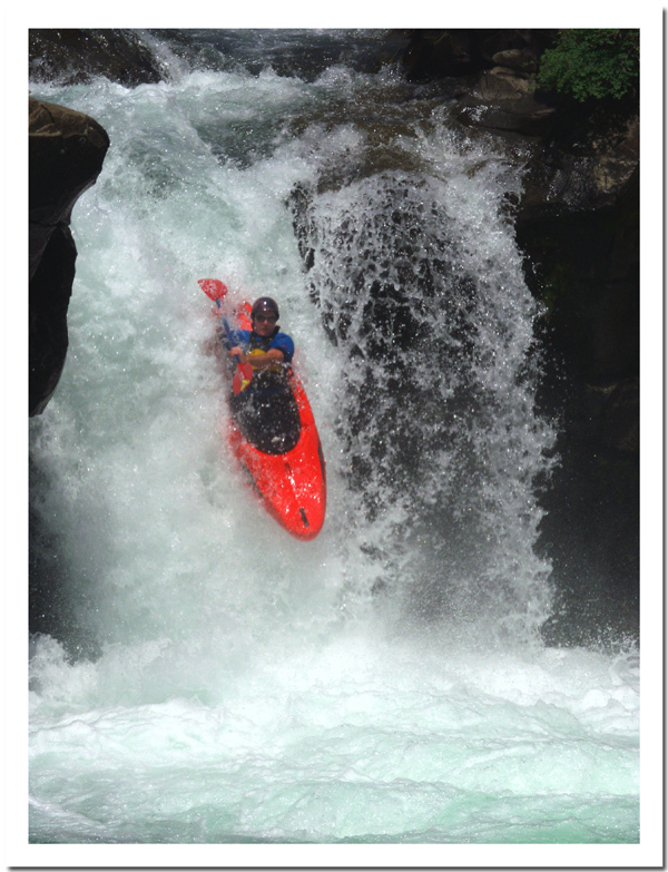
The distance, starting at the boat launch area downstream of Lower Falls, is about 7.5 miles of river, plus 3 miles of lake paddling. Starting near the Class IV/V Lower Falls adds another half mile.
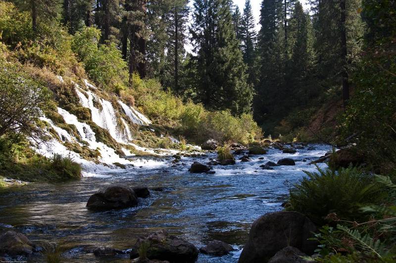
During late summer and fall, launching on this run involves boat dragging or such till you get to Little Springs. These springs add just enough water that boaters can scratch down the creek the next mile to get to Big Springs where a lot of water comes into the river.
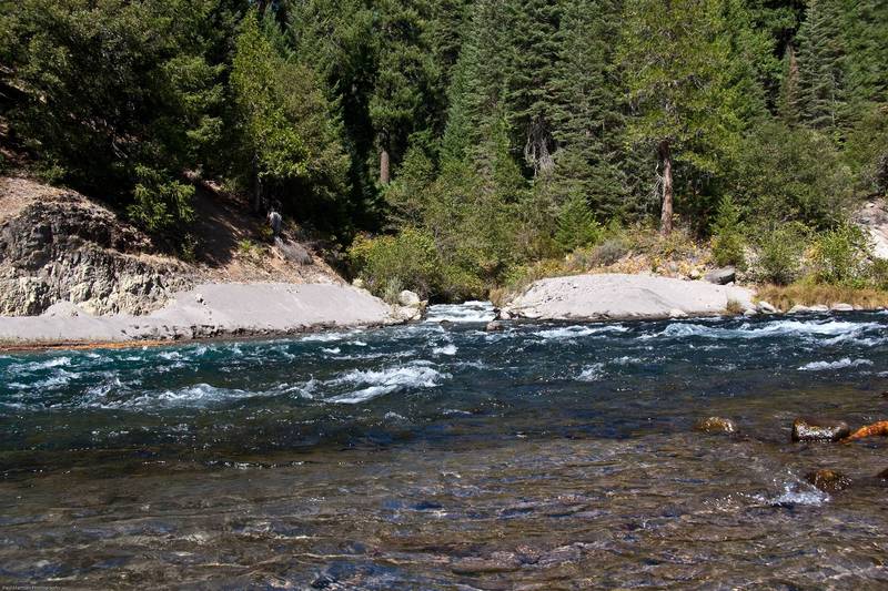
The first rapid below Big Springs is the steepest of the run with multiple rocks and pourovers to avoid. Below that, the river eases for a ways then picks up with a very long section of continuous class 3. The gradient eases gradually as the river goes downstream creating longer sections of slower water, between the mostly continuous 2 rapids. A few steeper rapids appear along the way.
Near the end, it is a treat to float past the exotic buildings of Wyntoon, the Hearst Corporation's private resort.
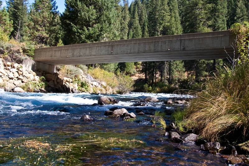
Getting There: The town of McCloud is about 10 miles east of Freeway I-5 on highway 89. The take out is about 10 miles south on Forrest Rd. 11. The put in is 5 miles east of McCloud on highway 89, then about a half mile south to Fowlers Camp.
Put in: On Highway 89 there will be signs to Fowlers Camp and the McCloud Loop drive. Turn right (south) and drive about 1/2 mile. Just befor Fowlers Camp turn right again at a fork towards the Lower Falls picnic area. A gravel road leads to a designated boater launching area. It is just a dirt clearing in the woods for parking up on a bluff above the river. A trail leads down to the river and a small somewhat less bushy area suitable for launching. This launch site is best when flows are higher in the spring and early summer.
A rough and dusty, dirt road leads past the designated launch area to the boundary with the Hearst Corporation property. Steep user trails lead down the bluff to the river to bushy launching areas. During low water season, this put in will reduce the boat dragging distance to Little Springs.
During spring high flows one can launch anywhere convenient below Lower Falls, or upstream of Lower Falls if one wants to boat that vertical drop.
Take out: Tarantula Creek boat ramp is the furthest upstream public access on McCloud Reservoir. Roads do extend up around the reservoir but they are private property and gated. The Hearst corporation owns all of the property along the river and reservoir between the take out and put in. When the reservoir is full, there is about 3 1/4 miles of flat paddling to the boat ramp. When the reservoir was at 24,000 acre feet, the lake elevation was about 10 feet below the high water mark. The flat water paddling distance was only reduced by 1/3 to 1/2 mile.
Camping: Fowler's Camp has 39 campsites.There are water faucets, picnic tables, pit toilets and campfire grills. There are several other campgrounds along the river, a short ways upstream. All the campsites are first come first served. There is a good hiking trail that leads upstream from Fowler's Camp to the other campgrounds, to various picnic sites and to viewing areas for middle and upper falls. The area is called the McCloud Loop.
Talking to the camp host and other campers may uncover friendly shuttle drivers and lots of information about the area.
Other Information Sources:
Cassady & Calhoun
CaCreeks.com
Dreamflows; McCloud Message Forum
Shasta-Trinity National Forest
Wyntoon information:
Memories of a former McCloud resident
Rapids in this Run (10)
Playspots (1)
Difficulty
Class III+(IV)
Length
11.0 mi
Gradient
60 ft/mi
max 85
Rapids
10
Access Points
Difficulty Classes
I Easy
II Novice
III Intermediate
IV Advanced
V Expert/Extreme
VI Unrunnable
Current Conditions
5-Day Forecast
Whitewater data from
American Whitewater
American Whitewater