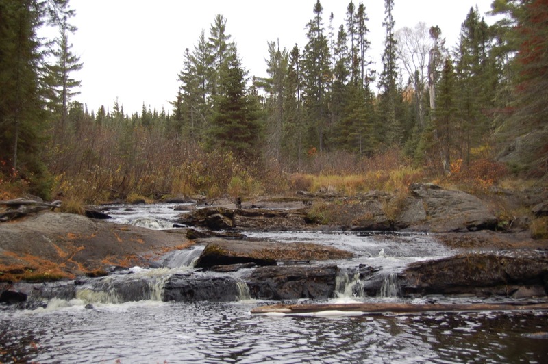
Hwy.41 Wayside to Old US Hwy.41 (2.7 + 7.8 miles)
Gauge Conditions
Runnable: 1,000.0 – 4,000.0 CFS
Likely too low for reasonable whitewater run. (We need your input! Add a comment about gauge reading and corresponding runnability/difficulty of this run.)
Data from American Whitewater & USGS
Run Map
Interactive run map
Loads as you approach this section.
Run Time Estimate
Select put-in and take-out to estimate time.
Plan This Trip
See wind-adjusted speed maps, forecast planning, and detailed time estimates.
Sign in to generate an AI timing estimate for this run.
Whitewater timing varies with scouting, portages, and group pace. Use as a planning baseline.
Description
Put-in is from a roadside park on Hwy.41
The main feature on the run is Tioga Falls (about 2 miles downstream).
Take-out is after a L-O-N-G paddle out on the Sturgeon River.
(While our rapids/features list includes waypoints and rapids down this stretch, our gradient statistics cited above are ONLY for the Tioga, and do not include this paddle-out).
Rapids in this Run (12)
Rapid
Foot-bridge
Rapid
USGS sampling site
 Rapid
Rapid
Trail Bridge
 Rapid
Rapid
Begin narrow and twisty
 Rapid
Rapid
Action increases
Rapid
Action eases (flatwater)
Rapid
Warning shot
Rapid
End of Tioga Falls Sequence
Rapid
Confluence, Tioga/Sturgeon
Rapid
III
Rapids
 Rapid
Rapid
Minor rips
 Rapid
Rapid
Begin continuous splishy-splash
Waterfalls (1)
Hazards & Portages (1)
Caution: The following locations may require scouting or portaging. Always check current conditions.
Difficulty
Class II-IV
Length
9.4 mi
Gradient
43 ft/mi
max 60
Rapids
12
1 Hazard
Access Points
Difficulty Classes
I Easy
II Novice
III Intermediate
IV Advanced
V Expert/Extreme
VI Unrunnable
Current Conditions
5-Day Forecast
Whitewater data from
American Whitewater
American Whitewater