Gauge Conditions
Runnable: 1,000.0 – 4,000.0 CFS
Likely too low for reasonable whitewater run. (We need your input! Add a comment about gauge reading and corresponding runnability/difficulty of this run.)
Data from American Whitewater & USGS
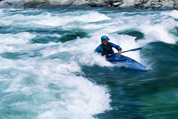
Photo

Photo courtesy of American Whitewater
Description
This section of the Tioga River begins with a constricted, serpentine channel that demands precise navigation through tight turns and potential submerged obstacles. Paddlers should be prepared for potential narrow passages and the need for quick, technical maneuvering, though specific difficulty ratings are not clearly established for this stretch.
Location
Other Rapids on This Run (16)
 Rapid
N/A
Rapid
N/A
Put In
Rapid
N/A
Foot-bridge
Rapid
N/A
USGS sampling site
 Rapid
N/A
Rapid
N/A
Trail Bridge
 Rapid
N/A
Rapid
N/A
Action increases
Rapid
N/A
Action eases (flatwater)
Rapid
N/A
Warning shot
Waterfall
III+
Tioga Falls
Rapid
N/A
End of Tioga Falls Sequence
Rapid
N/A
Confluence, Tioga/Sturgeon
Rapid
III
Rapids
 Rapid
N/A
Rapid
N/A
Minor rips
 Hazard
N/A
Hazard
N/A
Dam/Weir?
 Rapid
N/A
Rapid
N/A
Take-out
Rapid
N/A
Take-out (or continue)
 Rapid
N/A
Rapid
N/A
Begin continuous splishy-splash
View Full Run
Hwy.41 Wayside to Old US Hwy.41 (2.7 + 7.8 miles)
Tioga
II-IV
9.4 mi
Current Conditions
5-Day Forecast
Whitewater data from
American Whitewater
American Whitewater