Gauge Conditions
Runnable: 1,000.0 – 4,000.0 CFS
Likely too low for reasonable whitewater run. (We need your input! Add a comment about gauge reading and corresponding runnability/difficulty of this run.)
Data from American Whitewater & USGS
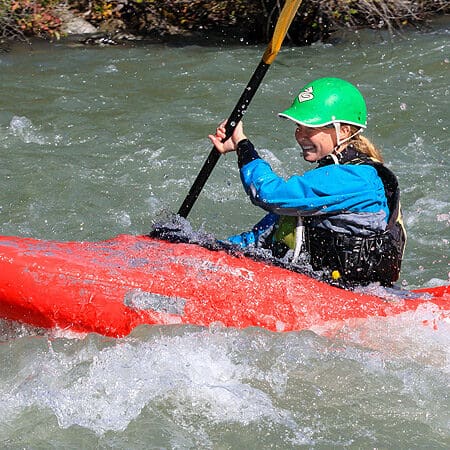
Photo
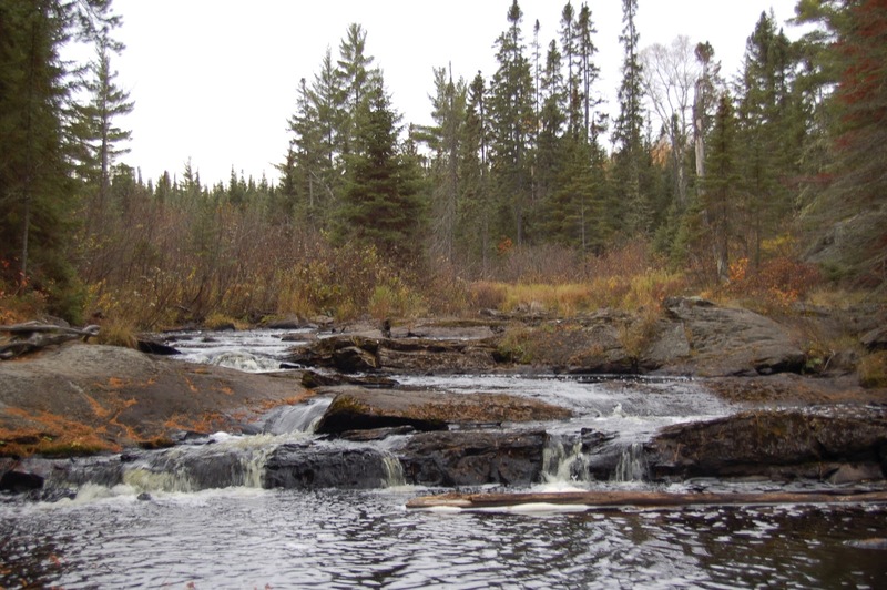
Photo courtesy of American Whitewater
Description
Before putting in, check clearance under this bridge.
It should be noted that many people may mistakenly believe that the minor rapids they see from this bridge in the wayside park are "Tioga Falls". They are not! These are (to the best of our knowledge) just an 'unnamed falls' on the Tioga River, as shown in the photo above, and on the website FishWeb.
Location
Other Rapids on This Run (16)
 Rapid
N/A
Rapid
N/A
Put In
Rapid
N/A
Foot-bridge
Rapid
N/A
USGS sampling site
 Rapid
N/A
Rapid
N/A
Begin narrow and twisty
 Rapid
N/A
Rapid
N/A
Action increases
Rapid
N/A
Action eases (flatwater)
Rapid
N/A
Warning shot
Waterfall
III+
Tioga Falls
Rapid
N/A
End of Tioga Falls Sequence
Rapid
N/A
Confluence, Tioga/Sturgeon
Rapid
III
Rapids
 Rapid
N/A
Rapid
N/A
Minor rips
 Hazard
N/A
Hazard
N/A
Dam/Weir?
 Rapid
N/A
Rapid
N/A
Take-out
Rapid
N/A
Take-out (or continue)
 Rapid
N/A
Rapid
N/A
Begin continuous splishy-splash
View Full Run
Hwy.41 Wayside to Old US Hwy.41 (2.7 + 7.8 miles)
Tioga
II-IV
9.4 mi
Current Conditions
5-Day Forecast
Whitewater data from
American Whitewater
American Whitewater