Pleasant Hlll Road to 9W
Gauge Conditions
Runnable: 280.0 – 5,000.0 CFS
The upper limit is a rough guess, based on historical data for this gauge. If you have better beta, please add a comment.
Runnable: 10.0 – 11.5 FT
Data from American Whitewater & USGS
Run Map
Interactive run map
Loads as you approach this section.
Run Time Estimate
Select put-in and take-out to estimate time.
Plan This Trip
See wind-adjusted speed maps, forecast planning, and detailed time estimates.
Sign in to generate an AI timing estimate for this run.
Whitewater timing varies with scouting, portages, and group pace. Use as a planning baseline.
Description
A remote camera uploads pictures to show current levels at kccny.org/locations/moodna-creek/ and rivercam.io/
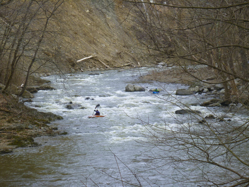
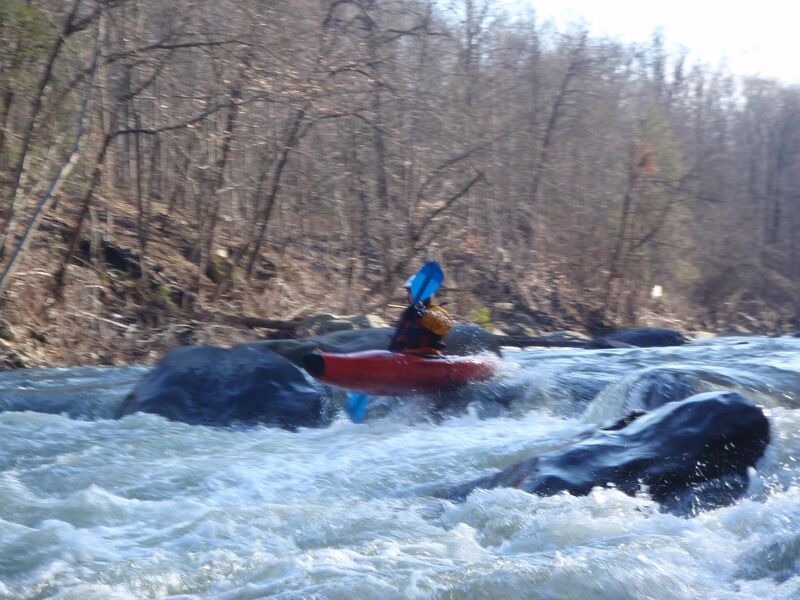
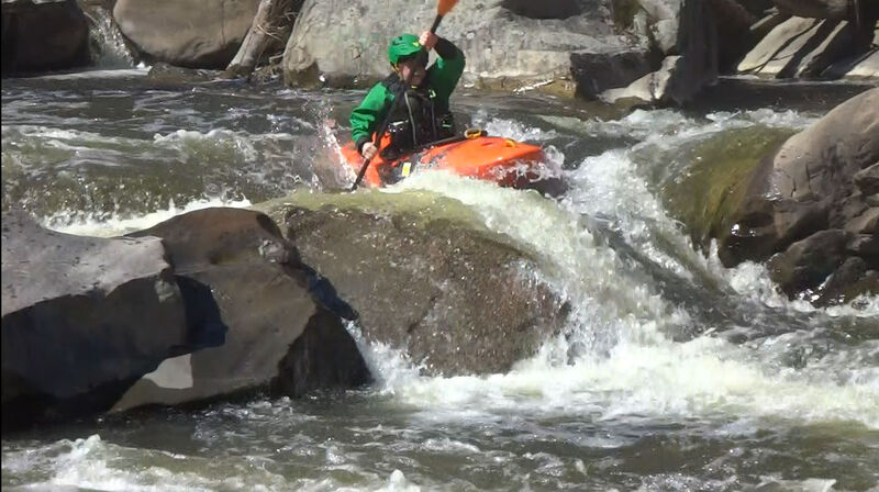
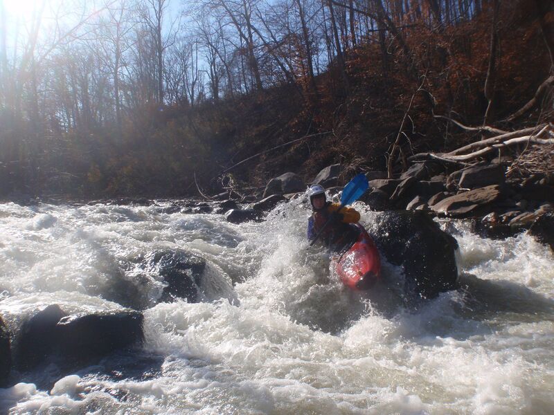
It's generally a Class 2-3 river at normal levels with the Class 2 warmup upstream of the Rt 32 bridge. At higher levels the very portagable and identifable pillars rapid gets into class 4.
The river holds well and isn't miserable at low levels.
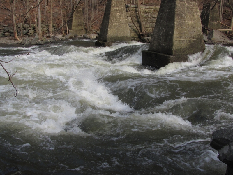
The hardest rapid is Hell's Teeth (aka Pillars). It has a hole that can get pretty nasty at higher flows...nasty as in it flips a lot of people, but it's deep and spits you out once you get upside down. The center pillar catches wood, often near the waterline , which sometimes isn't very visable.
The most dangerous rapid is Factory below the 2nd dam which drops down a chute of large cobbles.
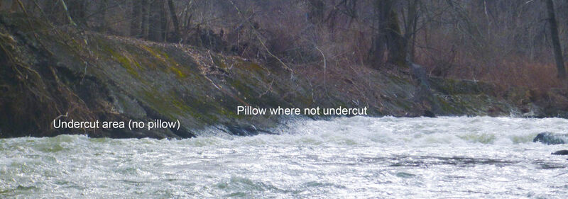
LOW HEAD WARNING. In the fall of 2021, Hurricane Ida undercut the small dam on river right below the 'packman' rapid, the rocky drop below Forge Hill Road. After passing Forge Hill road bridge, the river turns right down the bumpy 'packman' rapid and then left before a building.
For those who've run the river before, this used to be an inconsequential drop of about a foot. Ida probably undermined the dam (and closed off the river's left channel at normal flows). At higher levels this is a significant recirc and though probably not uniform enough to be a true keeper isn't fun to be in...sneak as far left as you can get away with...at higher levels bump down to the left of the island.
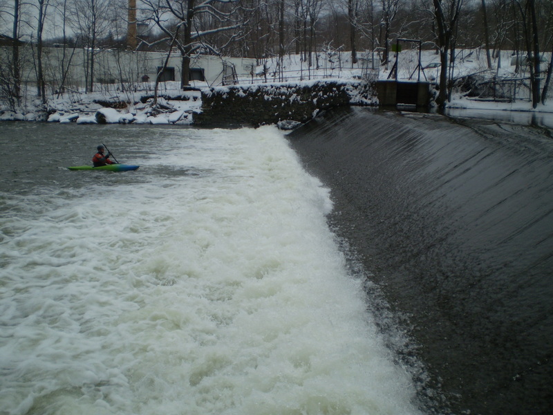
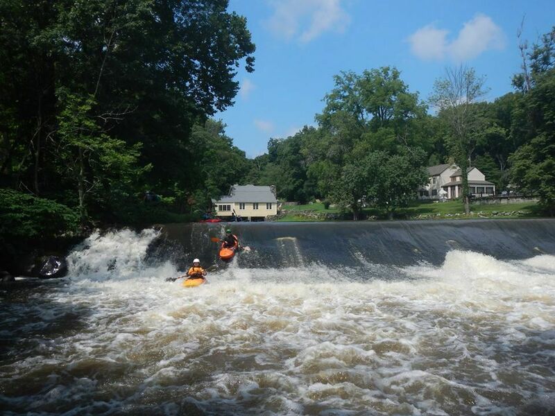
There are two big dams during the run. The first at the Rt 32 bridge you can generally slide over without any problems except for boat abuse.
The second has a kick-up at the bottom that's quite a wall of water at high levels. (2021 update - center dropped so doesn't kick up as much).
The Moodna Gorge cuts thru glacial till and changes after every flood.
The old (pre-2010) hazards of I-beams below the Jaws rapid and under the Old Forge Hill bridge were eliminated by Hurricane Irene which moved the entire river to the right some 100 feet .
The Class 2 section above the Route 32 Bridge is a beautiful stretch of river where you will see some wildlife but not much fun at low water. As you'd expect there's access along route 32. There's also a class 2 section below Forge Hill Bridge with good parking and ok pullout just upriver of 9w on river left.
At high levels, the first three-quarters mile of Woodbury Creek is fun with a rocky slide past the Blackrock Fish and Game club (good for cheers on sunny Saturdays). Put in near Creamery Road. But don't go higher on Woodbury Creek. Moodna above the thruway is flat water all the way to the rocky chute below the dam below Beaverdam Lake.
Rapids in this Run (5)
Waterfalls (1)
Hazards & Portages (7)
Caution: The following locations may require scouting or portaging. Always check current conditions.
Difficulty
Class II-III+(IV)
Length
5.4 mi
Gradient
50 ft/mi
max 90
Rapids
5
7 Hazards
Access Points
Shuttle Info
**Locate the town of Vails Gate, NY (AKA the intersection of Rt 32 and Rt 94)**
**Class 3(4) Putin:**
From the intersection of Rt 32/Rt 94 travel south on Rt 32.
Putin about 2 miles south where the moodna crosses under the Rt 32 bridge. Park just south of bridge on west (Northbound) side.
Best launch that doesn't involve walking thru provide property is from the southwest corner of the bridge down concrete drainage gully - lower boats on your rope and walk down carefully.
**Class 2 Putin:**
From the intersection of Rt 32/Rt 94 travel south on Rt 32.
Travel South on Rt 32 about 4 miles and make a hard dog leg Right on Juenger Rd. Travel 200 hundred yards to Rt 79. Make a right and park near the bridge where the moodna passes under Rt 79.
**Forge Hill Bridge Pullout**(lower class 2 putin):
```
Dirt road just northwest of bridge.
```
**New Windsor Public Works Department Take out:** Take the first left after crossing the Moodna headed north on 9w. Park near the boat ramp. This used to be an official kayak launch, but the ramp got undercut and it's above the tideline at low tide and they put a better rec launch in at Plum Point.
**Bar Takeout:**
Do not park at the historical marker site or risk a visit from the local police.
From the intersection of Rt 32/Rt 94 travel East on Rt 94. Make a Right on Old Forge Hill Rd/Rt 74. You will quickly pass over the Jaw's Rapid bridge (scout?). Continue to the traffic light and cross Rt 9w. Down the road a short distance there is a bar on your right with a large parking lot. We have taken out here. **Ask permission to park 1st and park away from the bar, closer to the river.**
**Make sure you stop in after paddling and tip heavy and thank them.** If you don't have two cars you can call a cab at 845-561-8330.
Difficulty Classes
I Easy
II Novice
III Intermediate
IV Advanced
V Expert/Extreme
VI Unrunnable
Current Conditions
5-Day Forecast
Whitewater data from
American Whitewater
American Whitewater