Big Rocks
Save this feature with the run it belongs to.
Gauge Conditions
Flows of 250 cfs are ok for floating from sleeping beauty to Souse hole without dragging.
Photo
Description
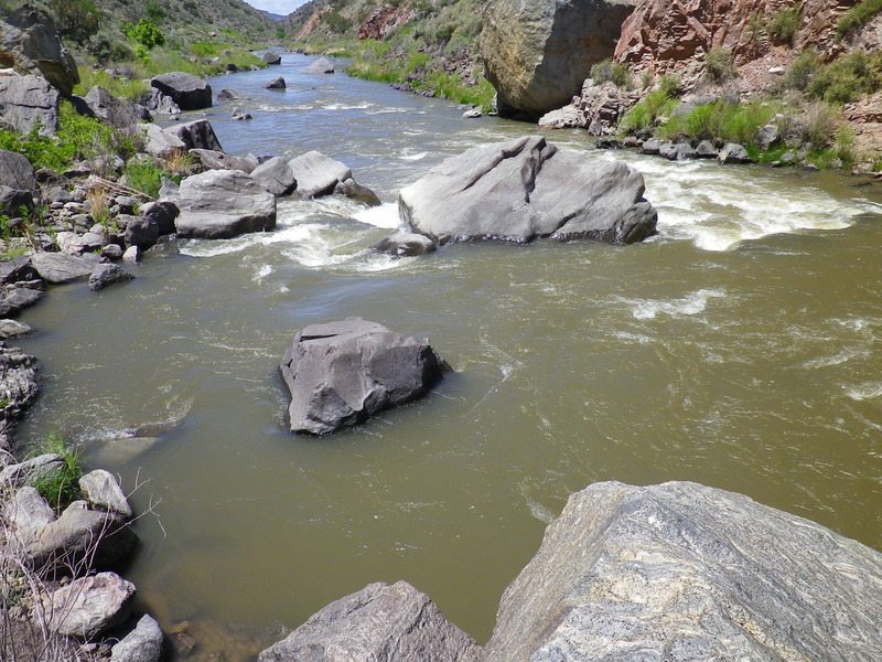
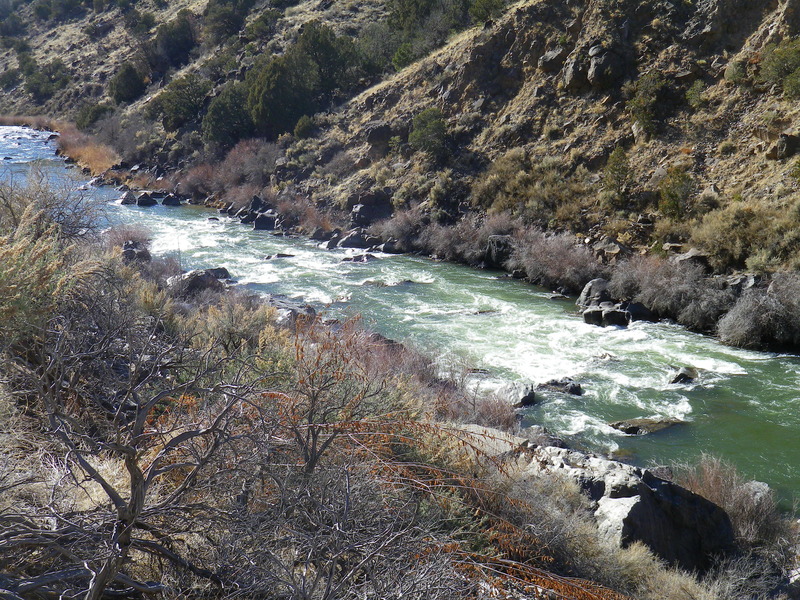
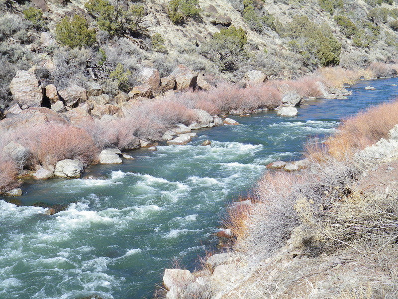
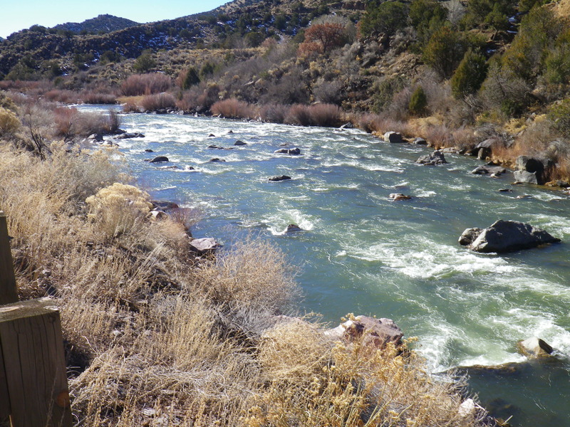
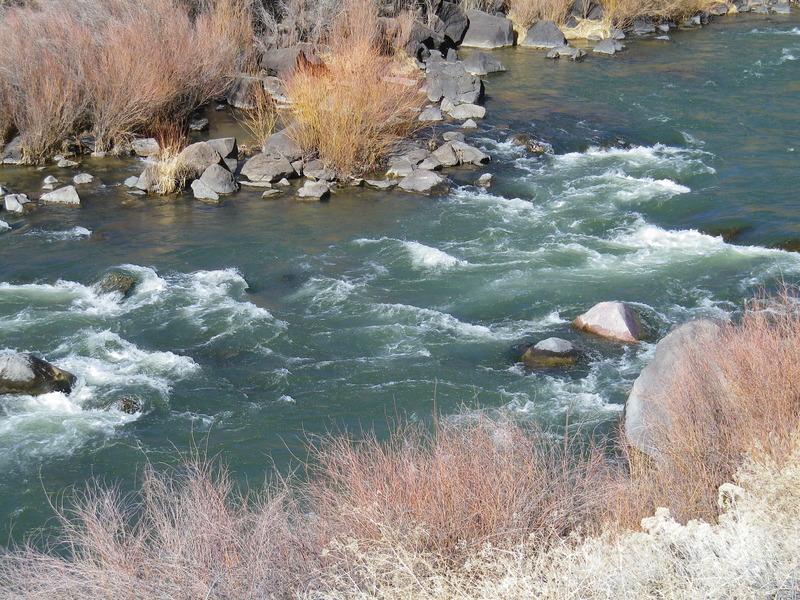
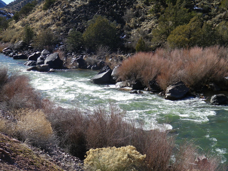
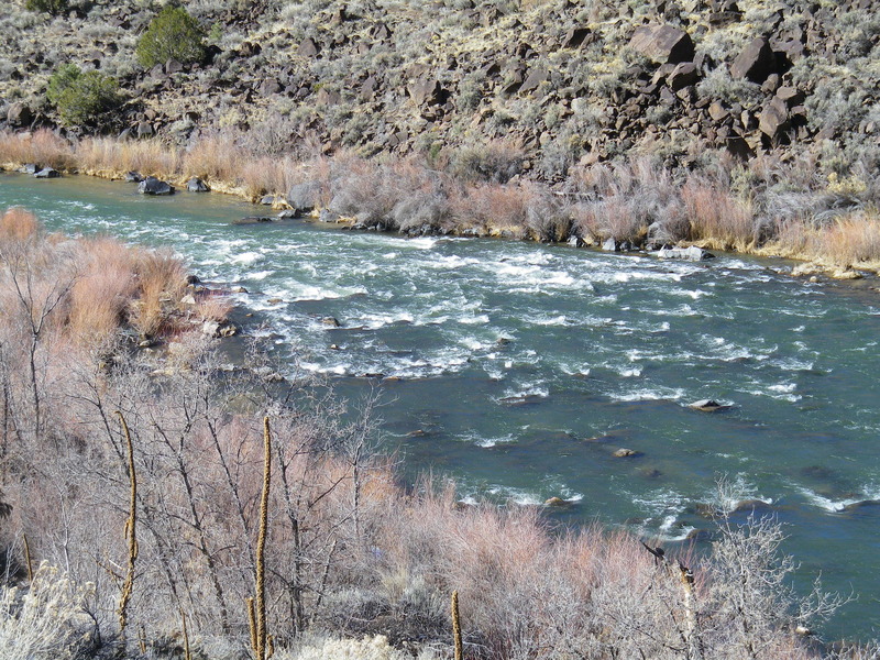
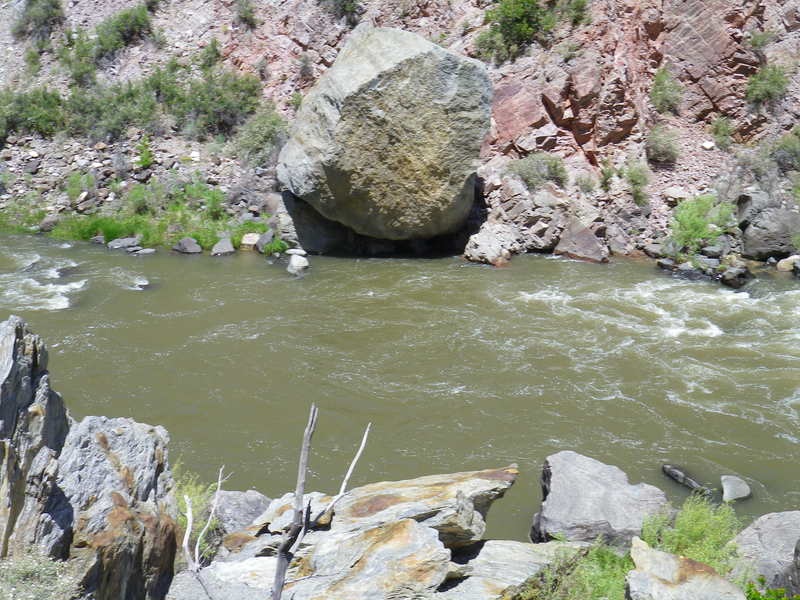
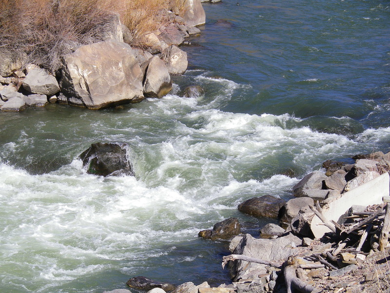
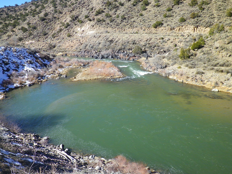
A long rapid that starts below the pool at Glen Woody Bridge. The river makes three turns before flowing into a jumble of truck-sized boulders. Upstream of the jumble the rapid is usually ran up the middle, and at low water, between the second and third turns, just right of center.
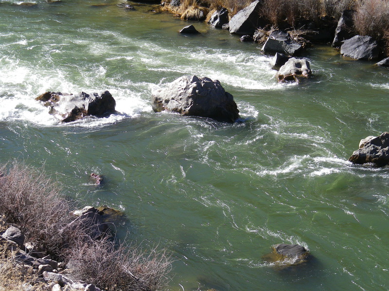
The line boaters take through the jumble at Big Rocks is inordinately flow dependent. The major landmark for determining a line is Pilot Rock, the first large center boulder the river passes in the jumble. At high flows boaters can pass just left of Pilot then pull to the right to miss the second large center boulder (Thunderdome or Pyramid), passing between Thunderdome and the right shore (a channel called the Ledge). Beware of the "Room of Doom" in between Pilot and its twin just to the right (Co-Pilot). As long as these rocks are visible, there is a sieve in between these rocks large enough for a person to flush through but too small for the vast majority of boats.
An alternative high water line starts between the second and third river turns above the jumble, where boaters move along the right shore (specifically between Co-Pilot and the right shore) then pass over the Ledge. This line is an easy sneak as long as the Ledge is runnable and becomes the preferred line when the water is high.
At moderate flows the route along the right shore might be too shallow or constricted and the channel left of Pilot is the best option. Again, pass on the left of Pilot then pull right to pass between Thunderdome and the right shore and over the Ledge.
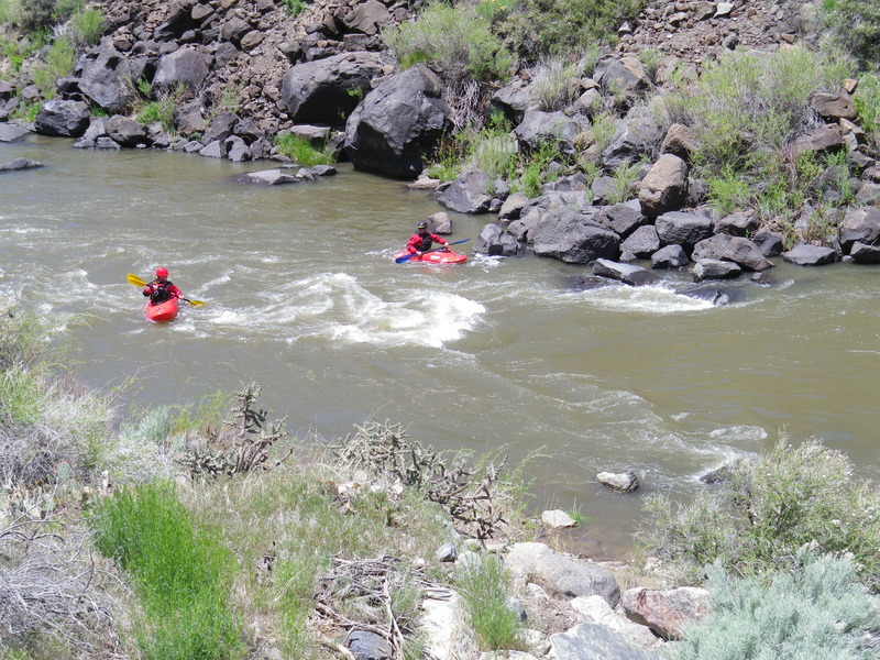
The Toilet Bowl – a very push class IV channel on the left side of Thunderdome – is a major concern. A wave train in the channel on the left side of Pilot can push boaters towards the left side of Thunderdome and into the Toilet Bowl Drop. In the left channel, striking and bouncing off Pilot with a boat often bounces boaters into that same predicament. The Toilet Bowl is a recirculating hydraulic sandwiched between two rocks that are rumored to be undercut. It's the biggest hazard on the Racecourse at most flows and should not be run except by the most experienced boaters.
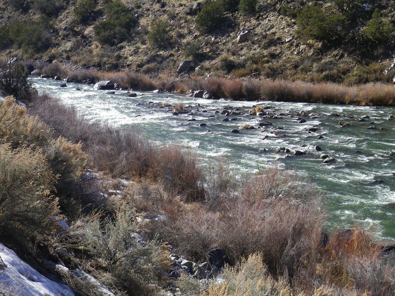
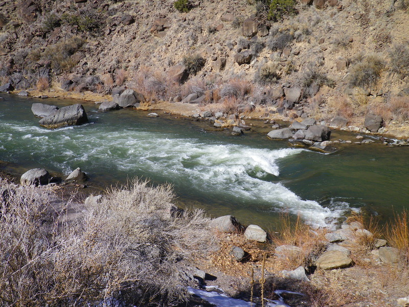
At low water (< 480) the Ledge becomes impassable but another channel is exposed between Thunderdome and the Ledge: this low water channel is called the Slot. The Slot starts at Thunderdome and cuts across the river on the downstream side of the Ledge, then a hard left turn (AFTER a rock called Gumball just downstream of the slot entrance) takes boaters downstream and out of the rapid. Because boaters are cutting across the current in front of Thunderdome, the river often pushes boats against Thunderdome causing them to flip on the rock; a preventative downstream lowside usually keeps boats right-side-up entering the Slot. This is also useful for getting rafts over the "chair" rock on the right side of the slot. At flows below 250, the shelf on the downstream of this rock starts to come out and can hold a raft in place.
Running the Slot usually takes some setup. At moderate to high flows being too far left while passing Pilot is a sure recipe for going into the Toilet Bowl. But at low flows, when the Slot is exposed, a large eddy appears along the left shore immediately downstream of Pilot, and catching this low water eddy prevents boaters from going into the Toilet Bowl; it also gives them a great place to setup for the Slot. But low water exposes a new obstacle in the left channel: Velcro Rock, just upstream from the low water eddy. At low water boats that strike Pilot often get pushed up onto this slightly submerge boulder where dislodging a raft takes some tugging.
The boulder jumble at Big Rocks is easily scouted from the road.
This rapid is highly channelized and unique because many of the rocks that give this rapid its name have been added by rockfalls in the past few decades.
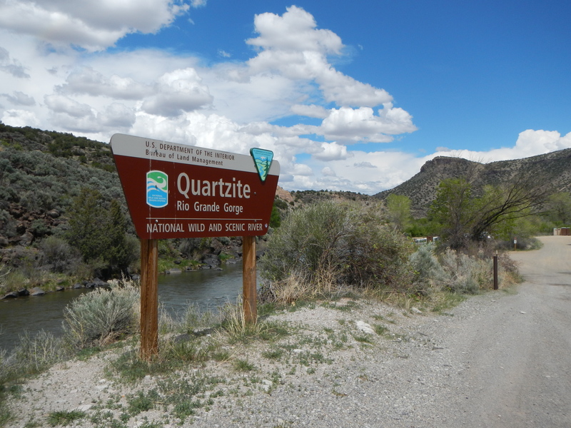
Location
Other Rapids on This Run (18)
 Rapid
N/A
Rapid
N/A
 Rapid
II
Rapid
II
 Rapid
III
Rapid
III
 Rapid
III
Rapid
III
 Rapid
III
Rapid
III
 Rapid
II+
Rapid
II+
 Rapid
III
Rapid
III
 Rapid
III
Rapid
III
 Rapid
III
Rapid
III
 Rapid
III
Rapid
III
 Rapid
II+
Rapid
II+
 Hazard
N/A
Hazard
N/A
 Rapid
N/A
Rapid
N/A
 Rapid
II
Rapid
II
 Playspot
III
Playspot
III
 Playspot
III
Playspot
III
 Rapid
II+
Rapid
II+
 Rapid
N/A
Rapid
N/A
Current Conditions
5-Day Forecast
American Whitewater