Center Street Bridge
Save this feature with the run it belongs to.
Gauge Conditions
Data from American Whitewater & USGS
CDEC Flow Data California
Data from California Data Exchange Center (CDEC)
Photo
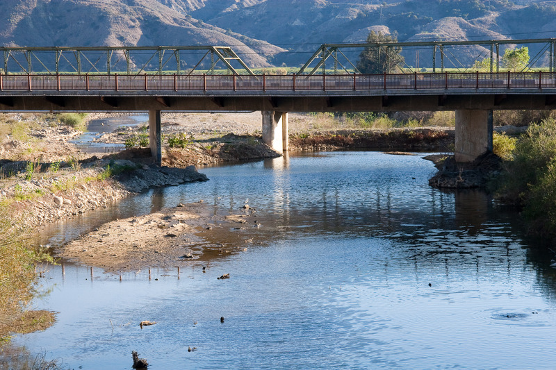
Photo courtesy of American Whitewater
Description
UWCD has built up earth dams under the bridge to divert some of the water through a gate on the right. Boaters can continue down a narrow channel on the left. These berms and channels probably change somewhat whenever they are washed out by winter high flows, then rebuilt afterwards.
Location
Interactive river map
Loads as you approach this section.

View Full Run
4) Lake Piru to Santa Clara River
Piru Creek
II+(III)
6.7 mi
Current Conditions
5-Day Forecast
Whitewater data from
American Whitewater
American Whitewater