Low head dam
Save this feature with the run it belongs to.
Gauge Conditions
Data from American Whitewater & USGS
CDEC Flow Data California
Data from California Data Exchange Center (CDEC)
Photo
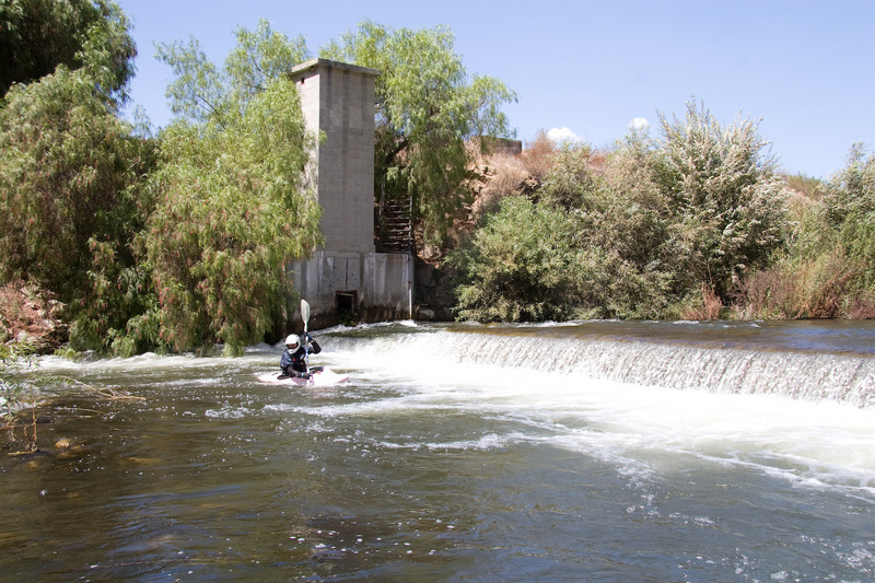
Photo courtesy of American Whitewater
Description
This dam had about a 2 foot drop over most of its width at 250 cfs. (sept 2, 2007) There was a chute on far river right, but it ran into thick hanging branches from a tree. We ran it a few feet out from the right where there was still plenty of water but no branches. The rest of the dam looked shallow enough that we could have scraped and pushed our way over. The reversal across the base of the dam was tiny at 250 cfs, but could become dangerous at some higher flow.
This dam is an abondoned USGS stream gauge with the gauging tower on the river right.
Location
Interactive river map
Loads as you approach this section.

View Full Run
4) Lake Piru to Santa Clara River
Piru Creek
II+(III)
6.7 mi
Hazard — Exercise extreme caution in this area.
Current Conditions
5-Day Forecast
Whitewater data from
American Whitewater
American Whitewater