Hazard
MI
Dam
Save this feature with the run it belongs to.
Gauge Conditions
Runnable: ? – ? CFS
Approximate - nearest available gauge. Use as general reference only.
Data from American Whitewater & USGS
Photo
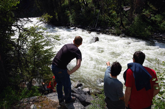
Photo courtesy of American Whitewater
Description
It appears there is a dam/weir at this point. Be very cautious, and be prepared to portage.
Location
Interactive river map
Loads as you approach this section.
Other Rapids on This Run (17)
 Rapid
N/A
Rapid
N/A
Put In
Rapid
II
Small ledge
Rapid
N/A
Johnson Road
 Rapid
II
Rapid
II
Second small ledge
Rapid
II
Third and Fourth small ledges
Rapid
I
Wave/Chute
Rapid
I
Head of better gradient
Rapid
N/A
Whitefish Falls, Upper ledge
 Playspot
II+
Playspot
II+
Whitefish Falls
Rapid
N/A
Island
 Rapid
N/A
Rapid
N/A
Diffin Road
Rapid
N/A
Power lines
Rapid
N/A
Saari Road
Rapid
I
Confluence, Werners Creek
Rapid
N/A
Confluence, Scott Creek
 Rapid
N/A
Rapid
N/A
Take Out
Rapid
N/A
USGS sampling site
View Full Run
Unnamed road to Niemi Road/Co.Hwy.102 (8.86 miles)
Whitefish, W.Br.
I-II(III)
8.6 mi
Hazard — Exercise extreme caution in this area.
Current Conditions
5-Day Forecast
Whitewater data from
American Whitewater
American Whitewater