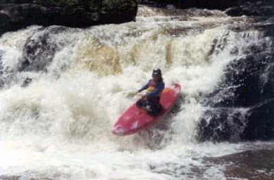
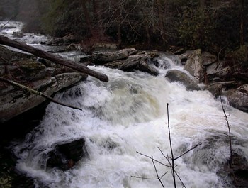
How's Your
River
×
Explore
Explore Map
Water Bodies
Gauges
Access Sites
Tidal Stations
Whitewater
Pricing
Login
Sign Up
Hazard Warning:
Hazard information may be user-submitted and unverified. Conditions change frequently. Always scout rapids and obstacles yourself.
Whitewater
Tennessee
Coker Creek - Highway 68 to Hiwassee River
Hidden Abashment
Hazard
TN
Class III+
Hidden Abashment
Coker Creek - Highway 68 to Hiwassee River (TN)
Monitor this Rapid
Water Body
This Run
Map
Other Rapids
Gauge
Weather
Directions
Gauge Conditions
Tellico River at Tellico Plains, TN
Upstream
Primary
Runnable: 3.0 – 5.5 FT
Data from
American Whitewater
&
USGS
Description
This drop lands from nine feet onto rocks. There is a line on the left that is currently unpleasant due to the mountain laurel and ill place pin rocks, but you wont have to get out of your boat
Location
Radar
Counties
Cell
Verizon
AT&T
T-Mobile
Dark
Satellite
Terrain
Other Rapids on This Run (7)
Rapid
N/A
Put In
0.0 mi
Rapid
III+
First Drop
0.1 mi
Waterfall
IV
Coker Creek Falls
0.1 mi
Waterfall
IV
Hiding Place Falls
0.2 mi
Waterfall
IV
Turkey Tail
0.3 mi
Waterfall
V
Snakedance
0.5 mi
Rapid
N/A
Take Out
6.0 mi
Type
Hazard
Difficulty
Class III+
Mile Marker
0.4 mi
Directions
Navigate
View Full Run
Highway 68 to Hiwassee River
Coker Creek
III-IV(V)
5.5 mi
Hazard
— Exercise extreme caution in this area.
Current Conditions
5-Day Forecast
Whitewater data from
American Whitewater
Hidden Abashment