Rapid
MI
Ledges
Save this feature with the run it belongs to.
Gauge Conditions
Runnable: ? – ? CFS
Approximate - nearest available gauge. Use as general reference only.
Data from American Whitewater & USGS
Photo
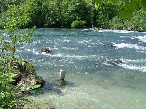
Photo courtesy of American Whitewater
Description
After nearly a mile of moving-water (with maybe a few minor riffles), after an East-South-East straightaway, the river takes a sharp left to head almost due North, and encounters the first good sequence of ledgey drop.
Location
Interactive river map
Loads as you approach this section.
Other Rapids on This Run (18)
 Rapid
N/A
Rapid
N/A
Put In
 Rapid
N/A
Rapid
N/A
Increased Action
 Rapid
N/A
Rapid
N/A
Ledge/Falls
 Rapid
N/A
Rapid
N/A
Ledge/Falls
 Rapid
N/A
Rapid
N/A
Ledge/Falls
 Rapid
N/A
Rapid
N/A
Ledge Falls Sequence
 Rapid
N/A
Rapid
N/A
Ledge Combo
 Rapid
N/A
Rapid
N/A
Residence/buildings Ledge Sequence
 Rapid
N/A
Rapid
N/A
Big Falls
 Rapid
N/A
Rapid
N/A
Next Ledge/drop sequence
 Rapid
N/A
Rapid
N/A
Major Action
 Rapid
N/A
Rapid
N/A
Warning!
 Rapid
N/A
Rapid
N/A
U-Turn
 Waterfall
N/A
Waterfall
N/A
East Branch Falls
 Rapid
N/A
Rapid
N/A
USGS sampling site
 Rapid
N/A
Rapid
N/A
Road Nears
 Rapid
N/A
Rapid
N/A
Take Out
 Rapid
N/A
Rapid
N/A
Erick Road Bridge
View Full Run
rail grade off AAA Rd to Skanee Rd (6.2 miles)
Huron, E.Br.
II-IV+
5.5 mi
Current Conditions
5-Day Forecast
Whitewater data from
American Whitewater
American Whitewater